Map Of Montenegro - Detailed Maps With Cities, Roads & Regions
Map of Montenegro with cities, roads, and regions. Our essential guide reveals all you need to navigate this Balkan jewel. Start your journey here!
Author:Finn WildeReviewer:Michael RachalApr 26, 202559.5K Shares850.6K Views
The Map of Montenegrois an essential tool for navigating the country, exploring its rich history, and planning trips. Montenegro, a small yet stunning country located on the Adriatic coast, has a diverse landscape, a deep cultural heritage, and a range of natural wonders.
Let's cover various types of maps available for Montenegro, highlight the national parks, and provide detailed information on the use of maps for navigation and trip planning.
Quick Facts About Montenegro
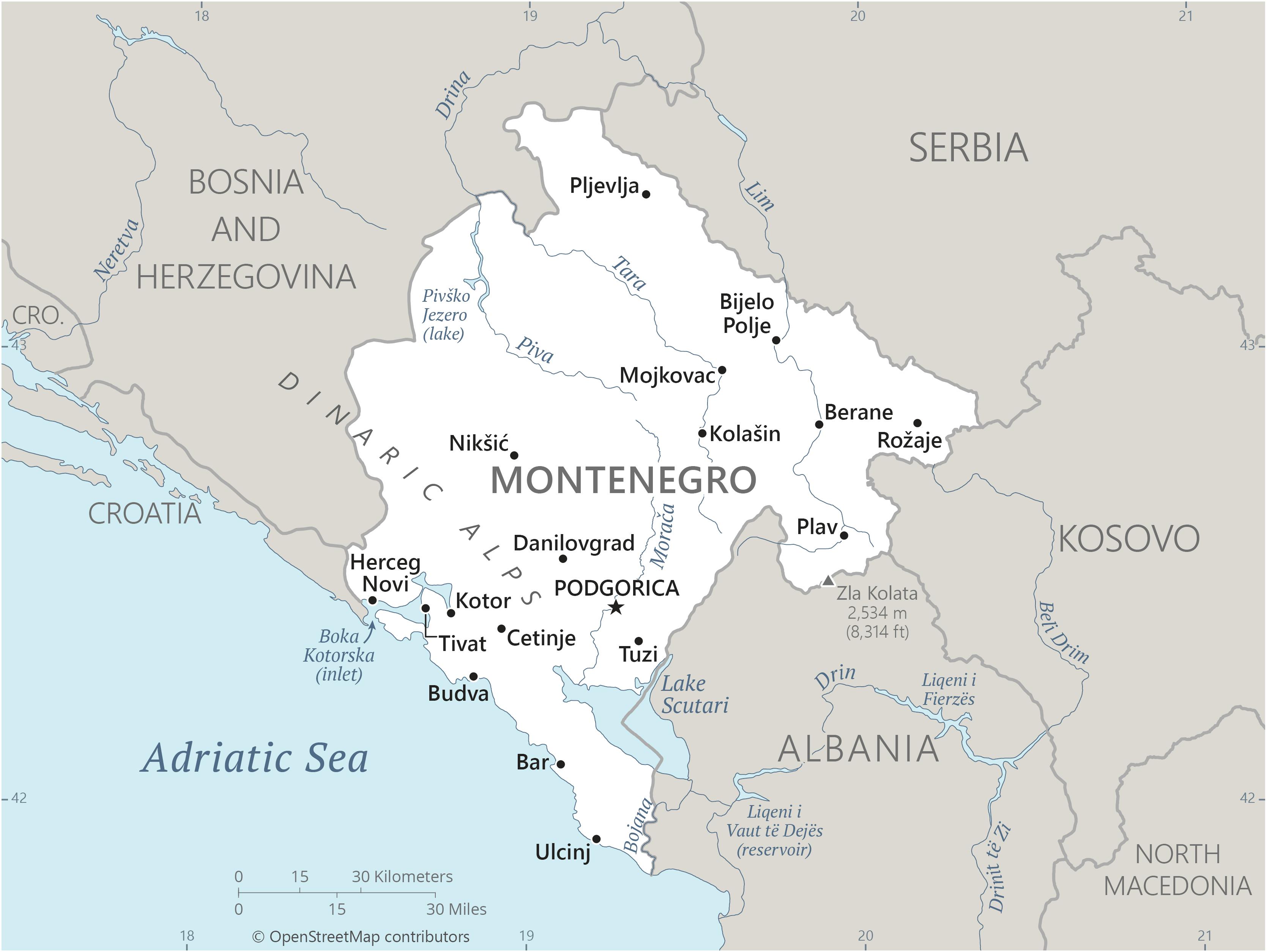
Montenegro is a small country located in Southeastern Europe. It has a population of approximately 620,000 people. The country shares borders with Croatia, Bosnia and Herzegovina, Serbia, Kosovo, and Albania. The capital of Montenegro is Podgorica, while the coastal town of Kotor is famous for its medieval architecture and historical significance.
Montenegro's history is marked by its role in the Roman Empire, the Ottoman Empire, and Yugoslavia. Known for its mountainous terrain and Adriatic coastline, Montenegro offers various natural attractions, including beaches, lakes, and national parks.
| Legal Name | Montenegro |
| Capital City | Podgorica |
| Total Land Area | 13,812 km² |
| Population | Approximately 633,937 |
| Currency | Euro |
| Dialling Code | +382 |
| Largest City | Podgorica |
| GDP | $8.85 billion |
| GDP Per Capita | $13,960 |
| Official Language | Montenegrin |
Regional Divisions: Coast, Central, And North
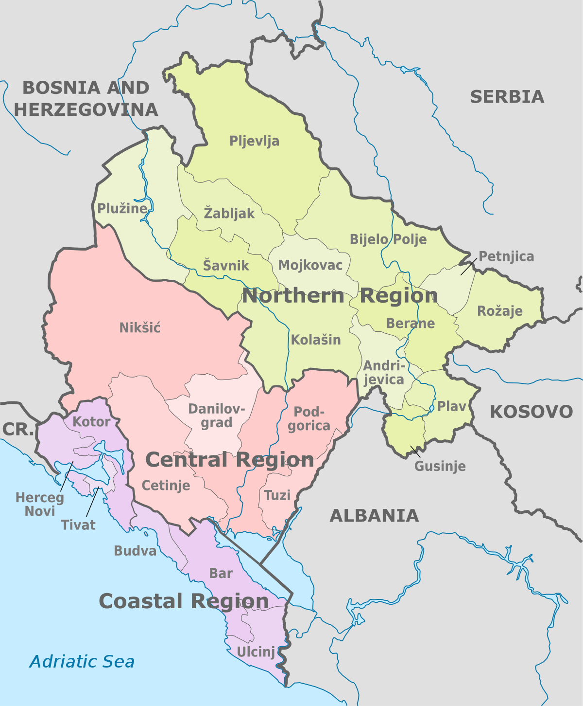
While not officially codified, Montenegro is often divided into three informal geographic regions:
Coastal Region
Includes Budva, Kotor, Tivat, Bar, and Ulcinj
- Rich in history, beaches, and Mediterranean culture
- Most visited area by international tourists
Central Region
Includes Podgorica, Nikšić, Cetinje
- Administrative and economic center
- Mixed terrain with plains and highlands
Northern Region
Includes Žabljak, Pljevlja, Berane
- Alpine terrain, national parks, skiing resorts
- Less touristy but ideal for eco-tourism and adventure
Understanding these divisions can help travelers structure their itinerary or researchers contextualize economic and cultural differences.
Types Of Maps Of Montenegro
Montenegro Mapcomes in many different kinds of kinds, each serving a specific purpose. Montenegro's physical maps depict the country's natural features, such as mountains, rivers, and coastline. Political maps depict the country's administrative subdivisions, such as municipalities and regions.
Topographic maps contain precise information about the landscape, including elevation levels and relief features, which is essential for hikers and adventurers. Road maps emphasize the road network, highlighting freeways and vital routes for travelers. Tourist maps, on the other hand, focus on points of interest, such as landmarks, hotels, and attractions.
Each map type provides useful information for a variety of purposes, such as navigating the country or planning a trip.
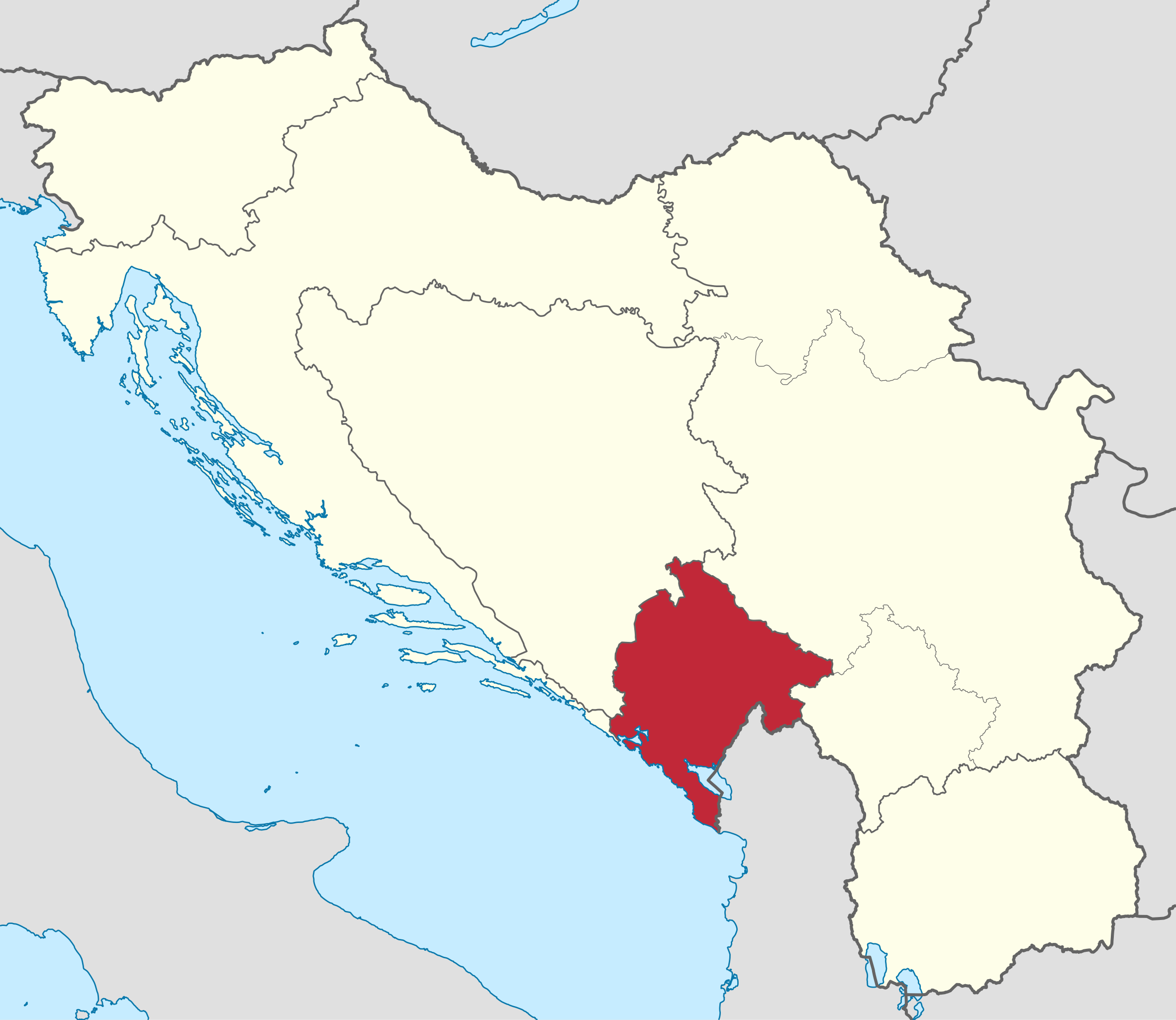
Political Map Of Montenegro
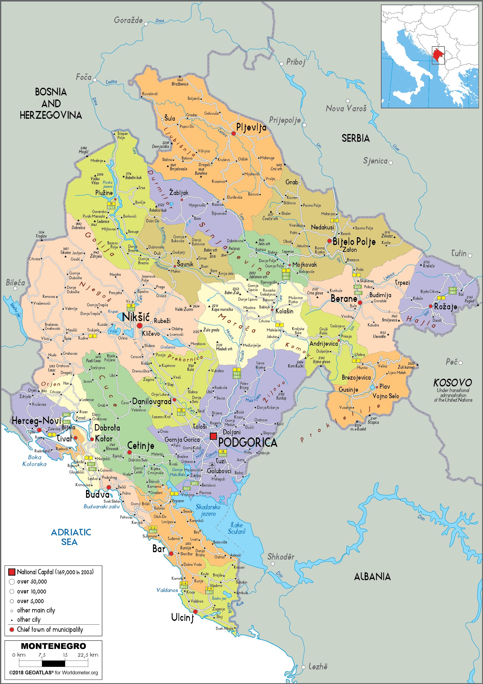
Montenegro is divided into 24 municipalitiesand 1 capital city (Podgorica). Each municipality operates semi-autonomously, with its own local government.
Major Municipalities:
- Podgorica(capital and largest city)
- Nikšić(industrial hub)
- Kotor(UNESCO World Heritage Site)
- Budva(coastal tourism hotspot)
- Bar(key port city)
- Herceg Novi(near Croatian border)
- Pljevlja(northern town rich in history)
- Educational purposes
- Electoral or policy-related research
- Travelplanning by regions
Physical Map: Mountains, Rivers, And Terrain
Montenegro’s name literally means "Black Mountain" (from Venetian monte+ negro), and the topography lives up to it.
Main physical features:
- Dinaric Alpsdominate most of the country
- Durmitor, Prokletije, and Bjelasicaare notable ranges
- The Tara River Canyonis the deepest gorge in Europe
- Major lakes include Lake Skadar(shared with Albania) and Black Lake(Crno Jezero)
This kind of map is best for:
- Outdoor adventures (hiking, rafting, skiing)
- Nature exploration
- Understanding the climate and biodiversity zones
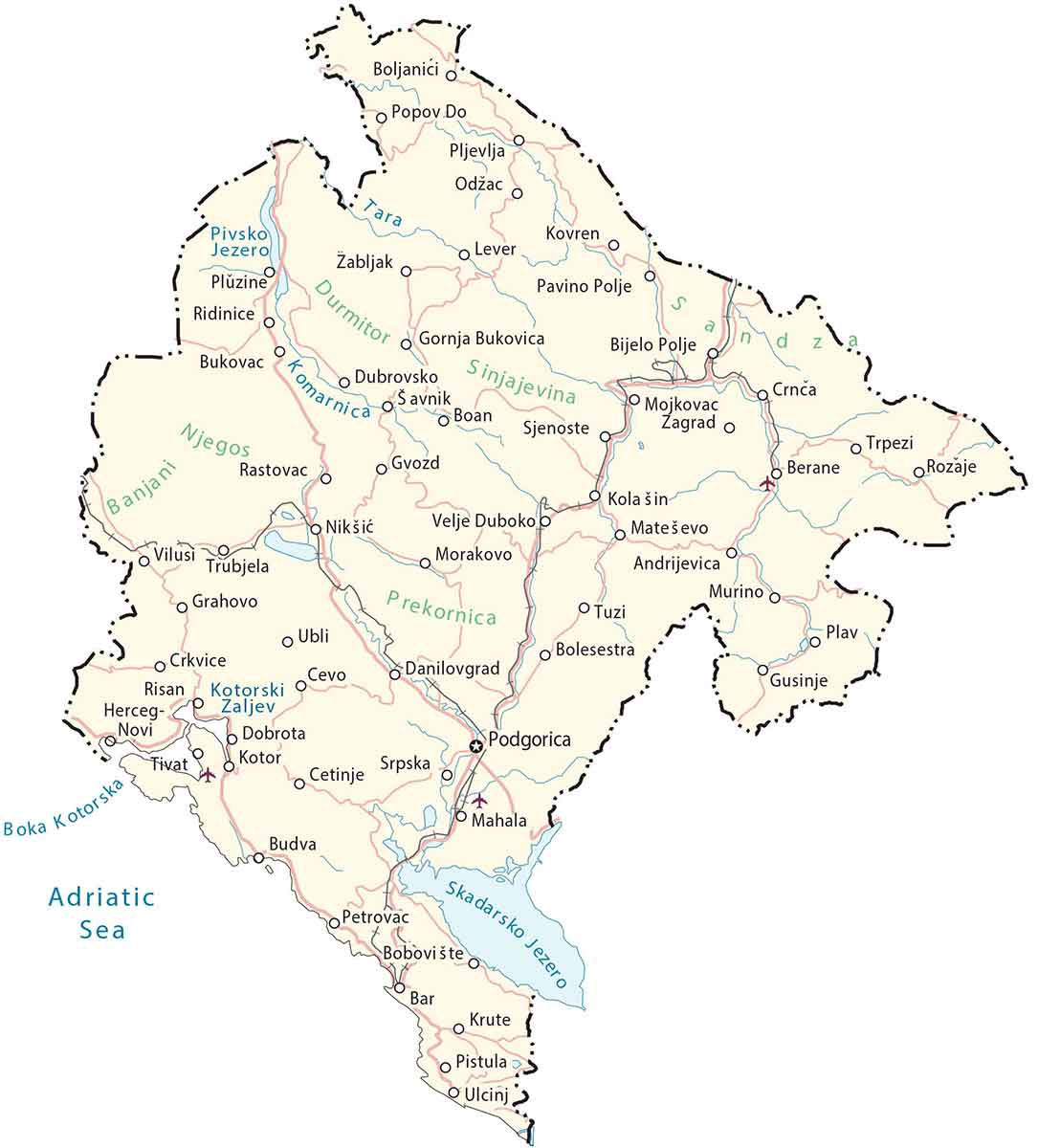
Road Map Of Montenegro
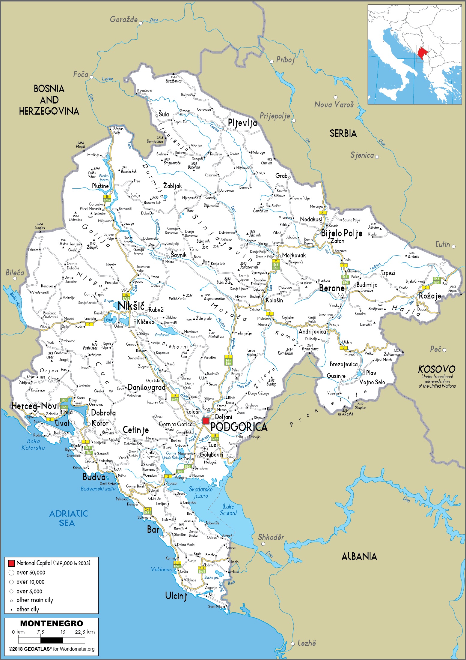
Road maps for Montenegro are useful for anyone traveling by vehicle or bus. These maps depict the country's road network, which includes major highways, secondary roads, and connections between cities and villages.
Montenegro has a well-developed road system that connects the capital, Podgorica, with coastal cities including Budva, Kotor, and Herceg Novi. Road maps also provide distances between significant places, road markers, and other critical navigational information.
These maps are very handy for travelers driving around the country to discover the picturesque coastal routes and mountainous interior.
Tourist Map Of Montenegro
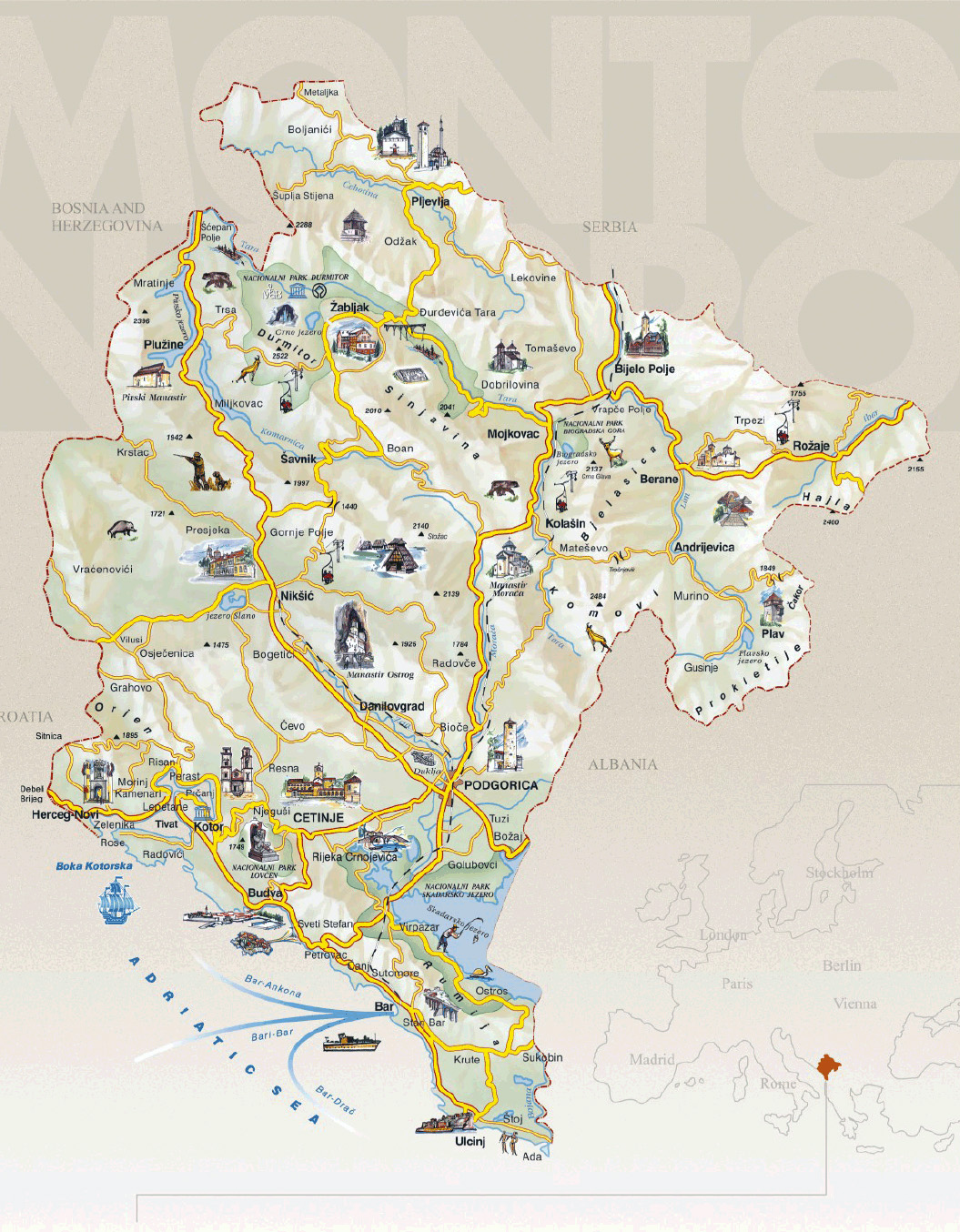
Tourist maps of Montenegro are designed for visitors who want to discover the country's attractions and sites. These maps emphasize key points of interest, including UNESCO World Heritage sites, natural wonders, historical landmarks, and popular tourist attractions.
Tourist maps highlight key sites such as Kotor, a walled medieval town on the Bay of Kotor, and Budva, a coastal city noted for its beaches and nightlife. Lake Skadar, the largest lake in the Balkans and shared with Albania, is another well-known tourist destination. Tourist maps are intended to direct visitors to these must-see destinationsand assist them in navigating Montenegro's many attractions.
Administrative Maps Of Montenegro
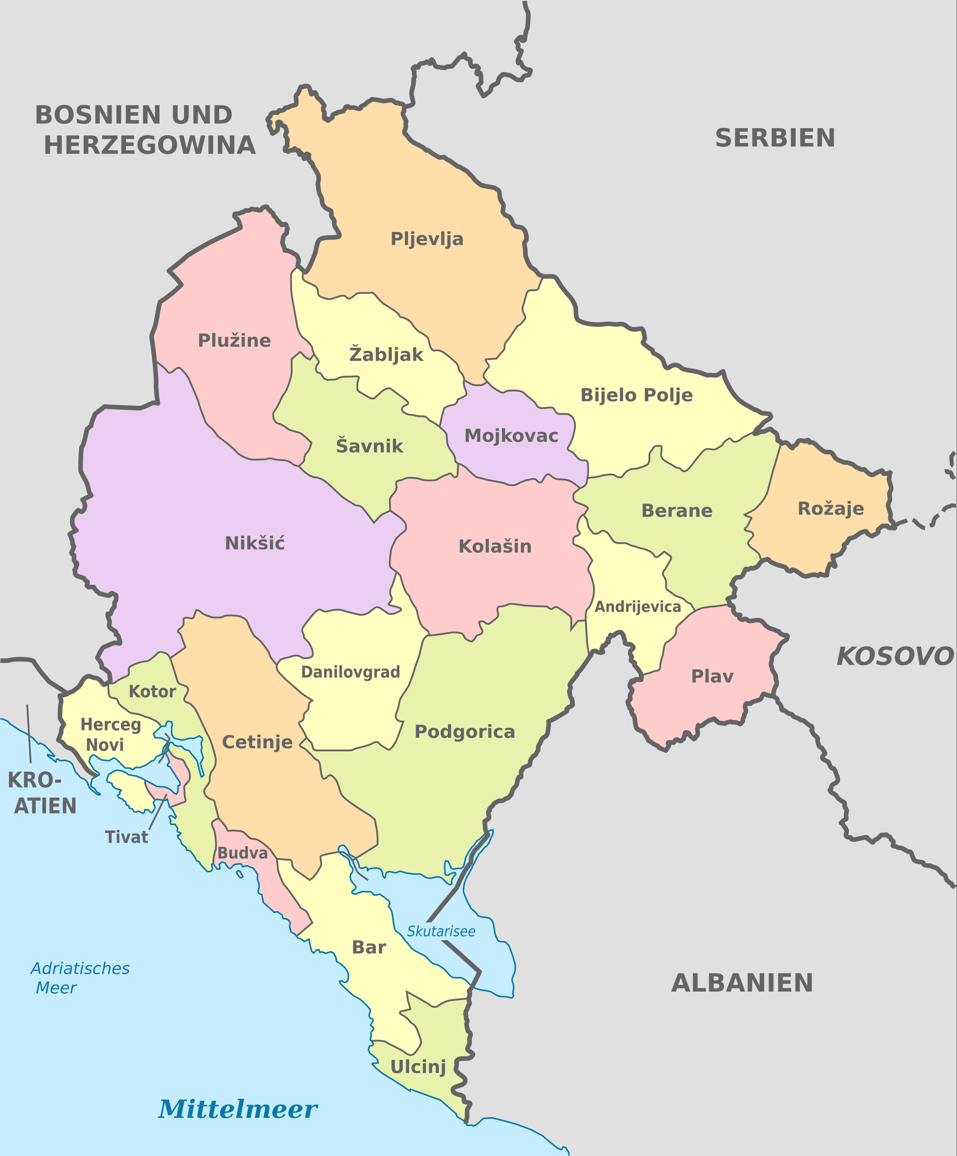
Administrative maps of Montenegro concentrate on the country's political divisions and governance. Montenegro is divided into 23 municipalities, each with their own governmental system.Podgorica is the largest municipality and serves as the capital. Other notable municipalities are Nikšić, Bijelo Polje, and Herceg Novi.
Administrative maps are useful for comprehending Montenegro's political boundaries and jurisdictions.These maps are also useful for travelers who need to locate certain regions or municipalities for business, government services, or local planning purposes.
Historical Maps Of Montenegro
Historical maps of Montenegro provide important insights into the country's history and territorial changes over time. These maps represent Montenegro's borders and regions throughout history, including its time as part of the Roman Empire, the Ottoman Empire, and subsequently Yugoslavia.
Historical maps also illustrate key events, such as Montenegro's founding as an autonomous kingdom in the nineteenth century and later merger into Yugoslavia. These maps are important tools for studying Montenegro's political and cultural evolution, as well as its historical interactions with neighboring countries.
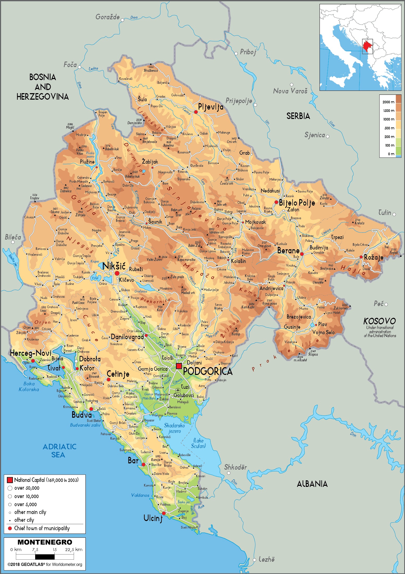
Topographic Maps Of Montenegro
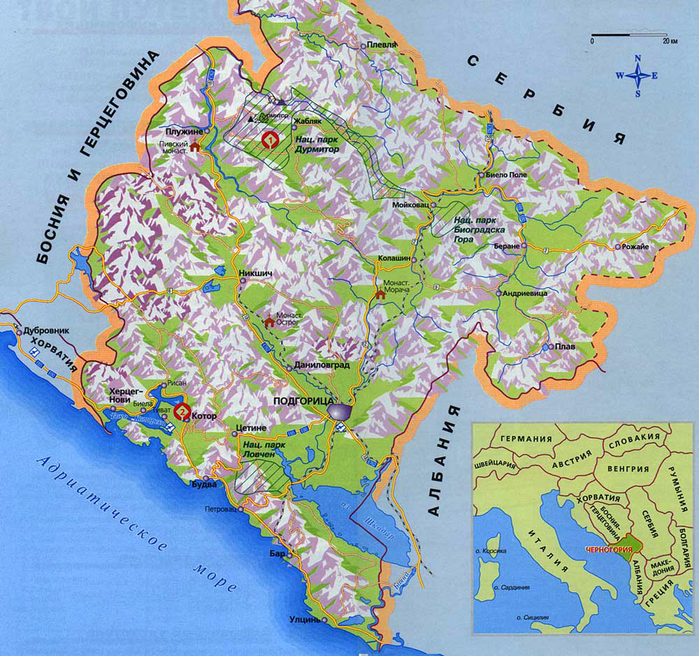
Topographic maps of Montenegro are essential for outdoor enthusiasts, particularly those interested in hiking, mountain climbing, or exploring the country's rough terrain. These maps include extensive information about the land's height, contours, and physical features like mountains, rivers, and valleys.
Montenegro's rugged landscape is a prominent feature on topographic maps, with peaks such as Bobotov Kuk in Durmitor National Park and the Prokletije mountains standing out.
The maps also include hiking trails, paths, and other information to help travelers navigate the country's varied and difficult terrain. Topographic maps are useful for anyone who wants to discover Montenegro's natural beauties on foot.
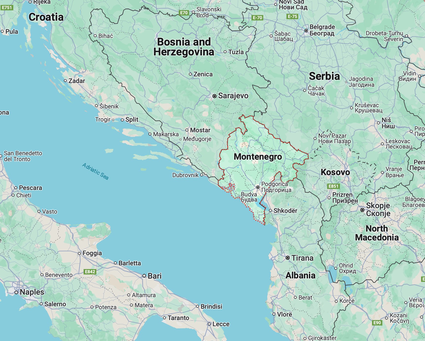
Locator Map Of Montenegro
A locator map of Montenegroplaces the country in its broader geographical context within Europe and the Balkan Peninsula. This type of map is especially useful for international travelers, students, and researchers trying to understand Montenegro’s position relative to neighboring nations.
Key Features Of A Locator Map:
- Shows Montenegro’s location in Southeastern Europe
- Highlights borders with Croatia, Bosnia and Herzegovina, Serbia, Kosovo, and Albania
- Marks the Adriatic Seato the southwest
- Often includes nearby European capitalsfor spatial reference
- Emphasizes Montenegro’s capital, Podgorica
Why Use A Locator Map?
- Ideal for presentations, educational materials, or travel guides
- Helps clarify regional dynamics, proximity to major cities, and access routes
- Provides a quick overview without overwhelming detail
Key Cities And Towns: Points Of Civilization On The Map
A political map clearly marks the locations of Montenegro's significant urban centers, each with its own story and economic focus.
- Podgorica (Population approx. 172,000): Administrative, economic, and cultural capital, located centrally.
- Nikšić (Population approx. 32,000): Industrial and educational center in the southern highlands.
- Budva (Population approx. 19,500): Major coastal tourist hub with historical significance.
- Pljevlja (Population approx. 16,000): Northern town with historical mining and energy industries.
- Herceg Novi (Population approx. 16,000): Coastal town at the entrance of the Bay of Kotor, known for tourism and fortresses.
- Cetinje (Population approx. 12,500): Former royal capital, a center of Montenegrin history and culture.
- Kotor (Population approx. 12,600): UNESCO World Heritage coastal town with a well-preserved old city.
- Bar (Population approx. 14,800): Main port city with maritime trade and historical sites.
- Ulcinj (Population approx. 11,000): Southernmost coastal town with long beaches and Albanian cultural heritage.
- Žabljak (Population approx. 1,400): High-altitude town, gateway to Durmitor National Park and winter sports.
- Kolašin (Population approx. 2,800): Growing mountain resort town for skiing and outdoor activities.
Using Maps For Navigation In Montenegro
Using maps for navigation in Montenegro is critical for moving around the country, especially in rural or hilly areas with insufficient signage. Road maps are useful for cars, whereas tourist maps direct visitors to popular sites and attractions.
Digital maps and GPS devices are widely used in Montenegro, particularly in cities, while paper maps are still useful in isolated or hilly locations where signal reception is limited. Maps are indispensable resources for anybody traveling, whether for navigation, sightseeing, or outdoor sports.
Using Maps For Trip Planning In Montenegro
Maps play an important role in organizing a vacation to Montenegro. Tourist maps assist travelers in locating significant points of interest, whilst road maps aid in mapping the most efficient routes between cities and towns. Topographic maps are essential for hikers since they provide information about the terrain and pathways to follow.
Furthermore, administrative maps help travelers comprehend the region they will visit, especially if they intend to explore specific municipalities or rural areas. Maps are vital for developing a precise and well-informed trip plan that ensures visitors see the best of the country's natural beauty and cultural history.
Explore Also: Map Of Luxembourg
Places To Visit In Montenegro
Montenegro has several notable attractions that attract tourists all year. Kotor, a UNESCO World Heritage Site, is known for its medieval old town, which is protected by ancient walls and fortifications. The town has attractive streets, churches, and squares, making it a must-see for tourists. Budva, renowned for its beaches, active nightlife, and historic old town, is another popular tourist destination.
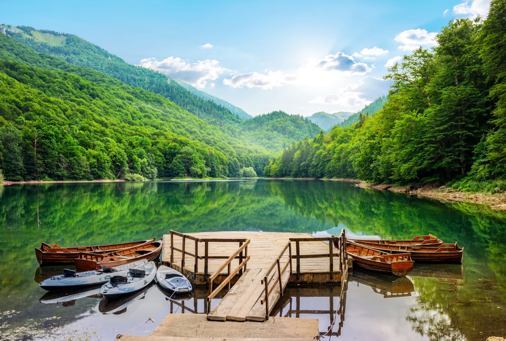
The Bay of Kotor, with its breathtaking views and tranquil waters, is also popular among tourists. Durmitor National Park has stunning scenery, including glacial lakes and steep canyons. Montenegro's national parks, such as Lovćen and Biogradska Gora, provide excellent opportunities for hiking, sightseeing, and outdoor activities.
National Parks In Montenegro
Montenegro has five national parks, each with its own unique scenery and natural elements.
Durmitor National Park
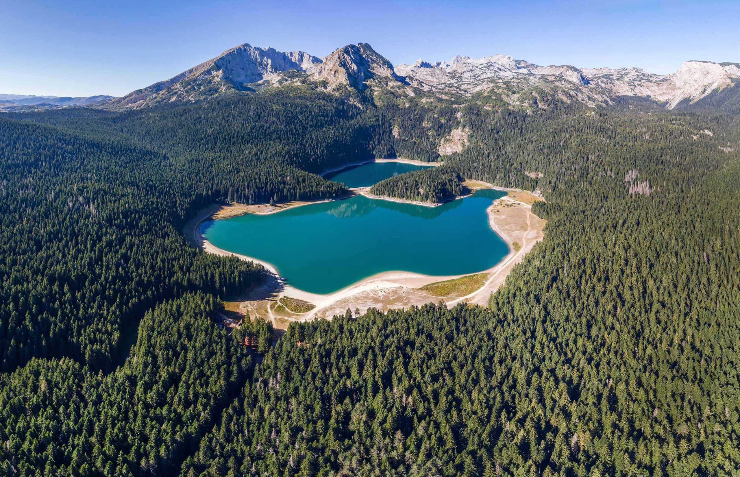
Durmitor National Park is one of the most well-known, having been designated a UNESCO World Heritage Site.It is recognized for its alpine climate, rocky mountains, and the Tara River Canyon, Europe's second deepest canyon. Durmitor also has many glacial lakes, making it an ideal location for trekking and adventure sports.
Biogradska Gora National Park
Biogradska Gora National Park is another important park, containing one of Europe's last remaining primeval woods. This park has a diverse ecosystem, containing uncommon plant and animal species, and offers hiking paths surrounding Lake Biograd. The park is a UNESCO Biosphere Reserve and ideal for wildlife enthusiasts.
Lovćen National Park
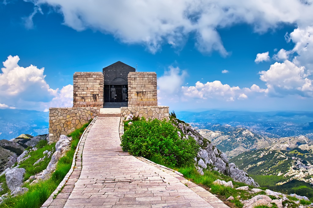
Lovćen National Park, near the coast, provides breathtaking panoramic views of the Adriatic Sea and nearby mountains. It also houses the mausoleum of Petar II Petrović Njegoš, a prominent historical figure in Montenegro. Visitors can climb to the tomb and enjoy the breathtaking scenery.
Skadar Lake National Park
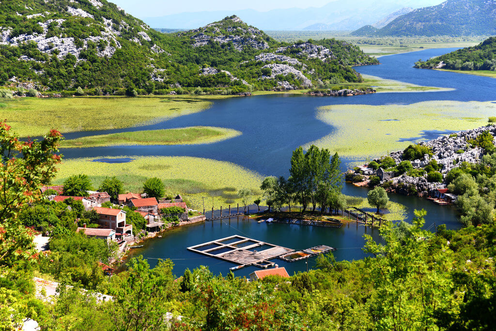
Skadar Lake National Park is renowned for its vast freshwater lake, where diverse bird species like pelicans and cormorants thrive. For those dreaming of clear horizonsand serene escapes, the park offers boat trips, birdwatching, and stunning views of its wetlands and surrounding hills.
Prokletije National Park
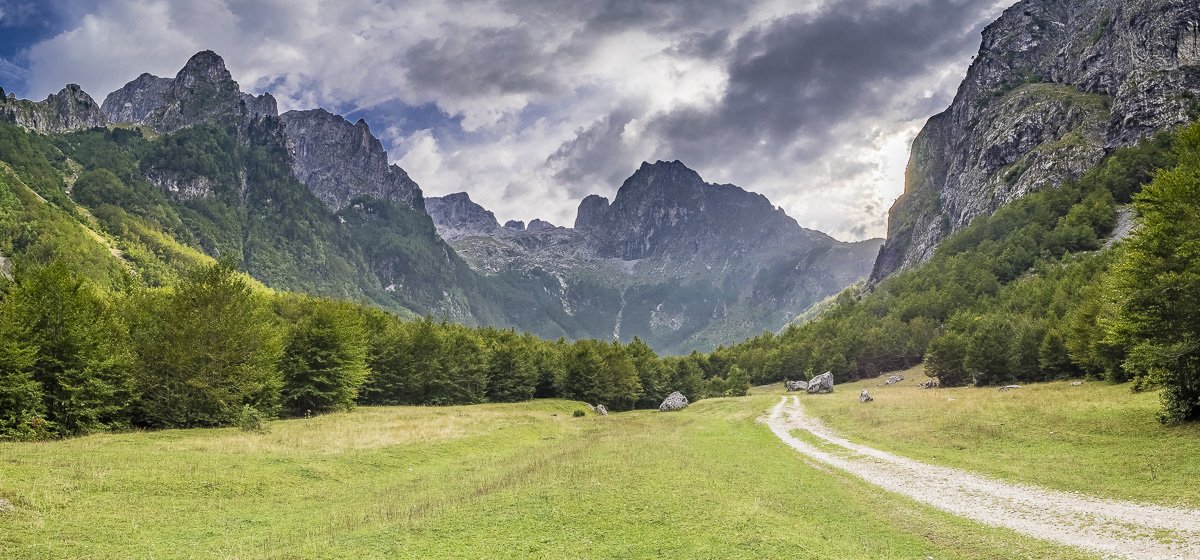
Prokletije National Park, located in the extreme northeast, is famous for its stunning mountain scenery and secluded location. It is one of Montenegro's least visited parks, providing a more private and peaceful environment for individuals seeking isolation in nature.
Fun Facts About Montenegro
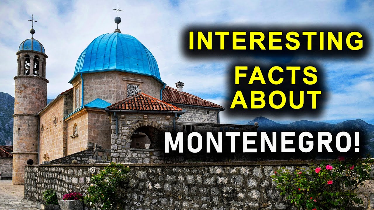
INTERESTING FACTS ABOUT MONTENEGRO!
Montenegro's name translates as "Black Mountain," due to its extensive pine forests. The Bay of Kotor is frequently referred to as the "southernmost fjord in Europe."
The country is home to some of the world's oldest olive trees, including one estimated to be over 2,000 years old. Montenegro also has a modest but expanding wine industry, with vineyards producing high-quality wines, especially in the southern region.
FAQs About The Map Of Montenegro
Which Traditional Holidays Are Celebrated In Montenegro?
Montenegro hosts events, like the Kotor Carnival, Mimosa Festival in Herceg Novi, and Lake Fest near Nikšić, that highlight the country's music, art, and local traditions.
Why Do Latitude And Longitude Matter On Maps?
Latitude and longitude give a coordinate system for determining accurate locations on Earth, which is essential for navigation and worldwide positioning.
How Is Family Life Structured In Montenegro?
Family life in Montenegro has always been close-knit, with strong bonds amongst extended family members. Respect for the elders and communal gatherings are important features of Montenegrin culture.
What Is The Significance Of Religion In Montenegrin Society?
The majority of Montenegrins identify as Orthodox Christians, followed by Muslims and Catholics. Religious customs and holidays are an essential component of the social fabric.
Final Thoughts
A map of Montenegro is a wonderful resource for anyone visiting this stunning nation. A map can help you navigate its mountainous terrain, organize a vacation to its historical places, or hike through its national parks. Montenegro's diverse environment, from coastal towns to alpine regions, provides a variety of experiences that are best enjoyed with accurate maps.
Jump to
Quick Facts About Montenegro
Regional Divisions: Coast, Central, And North
Types Of Maps Of Montenegro
Key Cities And Towns: Points Of Civilization On The Map
Using Maps For Navigation In Montenegro
Using Maps For Trip Planning In Montenegro
Places To Visit In Montenegro
National Parks In Montenegro
Fun Facts About Montenegro
FAQs About The Map Of Montenegro
Final Thoughts

Finn Wilde
Author
For Finn Wilde, the wilderness is more than just a destination - it’s a way of life. Over the past decade, he has led multiple expeditions in some of the world’s most remote regions, from the icy fjords of Greenland to the rugged trails of Patagonia.
Finn emphasizes sustainability in all of his adventures, helping participants connect with nature while promoting responsible exploration. His expeditions inspire individuals to explore the great outdoors while fostering a deep respect for the environment.

Michael Rachal
Reviewer
Michael Rachal believes that luxury lies in the details. With over 20 years of experience in the luxury travel industry, he has crafted hundreds of bespoke itineraries for clients seeking personalized, unforgettable experiences.
Whether guiding clients through private cultural tours or curating culinary journeys with world-renowned chefs, Michael ensures that each trip is tailored to perfection.
His ability to anticipate needs and exceed expectations has earned him a reputation as a leading expert in luxury travel.
Latest Articles
Popular Articles