Montenegro Map - How To Find Your Way Around
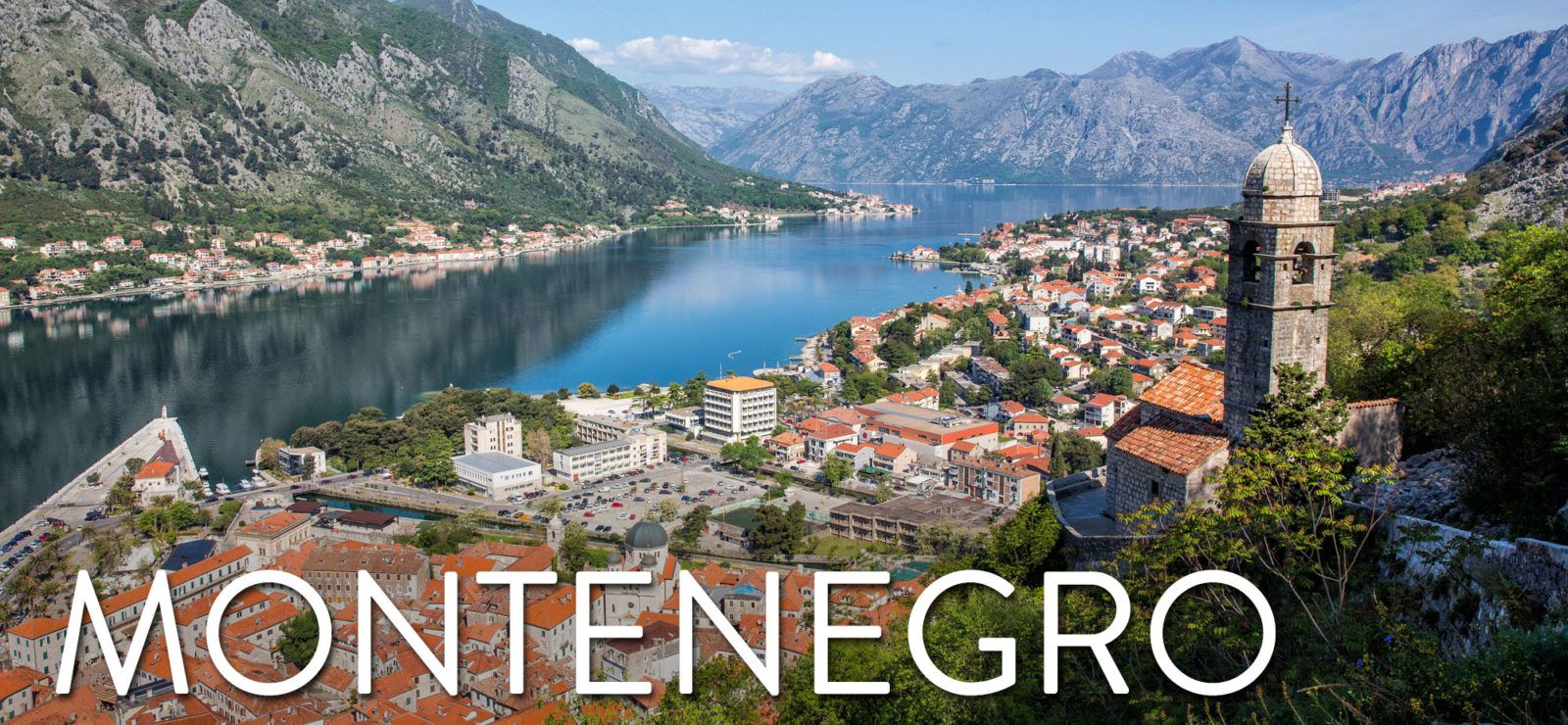
Montenegro map - Montenegro is a small country in Europe's Balkan Peninsula, with a population of approximately 620,000 people. Montenegro is best recognized for its beautiful coastline and rich cultural heritage. It has been inhabited since the Neolithic period, with the first recorded reference in 1190 AD.
Author:Finn WildeReviewer:Michael RachalMay 20, 202299.4K Shares2M Views
Montenegro map- Montenegrois a small country in Europe's Balkan Peninsula, with a population of approximately 620,000 people. Montenegro is best recognized for its beautiful coastline and rich cultural heritage. It has been inhabited since the Neolithic period, with the first recorded reference in 1190 AD.
About Montenegro
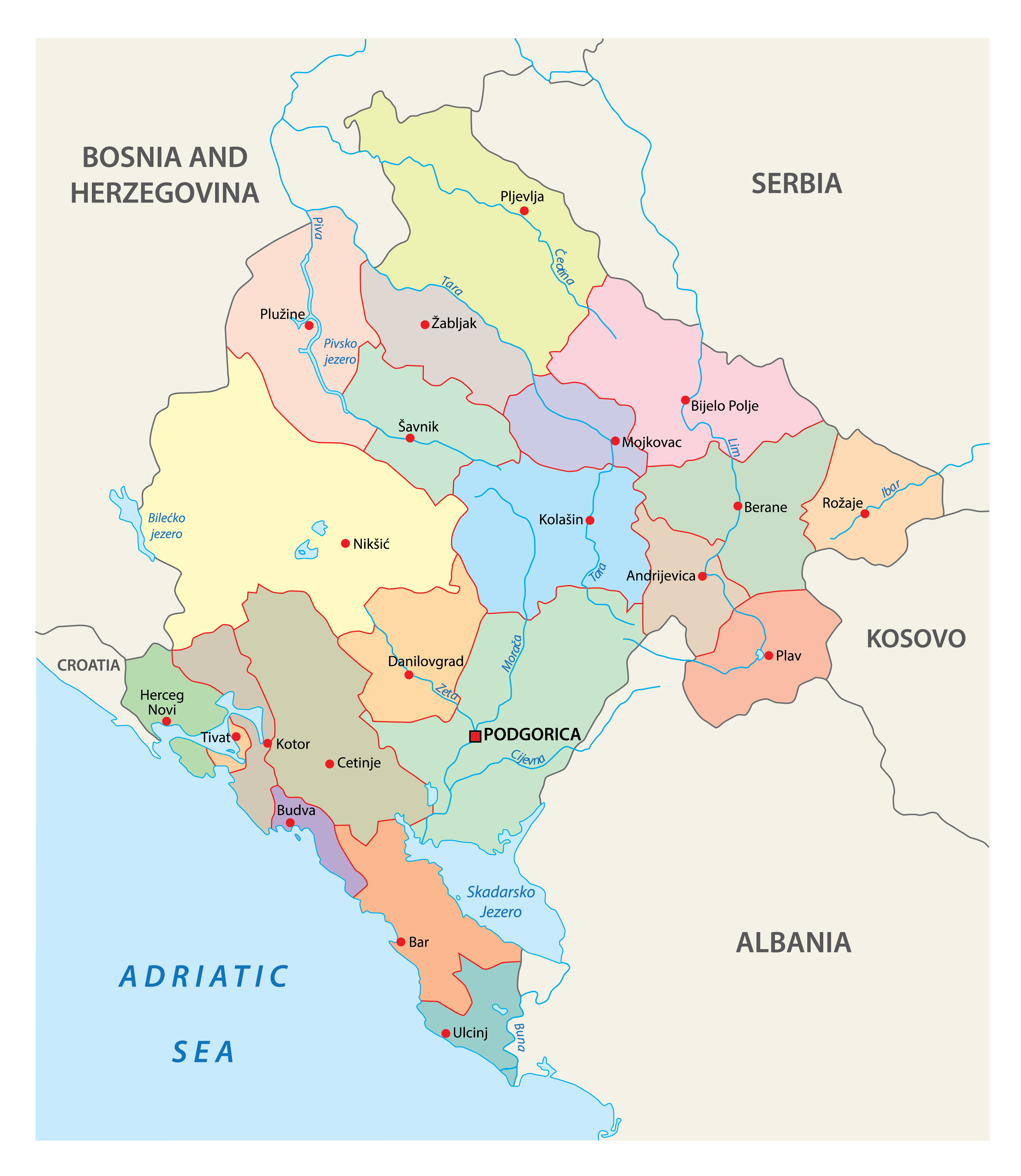
Montenegro is a Balkan country located on the Adriatic Sea, having boundaries with Serbia to the northeast, Bosnia and Herzegovina to the north and west, Kosovo to the east, Albania to the southeast, the Adriatic Sea and Croatia to the southwest, and a maritime boundary with Italy. Podgorica, Montenegro's capital and largest city, covers 10.4 percent of the country's territory of 13,812 square kilometers (5,333 square miles) and is home to nearly 30 percent of the country's total population of 621,000 people.
The country's English name is derived from Venetian and translates as "Black Mountain," referring to Mount Loven's look when clothed in dense evergreen trees. Crna Gora, which alternatively means "black mountain" or "black hill," was originally referenced in a charter issued by Stefan Milutin. In the 15th century, it came to denote the majority of modern Montenegro. In the historical period following the fall of the Serbian Despotate, modern-day Montenegro became more known by that name. Originally referring to merely a tiny strip of land ruled by the Patrovii tribe, the word grew to refer to the entire hilly region once the Crnojevi aristocratic family acquired power in Upper Zeta.
Map Of Montenegro
Following the conclusion of World War I, the kingdom was incorporated into Yugoslavia. After the dissolution of Yugoslavia, the two republics that are now known as Serbia and Montenegro joined forces to declare themselves a federation. After holding a referendum on the issue in May 2006, Montenegro made the decision to declare its independence, which led to the dissolution of the confederation.
The Human Development Index places Montenegro at the 48th spot, and its economy places it in the upper-middle income range. The United Nations, the North Atlantic Treaty Organization, the World Trade Organization, the Organization for Security and Co-operation in Europe, the Council of Europe, and the Central European Free Trade Agreement are among organizations in which it participates. In addition to being a founding member of the Union for the Mediterranean, Montenegro is also in the process of becoming a member of the European Union at the present time.
Montenegro On Map
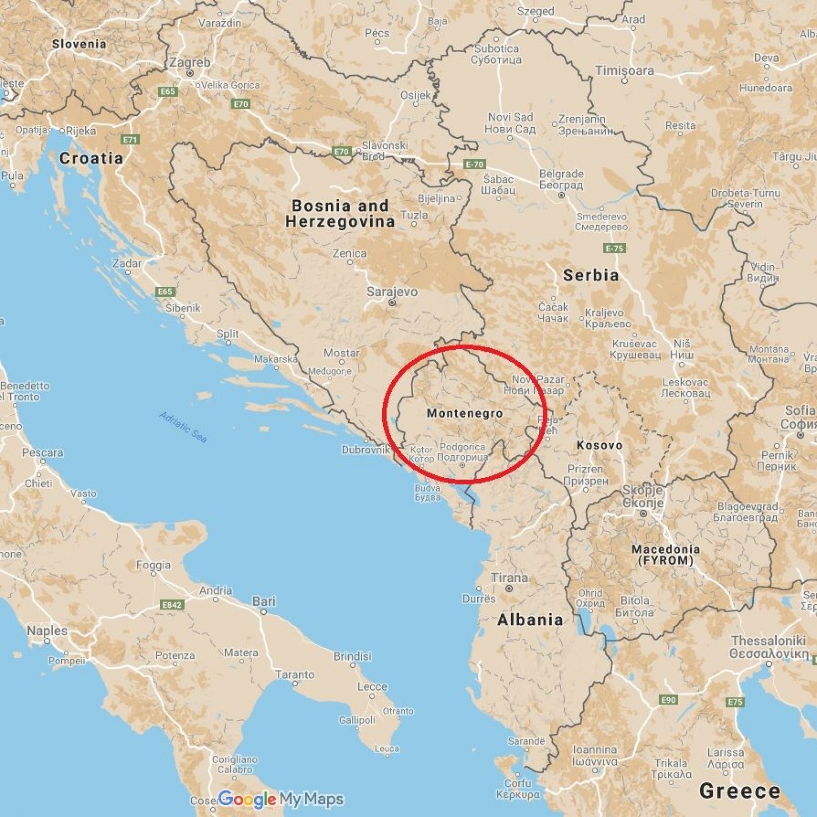
The country of Montenegro can be found in the southeastern part of Europe. Montenegro is a landlocked country that is located in Southeastern Europe. It is bounded to the north by the Adriatic Sea, to the east by Kosovo, to the south by Albania, and to the west by Bosnia and Herzegovina and Croatia.
People Also Ask
Where Is Montenegro On The Map?
The physical map of Montenegroreveals that the majority of the country is composed of mountain ranges. Because of its location on the Balkan peninsula and on the Adriatic Sea, it is home to a varied environment that ranges from towering peaks along the Serbian and Albanian borders to a small coastal plain. This diversity is a result of the country's geographic location. The Durmitor range, Mount Orjen, and Mount Lovcen are among the most significant mountain ranges in Montenegro. These mountain ranges are comprised of some of the most severe terrain in all of Europe.
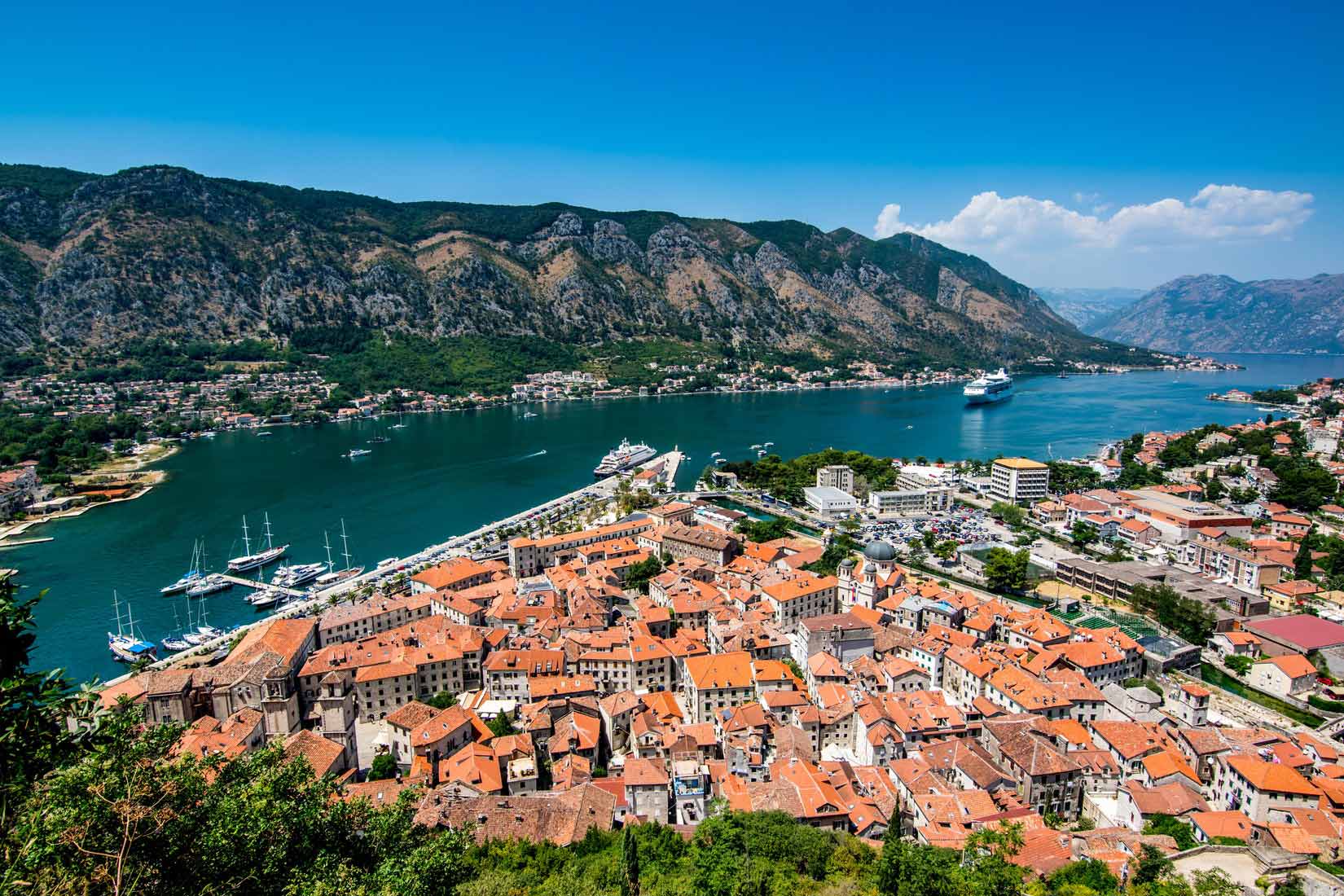
The peak of Bobotov Kuk, which is part of the Durmitor range and has a height of 2,670 meters, is the highest point (2,522 m). A yellow triangle indicating its location has been placed on the map. The Bay of Kotor, which is actually a river canyon that has been buried, is a major feature on the coast of Montenegro, and it is located to the east, along the Adriatic Sea. It is approximately 17 miles (28 kilometers) in length. The mountains of Loven and Orjen, which are located to the east and west of the bay, respectively, enclose the bay.
The Drina, the Tara, and the Lim are three of the most important rivers in Montenegro. As can be seen on the map to the right, Lake Skadar can be found on the boundary between Montenegro and Albania. Montenegro and Albania both have access to this lake, which is the country's largest. It is also the largest lake in Southern Europe and has a surface size that ranges from 370 to 530 km2 (140 to 200 sq mi). The depth of Lake Skadar ranges from 5.01 to 5.01 meters on average (16.4 ft). The Adriatic Sea is the lowest point in Montenegro, at an elevation of 0 meters.
What Is Montenegro Famous For?
If there is something that this place is famous for, that would be its mountains. The high mountains of Montenegro have an average elevation of almost 7,000 feet (2,000 meters), making them some of the most difficult terrain in all of Europe. The highest point in the country is located in the Durmitor Mountains and is known as Bobotov Peak. It has an elevation of 2,522 meters (8,274 feet). During the most recent phase of glaciation, the mountains of Montenegro were the part of the Balkan Peninsula that saw the greatest amount of ice erosion.
What Is The Best Time Of The Year To Visit Montenegro?
The summers in Montenegro are often dry and mild, while the winters tend to be wetter and colder. The months of June through August are considered to be the ideal time to travelto Montenegro. July is the hottest month of the year, with an average daily maximum temperature of 31 degrees Celsius and an average minimum temperature of 22 degrees Celsius. January had the year's lowest average high temperature of 11 degrees Celsius and the year's lowest average low temperature of 2 degrees Celsius.
July is the driest month of the year, with only 6 millimeters of rainfall and 30 days of ideal sunshine. November is the wettest month, with a total of 49 mm of precipitation falling over the course of four days.
Conclusion
There are a number of options to get around Montenegro if you don't have a car, and you won't have to rely on a tour guide even if you go there. If you're planning a trip there, keep reading. You have the option of taking public transportation, renting a bicycle, or calling a taxi. Additionally, there is the possibility to rent a car while in Montenegro.

Finn Wilde
Author
For Finn Wilde, the wilderness is more than just a destination - it’s a way of life. Over the past decade, he has led multiple expeditions in some of the world’s most remote regions, from the icy fjords of Greenland to the rugged trails of Patagonia.
Finn emphasizes sustainability in all of his adventures, helping participants connect with nature while promoting responsible exploration. His expeditions inspire individuals to explore the great outdoors while fostering a deep respect for the environment.

Michael Rachal
Reviewer
Michael Rachal believes that luxury lies in the details. With over 20 years of experience in the luxury travel industry, he has crafted hundreds of bespoke itineraries for clients seeking personalized, unforgettable experiences.
Whether guiding clients through private cultural tours or curating culinary journeys with world-renowned chefs, Michael ensures that each trip is tailored to perfection.
His ability to anticipate needs and exceed expectations has earned him a reputation as a leading expert in luxury travel.
Latest Articles
Popular Articles