Map Of Bosnia And Herzegovina - Rich History And Diverse Regions
Bosnia & Herzegovina promises a voyage that will never be forgotten, where a complex tapestry of cultures produces a totally unique travel experience, stunning landscapes inspire awe, and old history whispers from weathered stones.
Author:Michael RachalReviewer:Finn WildeMar 11, 2025909 Shares181.7K Views
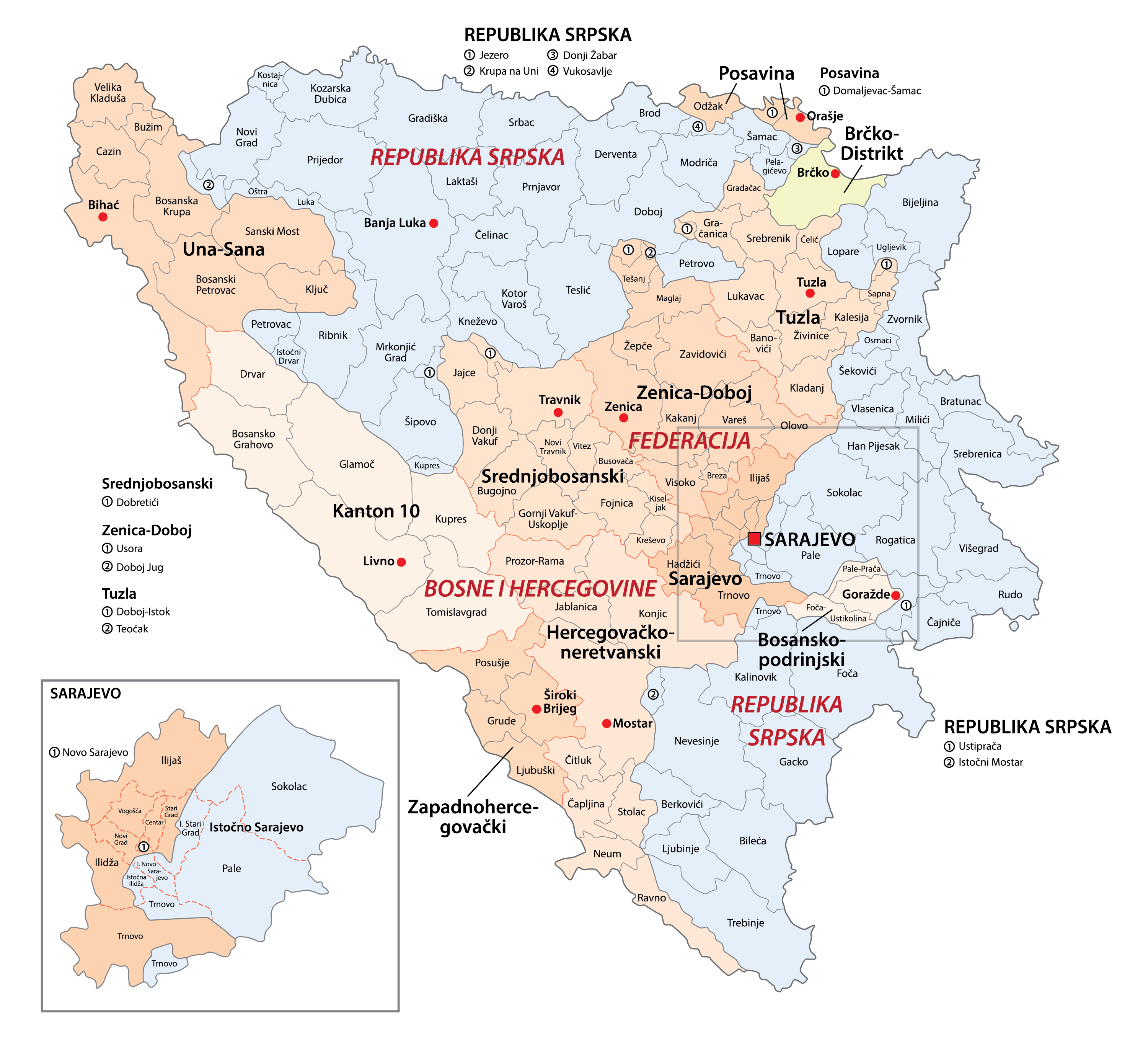
Traveling through Bosnia and Herzegovina's map is like traveling through its essence. The country's terrain varies from the soft river flow to the untamed summits of the Dinaric Alps.
At its center is Sarajevo, a resilient city encircled by historically and culturally rich areas. Natural wonders like Sutjeska National Park and Kravice Falls are also indicated on the map. Every landmark in this nation serves as a testament to its beauty and tenacity.
Geographical Overview Of Bosnia And Herzegovina's Map
Bosnia and Herzegovina is a country on the western part of the European Balkan Peninsula. It is divided into two halves. In the north and center is Bosnia , while in the north and center is Bosnia in the south and southwest is Herzegovina.
Even though these historical regions still exist, the Dayton Accords of 1995created two independent political entities which are the Federation of Bosnia and Herzegovina in the west and central regions, and the Republika Srpska (Bosnian Serb Republic) in the north and east. Other important cities in the country are Mostar and Banja Luka, while Sarajevo is the capital.
A diverse range of ethnic and religious influences may be seen in Bosnia and Herzegovina due to its long history as a crossroads for multiple powers. Three major religions that are typically associated with Bosniaks, Serbs, and Croats are Islam, Orthodox Christianity, and Roman Catholicism. Due to its multiethnic population and strategic location between Serbia and Croatia, Bosnia and Herzegovina has always been vulnerable to territorial aspirations by nationalists.
Quick Facts About Bosnia And Herzegovina
| Legal Name | Bosnia And Herzegovina |
| Capital City | Sarajevo |
| System of Government | Consociational Democracy |
| Total Land Area | 51,209 km² |
| Population | 3,140,095 Million People |
| Currency | Konvertibilna markas (BAM) |
| Dialling Code | +387 |
| Largest City | Sarajevo |
| GDP | $27.83 billion |
| GDP Per Capita | $8,668 |
| Official Language | Bosnian, Croatian, and Serbian |
Map Of Bosnia And Herzegovina's Cities
Bosnia and Herzegovina, a country situated in the western Balkans, occupies 51,209 square kilometers of the European continent. While primarily landlocked, it possesses a small coastline on the Adriatic Sea in the south. The nation shares borders with Montenegro, Serbia, and Croatia.
The Dinaric Alps
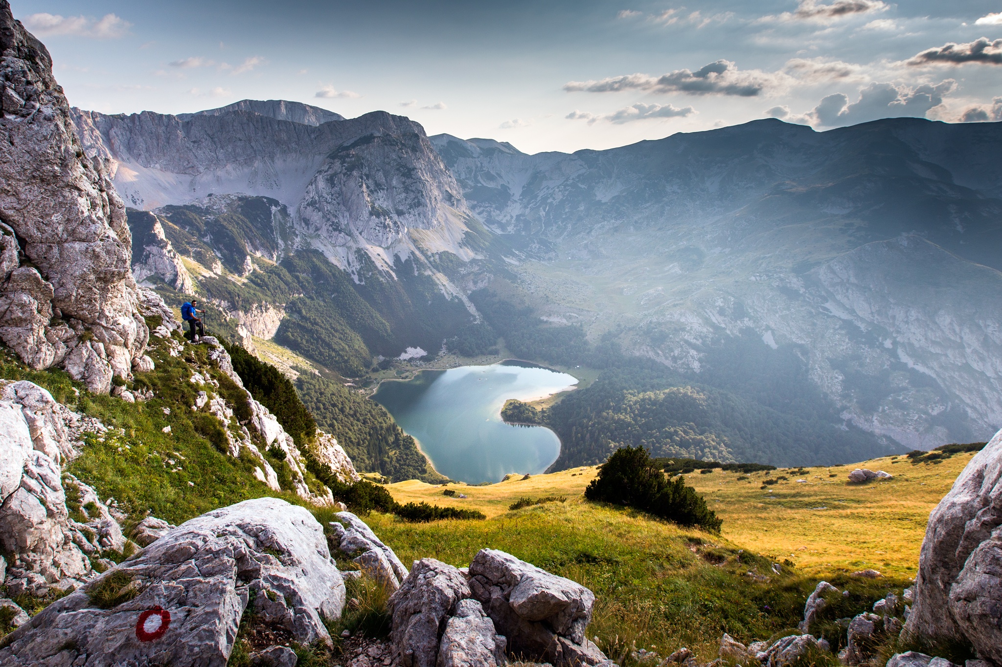
Dominating the Bosnian landscape, with hills and mountains comprising nearly two-thirds of the country. Mount Maglić, reaching 7,828 feet, is the highest peak, located near the Montenegrin border. The central region experiences colder temperatures due to its higher elevation.
Thick Forests
blanket nearly half of the country. In the north, the Pannonian Plain, a fertile region stretching east to west, offers a contrast with its rolling hills. Agriculture thrives in this area along the Sava River valley.
The Adriatic Sea
Accessible through a narrow coastal strip in the southwest, where a more temperate Mediterranean climate prevails. The country is traversed by significant rivers, including the Neretva, Sava, Vrbas, Drina, Una, and Bosna, many of which flow through major cities, including the capital, Sarajevo.Map Of Bosnia And Herzegovina's Cities
Population Of Bosnia And Herzegovina
The population of Bosnia and Herzegovina is expected to gradually shrink between 2024 and 2029, by an estimated 0.1 million, or 2.89 percent. For the third year in a row, the population is predicted to fall, hitting a new low of 3.4 million by 2029. All people counted in the national census are included in this assessment of the overall population.
Regions On The Map Of Bosnia And Herzegovina
Bosnia and Herzegovina is politically separated into two entities. The Republika Srpska, which is situated in the east and north, and The Federation of Bosnia and Herzegovina, which is located in the central and western parts of the country, leaving each entity to be autonomous.
Capital Of Bosnia And Herzegovina - Sarajevo
History Of Bosnia and Herzegovina
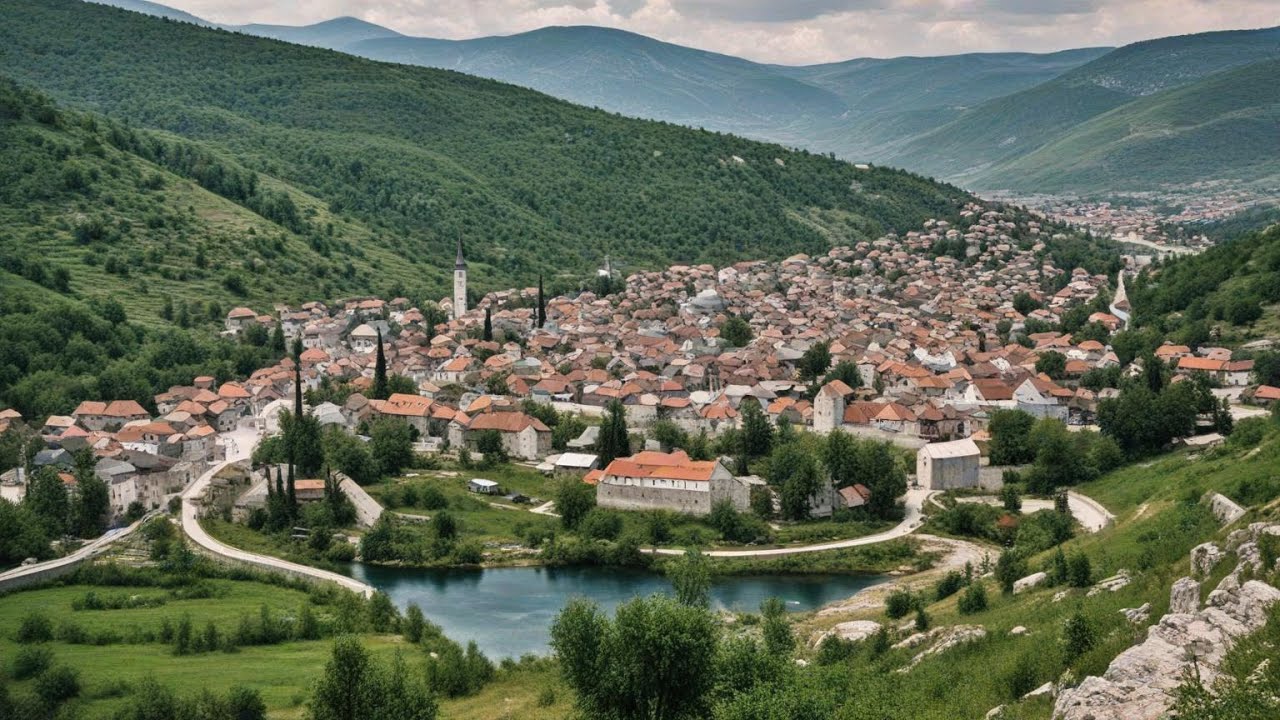
Sarajevo, the capital of Bosnia and Herzegovina, is situated in the Miljacka River valley, surrounded by stunning views of Mount Trebević. Numerous mosques, including as the Gazi Husrev-Bey Mosque and the Ali Pasha Mosque, show how strongly the city has been influenced by Islam. A good illustration of the city's Ottoman history is the bustling old market, or Baščaršija.
The history of Sarajevo is extensive, with evidence of Neolithic settlements dating back to the Butmir civilization. The city was the site of the Archduke Franz Ferdinand's1914 assassination, which had a major impact on the pre-war events.Today, Sarajevo is a vibrant city with a diverse cultural scene thanks to its fusion of Ottoman, Austro-Hungarian, and modern influences.
National Parks In Bosnia And Herzegovina
There are four national parks in Bosnia and Herzegovina, a country with a variety of landscapes and historic sites. In the middle of the 20th century, Sutjeska and Kozara National Parks were created by the Republican administration. Una and Drina National Parks were recently added to this protected network by the Bosnian government. The nation's dedication to protecting its distinctive natural heritage is demonstrated by this program.
Sutjeska National Park
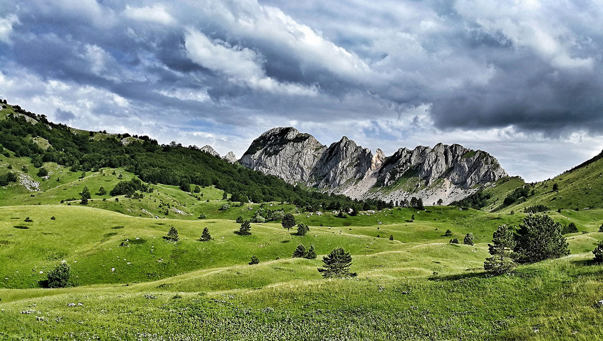
The earliest national park in Bosnia and Herzegovina is Sutjeska National Park, which was created in 1962. The park, which covers 175 square kilometers in the southeast of the nation, includes Mount Maglić, Bosnia and Herzegovina's highest peak, and a sizable section of the Dinaric Alps.
The park features a variety of scenery, ranging from rough alpine summits to thick forests. The park's beautiful splendor is enhanced by the Sutjeska River's flow through it. Within the park, the Zelengora mountain range is well known for its breathtaking wilderness and natural beauty. Notably, the fighting of the 1990s left Sutjeska National Park virtually unaffected, protecting its pristine ecosystem for years to come.
Kozara National Park
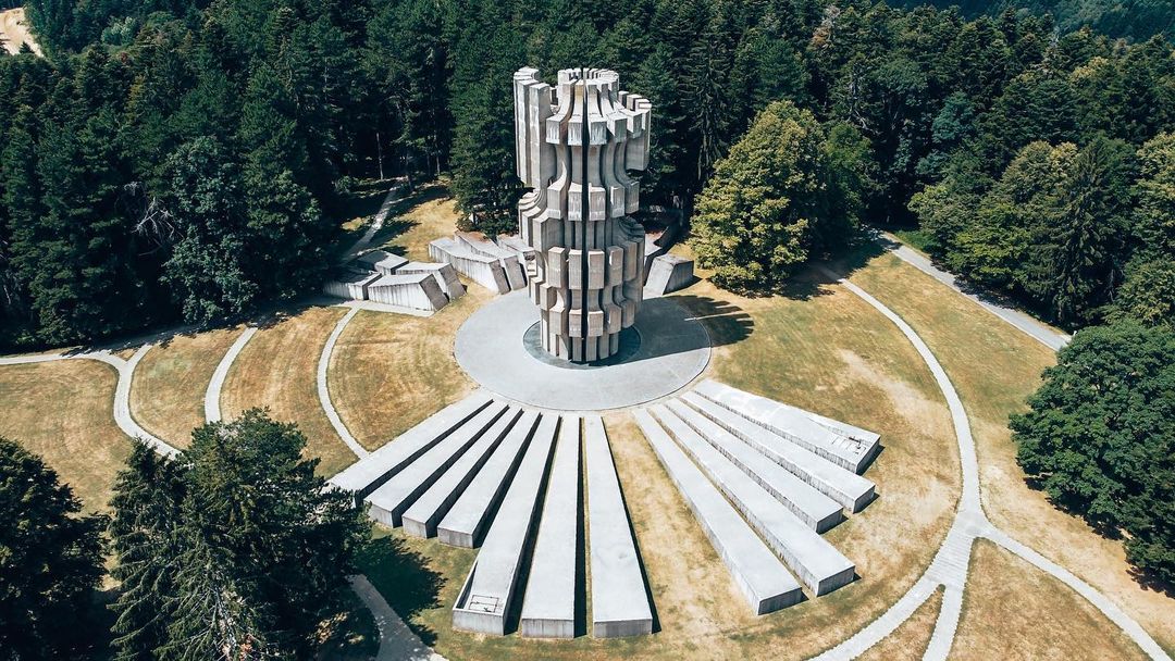
Located in the northwest of Bosnia and Herzegovina, Kozara National Park spans 3,520 hectares and was created in 1967. Along with other noteworthy peaks including Gola Planina, Rudine, Jarcevica, and Vrnovacka Glava, the park includes the Kozara mountain range.
The park has a mild continental climate and is surrounded by the rivers Una, Sava, Sana, and Vrbas.Kozara is an important historical site. The civilian population suffered greatly as a result of the Axis troops' persecution of the local populace and resistance fighters during World War II. As a moving reminder of the area's past, a monument complex inside the park honors these occasions.
Una National Park
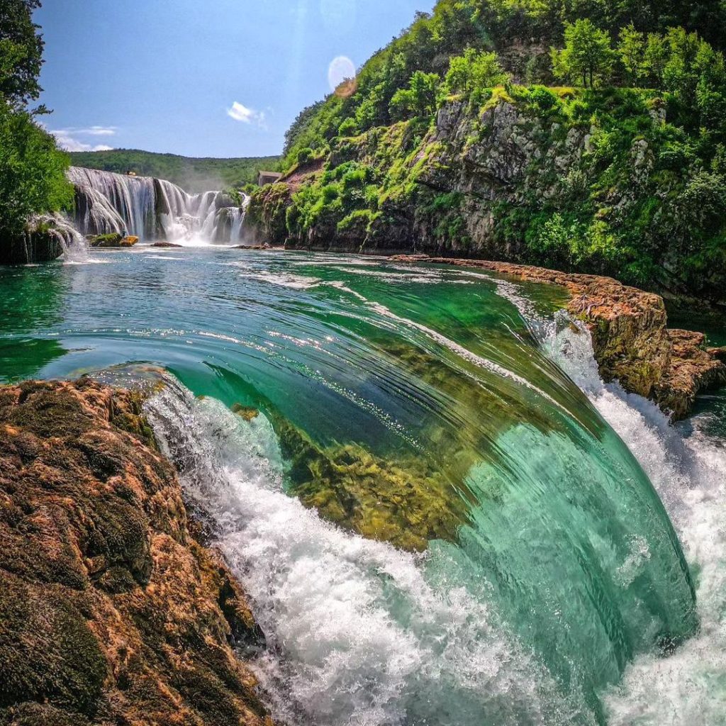
The 3,520-hectare Kozara National Park was created in 1967 and is located in the northwest of Bosnia and Herzegovina. The Kozara mountain range and other prominent peaks including Gola Planina, Rudine, Jarcevica, and Vrnovacka Glava are also included in the park. The park, which is surrounded by the rivers Una, Sava, Sana, and Vrbas, experiences a moderate continental climate.
Kozara is an important historical site. The civilian population suffered greatly as a result of the Axis troops' persecution of the local populace and resistance fighters during World War II. As a moving reminder of the area's past, a monument complex inside the park honors these occasions.
Drina National Park
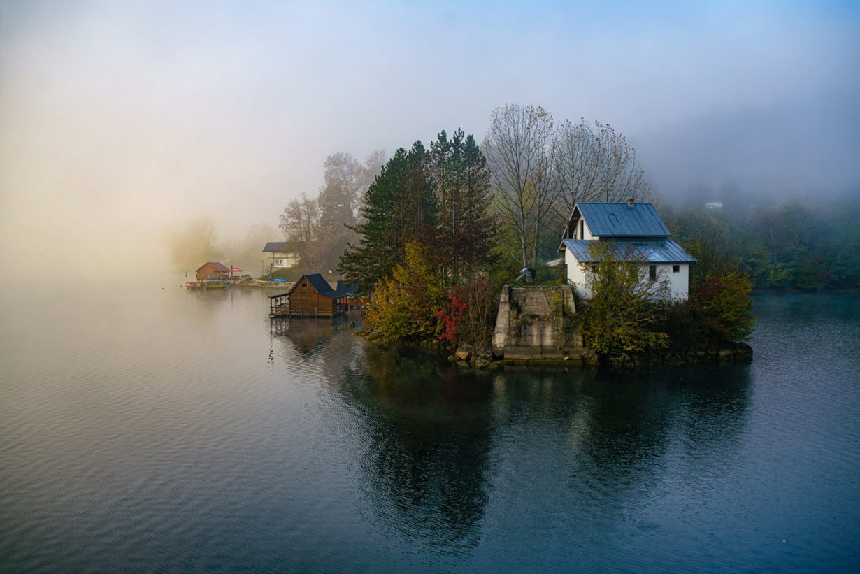
The newest protected area in Bosnia and Herzegovina is Drina National Park, which was created in 2017. The Drina River divides the 6,325-hectare park, which is located in eastern Bosnia close to Srebrenica, from Tara National Park in Serbia.
Drina National Park is well known for its distinctive geological features and remarkable biodiversity. For a wide variety of wildlife, such as mountain goats, brown bears, and golden eagles, it offers an essential habitat. This exceptional natural area makes a significant contribution to the region's ecological diversity.
Major Routes And Highways In Bosnia And Herzegovina
A growing transportation network is essential to Bosnia and Herzegovina's economic development and regional connectivity. An essential route that links the Adriatic coast and Croatia's northern border is the A1 Motorway, which is a component of the Pan-European Corridor Vc. Sarajevo, Zenica, and Mostar are important cities along this route that support global traveland commerce. Northeastern communication will be improved by planned additions to the A2 Motorway.
The M-5, which is a part of the E761 European Route, and the M-17, which runs parallel to the A1 Motorway, are important roads that connect the nation's major cities and offer other routes. The M-6 connects Sarajevo to the south, and the M-18 connects Sarajevo to Tuzla and the east.
A number of important border crossings, such as Gradiška on the Croatian border, Metković close to the Adriatic coast, and Šamac near the Sava River, make it easier to travel and conduct business with nearby nations. The extension of the A1 Motorway and improvements to auxiliary roads are essential for improving regional connectivity and integration in Bosnia and Herzegovina because the country's transportation system is always changing.
Top Attractions On The Map Of Bosnia And Herzegovina
1. Mostar Old Bridge
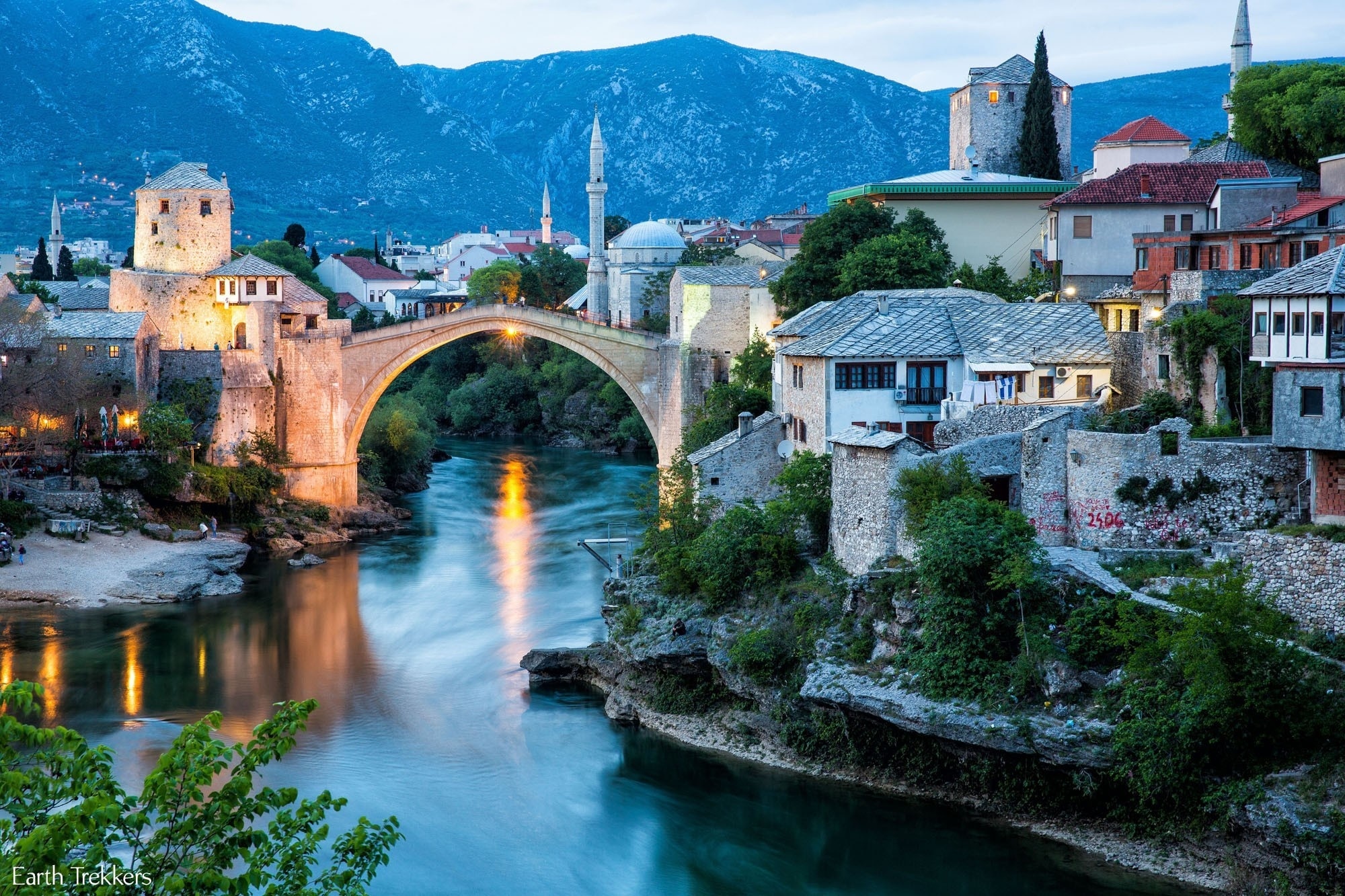
The Stari Most, a UNESCO World Heritage Site, has a moving tale of devastation and rebirth. Although its destruction during the 1993 Bosnian War was a devastating event in the history of the area, its painstaking rehabilitation served as a symbol of resiliency and optimism.
In addition to providing breathtaking views of the Neretva River, the bridge now acts as a reminder of the resilience of the human spirit and the significance of preserving cultural heritage for coming generations.
2. Bascarsija
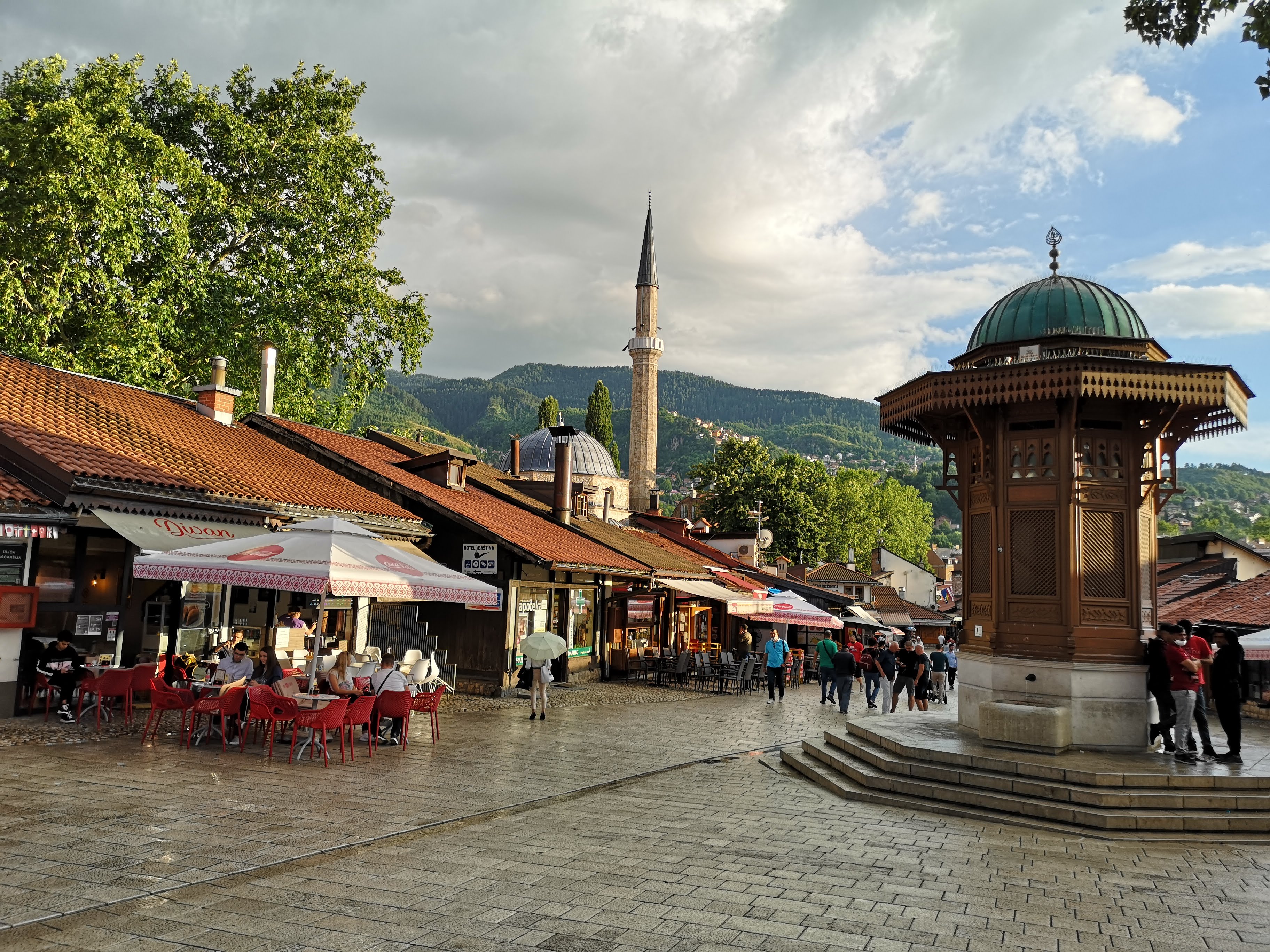
The ancient center of Sarajevo, Baščaršija, is a mesmerizing fusion of Ottoman architecture and lively life. Dating back to the 15th century, this lively old bazaar is a maze of winding cobblestone streets dotted with vintage stores, cafes, and eateries.
The Sahat Kula (Clock Tower) contributes to the district's distinct attractiveness, while the Gazi Husrev-beg Mosque, a masterpiece of Ottoman architecture, is a notable landmark. With the perfume of freshly made Bosnian coffee blending with the sounds of street musicians and the animated conversation of residents, Baščaršija provides a multisensory experience.
3. Museum Of Crimes Against Humanity And Genocide 1992-1995
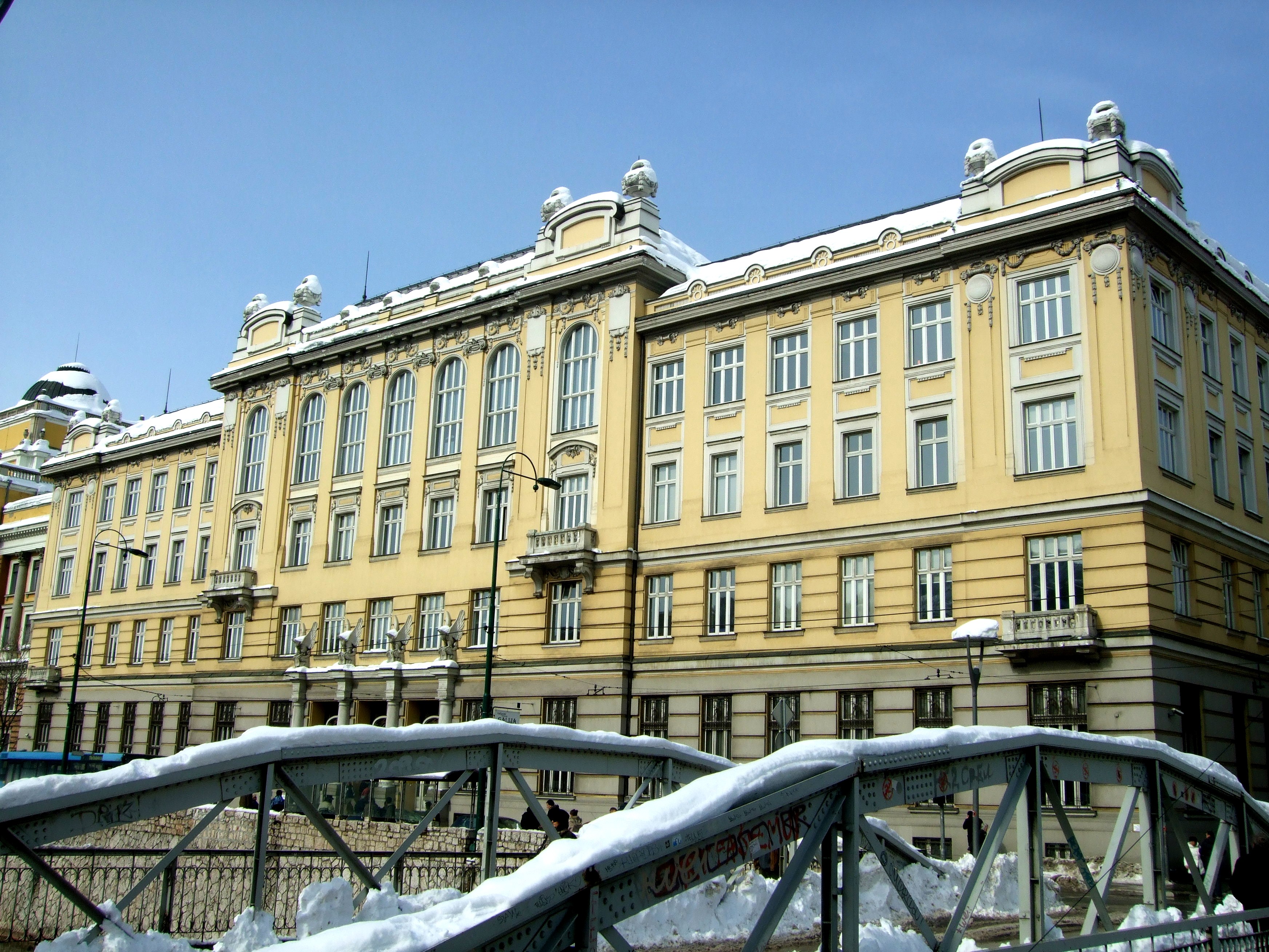
The Museum of Crimes Against Humanity and Genocide 1992-1995 is a potent monument to the horrors of the Bosnian War, located in Sarajevo, Bosnia and Herzegovina. The museum provides a graphic account of the war crimes and acts of genocide against the Bosnian Muslim community through its collection of relics, images, and firsthand accounts. Mass murder, concentration camps, and the terrible loss of cultural legacy during the war are all stark facts that visitors are forced to face in the exhibitions.
The museum is committed to education and commemoration, making sure that the atrocities of the past continue to serve as a lesson for the future. By highlighting the negative effects of ethnic hatred and violence, it encourages introspection and discussion in an effort to stop tragedies like these from happening in the future. It is a somber place that remembers the victims and reaffirms our shared dedication to justice and peace.
4. Kravice Falls
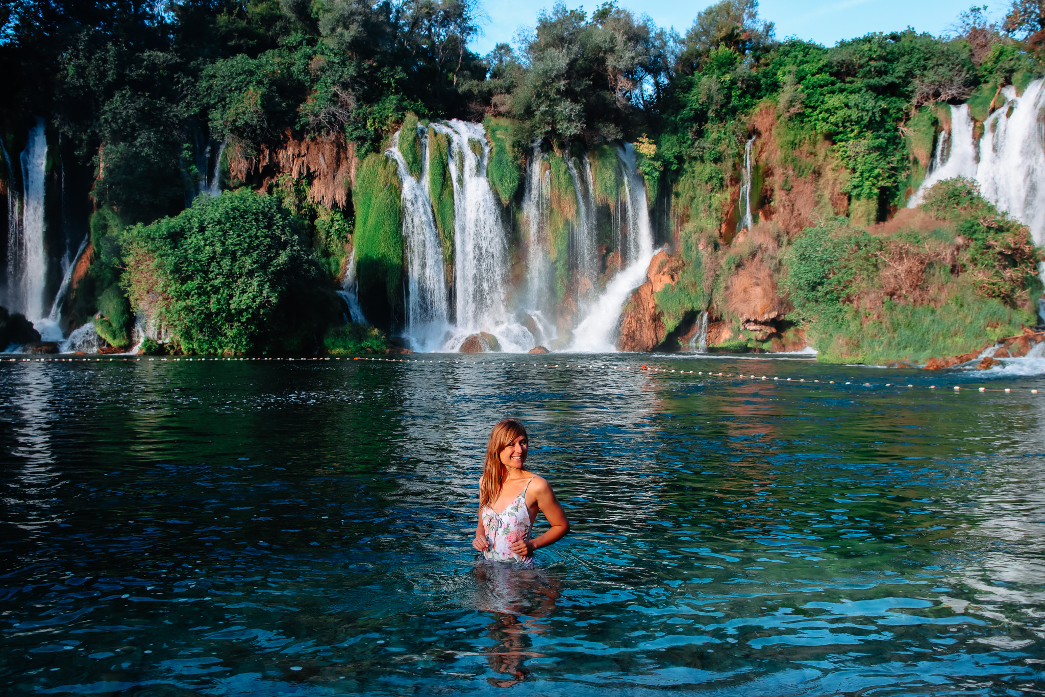
The Kravice Falls, a magnificent natural wonder close to Ljubuški in Bosnia and Herzegovina. Surrounded by rich vegetation, the Trebižat River plunges 25 meters into a vivid turquoise pool. Swimming in the cool waters, having a picnic in the peaceful setting, or just taking in the view are all options for visitors.
As the seasons change, the falls' ever-changing splendor is revealed, from the lively energy of spring to the peaceful quiet of winter. The experience is further enhanced by meandering trails and quaint eateries. A genuine gem that highlights Bosnia and Herzegovina's rich natural legacy is Kravice Falls.
5. Sarajevo War Tunnel
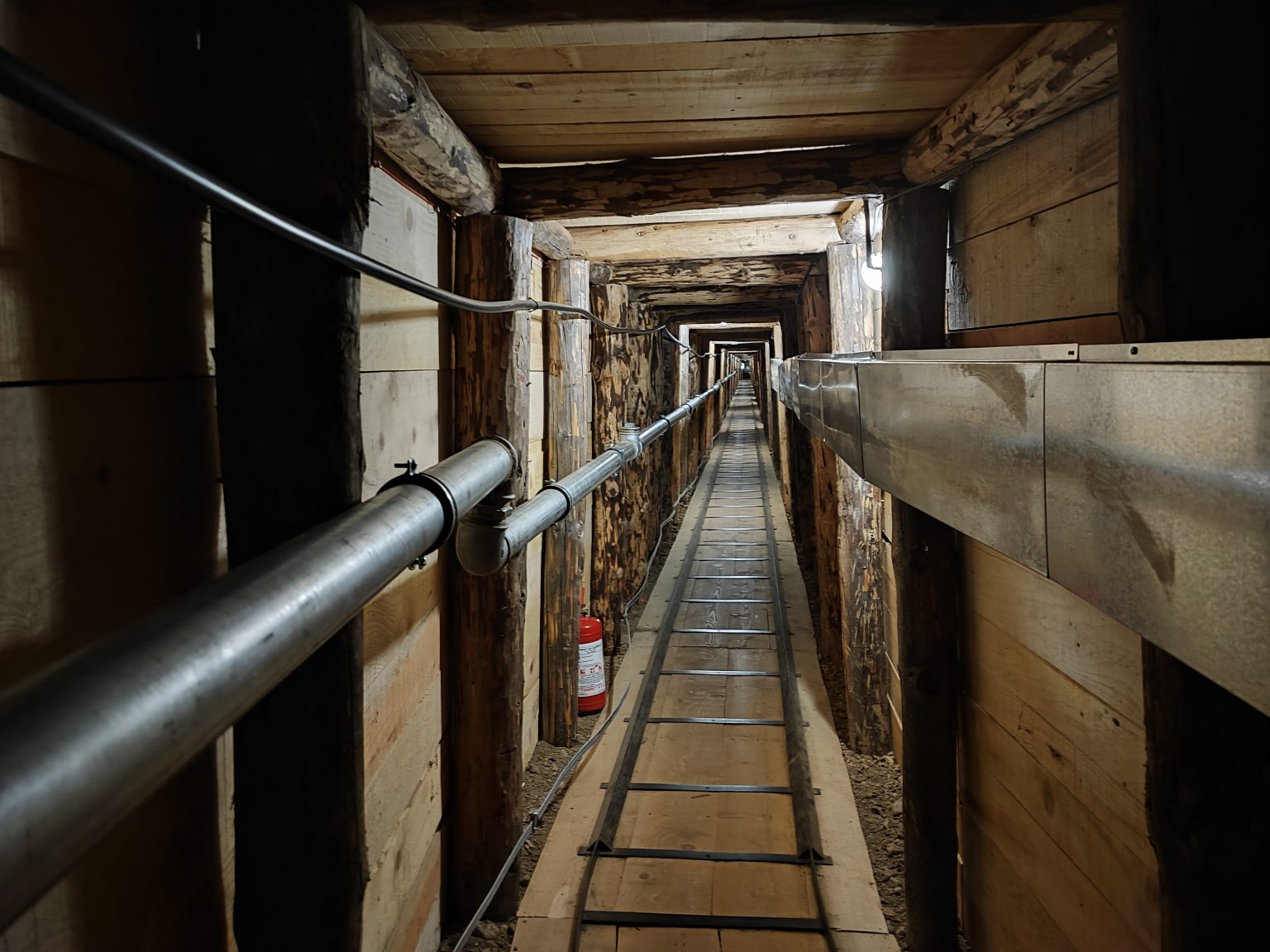
During the horrific siege of Sarajevo (1992-1995), the historic Sarajevo War Tunnel also called the Tunnel of Hope acted as a lifeline for the city. Concealed beneath the Sarajevo airport, this 800-meter-long tunnel allowed civilians to flee the fighting and served as a vital route for the transportation of necessities like food and medicine. The tunnel provided a glimmer of hope during a time of extreme adversity by linking the beleaguered city to territory under the control of Bosnian forces.
6. Apparition Hill
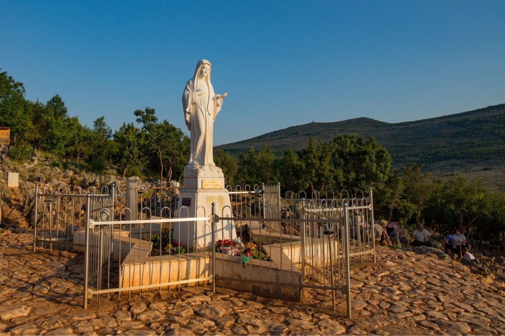
Podbrdo, the local name for Apparition Hill, is a sacred location in Medjugorje, Bosnia and Herzegovina. Since six local youngsters supposedly saw visions of the Virgin Mary there in 1981, the modest village has grown to become a popular destination for Catholic pilgrims from all over the world. In order to worship, meditate, and find a spiritual connection at the location of the alleged apparitions, pilgrims climb the steep slope.
7. Yellow Fortress
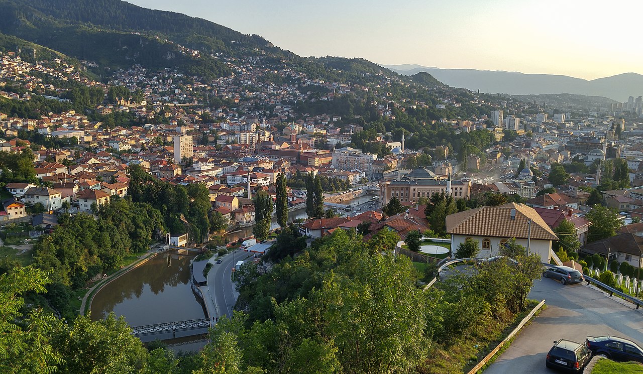
The Yellow Fortress, also known as Žuta Tabija, is a historically significant defensive building located in Sarajevo, Bosnia and Herzegovina. Originally constructed as part of the city's fortifications in the 18th century, it provides breathtaking panoramic views of the city and a window into Sarajevo's Ottoman past.
Nowadays, both locals and visitors like visiting the Yellow Fortress, particularly after sunset when the metropolis is engulfed in warm tones. Additionally, it serves as a symbolic site during Ramadan, when the daily fast is typically broken by the firing of a cannon. The fortress is a reminder of Sarajevo's long history and persistent customs.
Dialing Code Of Bosnia And Herzegovina
The country calling code for Bosnia and Herzegovina is +387. Following Yugoslavia's breakup in 1992, when the former nation's code, +38, was redistributed among its successor governments, this code was assigned.
Currency Of Bosnia And Herzegovina
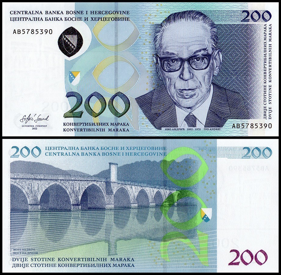
Bosnia and Herzegovina's official currency is the convertible mark (KM). It is legal tender throughout the entire country, including the Republika Srpska and the Federation of Bosnia and Herzegovina, and is divided into 100 fening. The designs of the 10, 20, 50, and 100 KM banknotes vary across the two entities, despite the currency itself being consistent.
Flag Of Bosnia And Herzegovina
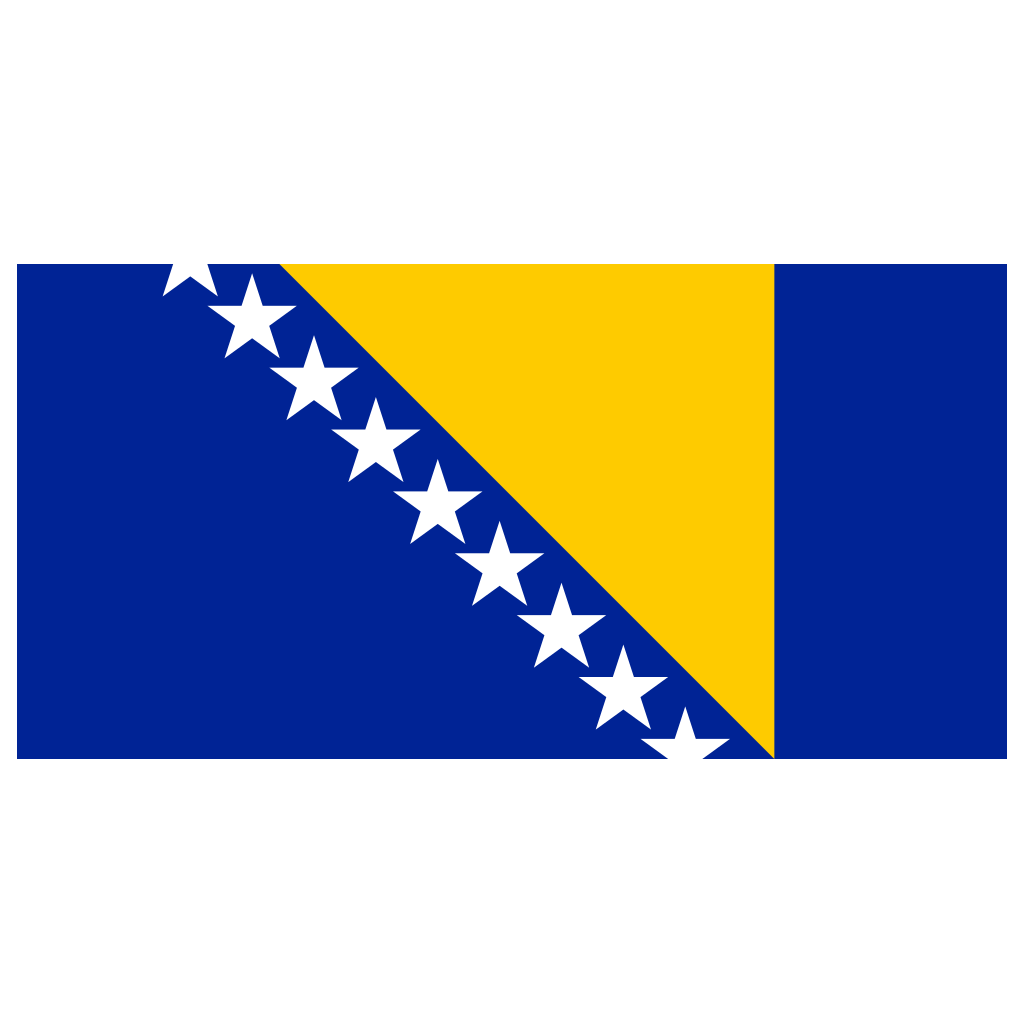
The creation of a cohesive national symbol was complicated by Bosnia and Herzegovina's heterogeneous ethnic composition. The administration used King Tvrtko I's medieval coat of arms, a blue flag with a white diagonal stripe and six golden fleurs-de-lis, to represent a common historical legacy after gaining independence.
However, this flag was not widely accepted, especially by the Serb and Croat communities. The problem was made more complex by the subsequent civil war and the Dayton Peace Accords, which split the nation into the Republika Srpska and the Federation of Bosnia and Herzegovina.
In 1998, the United Nations created a new flag after realizing the need for a more inclusive emblem. The goal of this flag, which had no particular ethnic or religious meanings, was to promote harmony and peace among the many people of the country.
FAQs
What Is The Balkan Peninsula?
The Balkan Peninsula is a region in Southeast Europe, bordered by the Adriatic, Ionian, Aegean, and Black Seas.
Which Countries Are Part Of The Balkans?
The Balkans include countries like Albania, Croatia, Serbia, Montenegro, North Macedonia, and others.
What Is The Dominant Climate In The Balkans?
The Balkans experience a mix of Mediterranean and continental climates.
What Are The Main Mountain Ranges In The Balkans?
The Dinaric Alps, Pindus, and Balkan Mountains are prominent mountain ranges in the region
Conclusion
As tourists traverse this varied terrain, they come across a heritage molded by millennia of history, evidence of the human spirit's tenacity, and a window into the continuous process of moving toward a more cohesive future.
You Might Also Like: Scottish Currency - A Practical Guide For Tourists
Jump to
Geographical Overview Of Bosnia And Herzegovina's Map
Quick Facts About Bosnia And Herzegovina
Map Of Bosnia And Herzegovina's Cities
Population Of Bosnia And Herzegovina
Regions On The Map Of Bosnia And Herzegovina
Capital Of Bosnia And Herzegovina - Sarajevo
National Parks In Bosnia And Herzegovina
Major Routes And Highways In Bosnia And Herzegovina
Top Attractions On The Map Of Bosnia And Herzegovina
Dialing Code Of Bosnia And Herzegovina
Currency Of Bosnia And Herzegovina
Flag Of Bosnia And Herzegovina
FAQs
Conclusion

Michael Rachal
Author
Michael Rachal believes that luxury lies in the details. With over 20 years of experience in the luxury travel industry, he has crafted hundreds of bespoke itineraries for clients seeking personalized, unforgettable experiences.
Whether guiding clients through private cultural tours or curating culinary journeys with world-renowned chefs, Michael ensures that each trip is tailored to perfection.
His ability to anticipate needs and exceed expectations has earned him a reputation as a leading expert in luxury travel.

Finn Wilde
Reviewer
For Finn Wilde, the wilderness is more than just a destination - it’s a way of life. Over the past decade, he has led multiple expeditions in some of the world’s most remote regions, from the icy fjords of Greenland to the rugged trails of Patagonia.
Finn emphasizes sustainability in all of his adventures, helping participants connect with nature while promoting responsible exploration. His expeditions inspire individuals to explore the great outdoors while fostering a deep respect for the environment.
Latest Articles
Popular Articles