Egypt Map - Key Locations, Regions, And Travel Tips
See the Egypt map with major cities, regions, and must-know travel tips. Learn how the geography shapes culture, history, and the best places to visit.
Author:Michael RachalReviewer:Finn WildeJun 23, 2025461 Shares115.1K Views
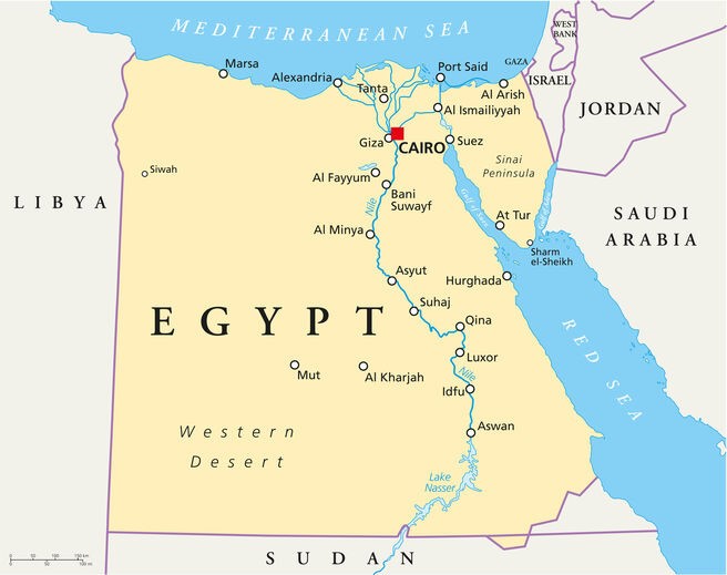
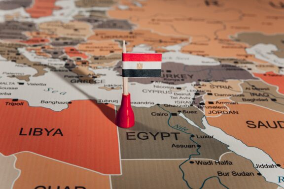
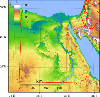
An Egypt mapshows where different places are in this large country in North Africa. Egypt is known for its ancient pyramids, the Nile River, and busy cities such as Cairo.
Most of the land is desert, but the map clearly shows that people mostly live near the river because that’s where water and farms are. Maps like this make it easier to understand how the land is shaped and where the most important places are.
Quick Facts About Egypt Map
- Location: Egypt is in North Africa, with land in both Africa and Asia (via the Sinai Peninsula).
- Borders: It shares borders with Libya, Sudan, and Israel.
- Coastlines: Egypt has coastlines along the Mediterranean Sea (north) and the Red Sea (east).
- Capital City: Cairois located near the Nile River in northern Egypt.
- Major River: The Nile River runs through the country from south to north; it’s the longest river in the world.
- Main Regions: Egypt is divided into Upper Egypt (south) and Lower Egypt (north).
- Deserts: The Sahara Desertcovers most of the land shown on the map.
- Important Landmarks on the Map: You can find the Pyramids of Giza, the Sphinx, Luxor, and Aswan on detailed maps.
- Sinai Peninsula: This area connects Egypt to Asia and is located in the northeasternpart of the country.
- Usefulness: Egypt maps help learn about history, travelroutes, cities, and natural features.
History Of Egypt
Egypt has one of the oldest and most famous histories in the world. From the days of the pharaohs to modern times, Egypt’s story is full of powerful kings, great inventions, and important changes. Its location near the Nile River helped it grow into a strong and successful civilization thousands of years ago.
Let’s look at the different periods that shaped Egypt’s history:
1. Ancient Egypt (c. 3100 BCE - 332 BCE)
Ancient Egypt began around 3100 BCE when King Narmer (also called Menes) united Upper and Lower Egypt. This started the First Dynasty and the long rule of the Pharaohs.
Key Features Of Ancient Egypt:
- Pyramids: Huge stone tombs built for pharaohs. The most famous ones are in Giza, built for kings like Khufu.
- Hieroglyphics: A writing system using pictures and symbols.
- Religion: Egyptians believed in many gods and life after death. They built temples and practiced mummification to prepare for the next life.
- Famous rulers: Hatshepsut (a powerful female pharaoh), Akhenaten (who changed religion), Tutankhamun (the boy king), and Ramses II (a great warrior and builder).
Egypt Was Divided Into Three Major Periods:
- Old Kingdom (Age of the Pyramids)
- Middle Kingdom (Time of expansion and culture)
- New Kingdom (Golden Age of wealth and empire)
2. Greek And Roman Rule (332 BCE - 641 CE)
In 332 BCE, Alexander the Great from Greece conquered Egypt. He founded the city of Alexandria, which became a center of learning and trade.
After Alexander died, his general Ptolemy became ruler and started the Ptolemaic Dynasty. This was a Greek-speaking royal family that ruled Egypt for about 300 years.
Famous queen: Cleopatra VII was the last Ptolemaic ruler. She is known for her beauty and her relationships with Julius Caesar and Mark Antony of Rome. After her death in 30 BCE, Egypt became part of the Roman Empire.
3. Islamic Egypt (641 CE - 1517 CE)
In 641 CE, Arab Muslim forces took control of Egypt. Islam became the main religion, and Arabic replaced Greek and Coptic as the main language.
Egypt was ruled by several Islamic powers:
- Umayyad and Abbasid Caliphates: Egypt was a province of these empires.
- Fatimid Dynasty (969-1171 CE): A Shi’a Muslim dynasty that made Cairo their capital and built Al-Azhar University, one of the oldest in the world.
- Ayyubid Dynasty (1171-1250 CE): Founded by Saladin, a famous general who fought the Crusaders.
- Mamluk Sultanate (1250-1517 CE): Mamluks were slave soldiers who became rulers. They protected Egypt from Mongols and ruled for over 250 years.
4. Ottoman Rule (1517 - 1805)
In 1517, the Ottoman Empire from Turkey took control of Egypt. Egypt became a province ruled by Ottoman governors, but local leaders (like the Mamluks) still had power.
The Ottomans built mosques, markets, and military forts, but Egypt did not grow much during this time. The economy weakened, and many Egyptians lived in poverty.
5. Modern Egypt Begins - Muhammad Ali Era (1805 - 1882)
In 1805, Muhammad Ali, an officer in the Ottoman army, became ruler of Egypt. He made many changes to modernize the country:
- Built factories and schools
- Improved farming and trade
- Started the Egyptian army
- Invited scientists and engineers to develop Egypt
He and his family ruled for many years and were known as the Muhammad Ali Dynasty.
6. British Rule And Independence (1882 - 1952)
In 1882, Britain took control of Egypt to protect the Suez Canal, which was important for trade and travel to India. Although Egypt had a king, the British made most of the decisions.
In 1922, Egypt gained partial independence, and King Fuad I became ruler of the new Kingdom of Egypt. But Britain still controlled the Suez Canal and other important areas.
During World War II, Egypt was a key base for Allied forces.
7. Republic Of Egypt (1952 - Present)
In 1952, the Egyptian army removed King Farouk in a peaceful revolution led by Gamal Abdel Nasser. Egypt became a republic with no king.
Key Modern Events:
- Suez Crisis (1956): Nasser took back control of the Suez Canal from Britain and France.
- Six-Day War (1967)AndYom Kippur War (1973): Conflicts with Israel over land and borders.
- Peace with Israel (1979): Under President Anwar Sadat, Egypt became the first Arab country to sign a peace treaty with Israel.
- Arab Spring (2011): Mass protests led to the removal of President Hosni Mubarakafter 30 years in power.
- Since then, Egypt has had leadership changes and continues to face political and economic challenges.
Geographical Overview Of Egypt
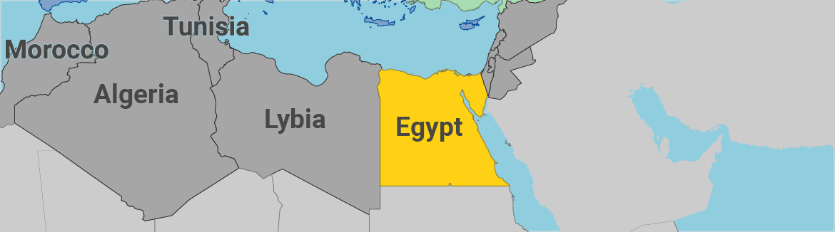
Egypt is located in North Africa, with a small part in the Middle East (the Sinai Peninsula). It is bordered by the Mediterranean Sea to the north, the Red Sea to the east, Sudan to the south, and Libya to the west.
A large part of Egypt is covered by desert, but the Nile River runs from the south to the north, providing water and life to the country. Most people live along this river because the rest of the land is too dry for farming or building cities. Egypt has mountains in the Sinai and along the Red Sea, as well as flat desert plains and green valleys near the Nile.
Capital Of Egypt
The capital of Egypt is Cairo. It is the largest city in the country and one of the biggest cities in Africa and the Arab world. Cairo sits on the banks of the Nile River in northern Egypt.
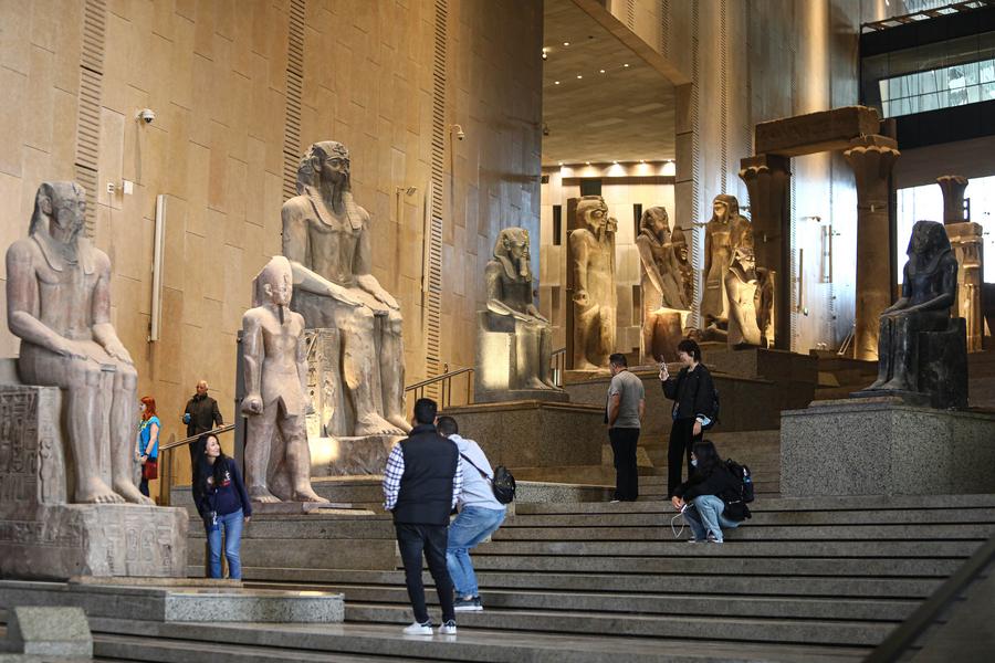
Cairo is the political, cultural, and economic center of Egypt. It’s also home to many famous sites like the Egyptian Museum, historic mosques, and is close to the Giza Pyramids. Cairo is a busy and crowded city, full of markets, traffic, and people from all parts of Egypt.
Map Of Egypt Cities
Cairo
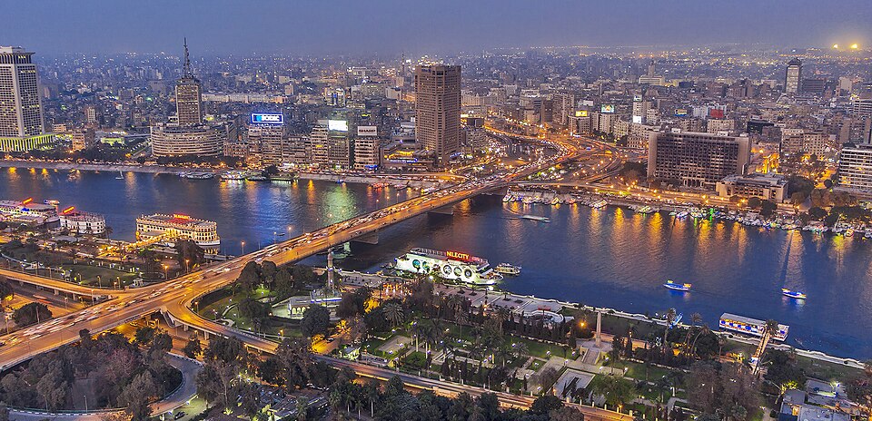
Cairo is the capital city of Egypt and the largest city in the country. It is very busy and full of life, with over 20 million people living in the greater Cairo area. The city sits right next to the Nile River and has many government offices, schools, hospitals, and businesses. It’s also home to the Egyptian Museum, where you can see real mummies and ancient treasures. Cairo is a mix of modern buildings, old mosques, and crowded markets.
Alexandria
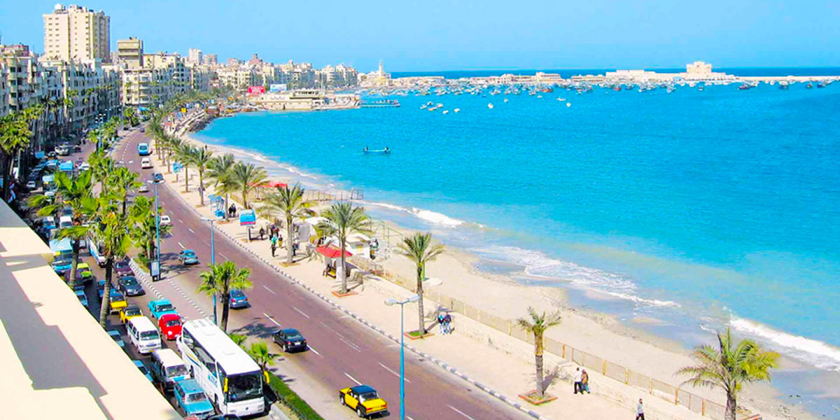
Alexandria is a port city on the Mediterranean Sea, in the north of Egypt. It was founded by Alexander the Great over 2,000 years ago. Alexandria was once one of the most important cities in the ancient world. Today, it is known for its libraries, beaches, and seafood restaurants. The Qaitbay Citadel, built on the site of the famous Lighthouse of Alexandria, is one of the city's top landmarks.
Giza
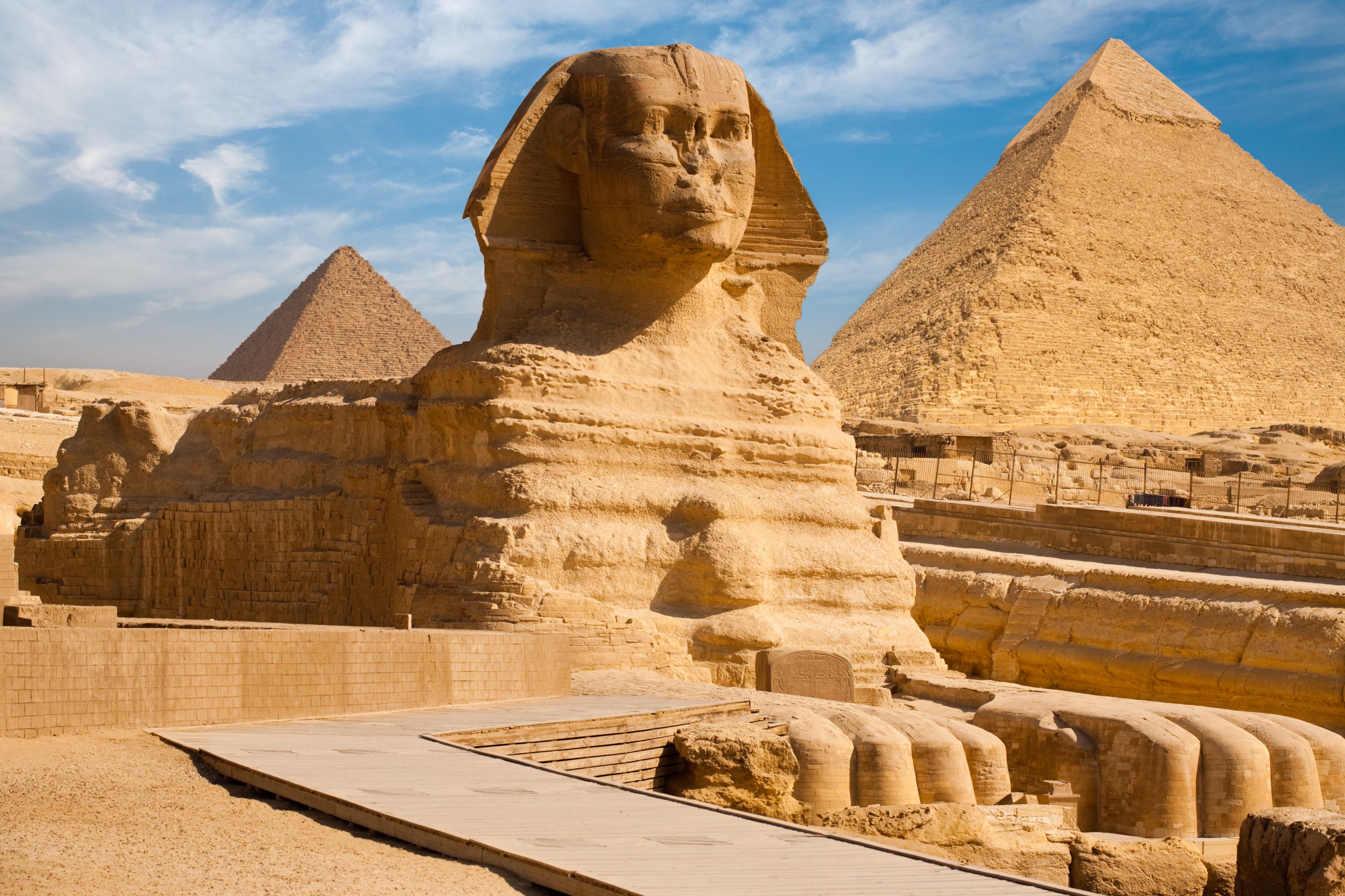
Giza is just across the Nile from Cairo. It is most famous for the Pyramids of Gizaand the Great Sphinx, which are thousands of years old. Tourists from around the world visit Giza to see these ancient wonders. The city also has schools, markets, and residential areas, but the pyramids are what make it truly special.
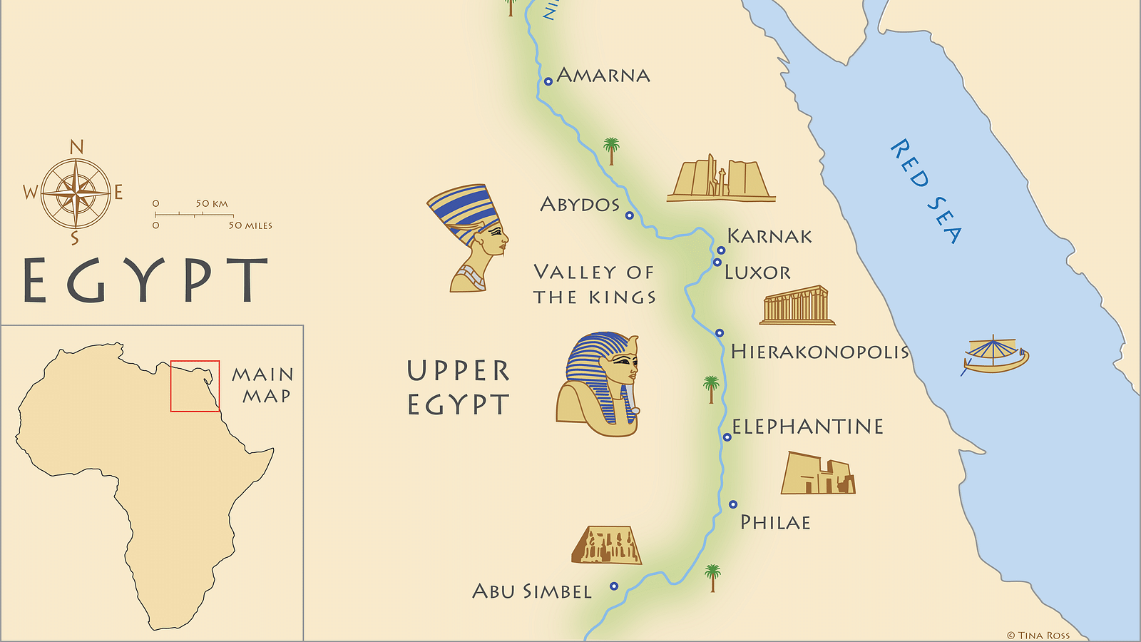
Luxor
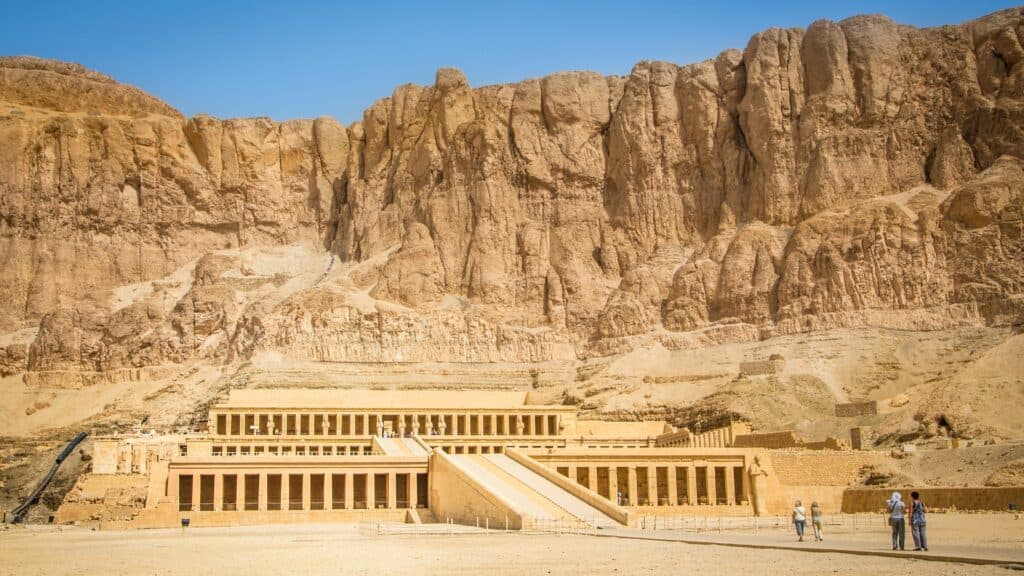
Luxor is in southern Egypt, and it is often called the world’s greatest open-air museum. The city was once the capital of ancient Egypt when it was known as Thebes. It has many famous sites, including the Valley of the Kings, where pharaohs were buried, and large temples like Karnak and Luxor Temple. Luxor sits on both sides of the Nile, with ancient ruins and modern hotels along the riverbank.
Aswan
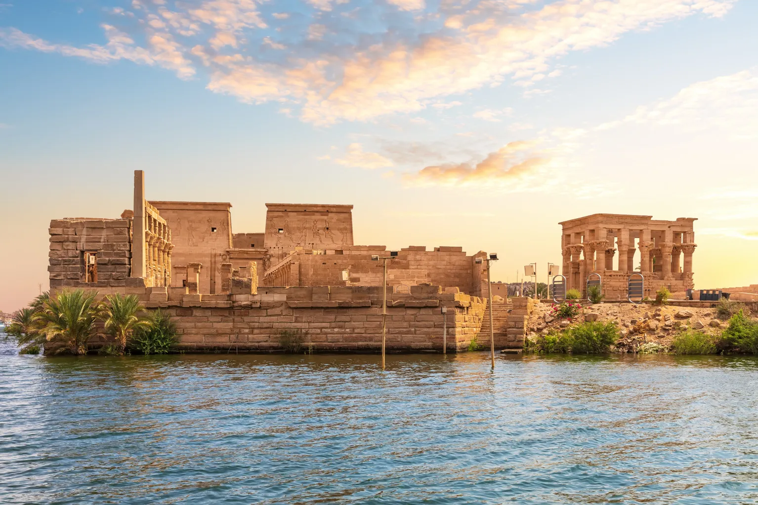
Aswan is a calm and peaceful city located even farther south along the Nile. It is smaller than Cairo and Luxor, but it is very beautiful. The city is close to the Aswan High Dam, which controls the Nile’s water flow. You can take boat rides to nearby islands and visit the Philae Temple. Aswan is also known for its Nubian culture, colorful homes, and warm weather.
Hurghada
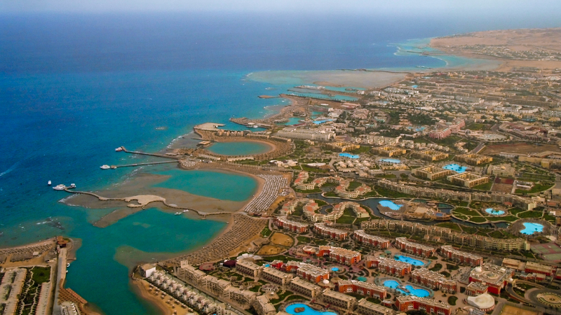
Hurghada is a beach resort town on the Red Sea coast, in the eastern part of Egypt. It is popular with tourists who want to enjoy sunny weather, sandy beaches, and water activities like scuba diving and snorkeling. The Red Sea near Hurghada has beautiful coral reefs and clear water. Many hotels, shops, and restaurants are built here for travelers.
Sharm El-Sheikh
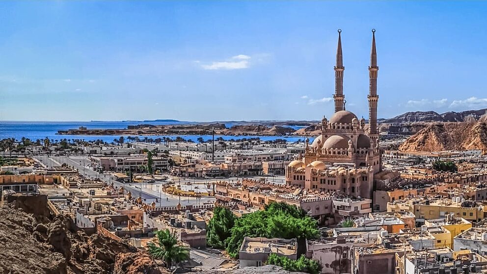
Sharm El-Sheikh is another famous resort city, located at the southern tip of the Sinai Peninsula. It is one of Egypt’s top destinationsfor diving, relaxation, and conferences. People love coming here to see the coral reefs and marine life. The city is also home to luxury hotels and hosted many international meetings and peace talks.
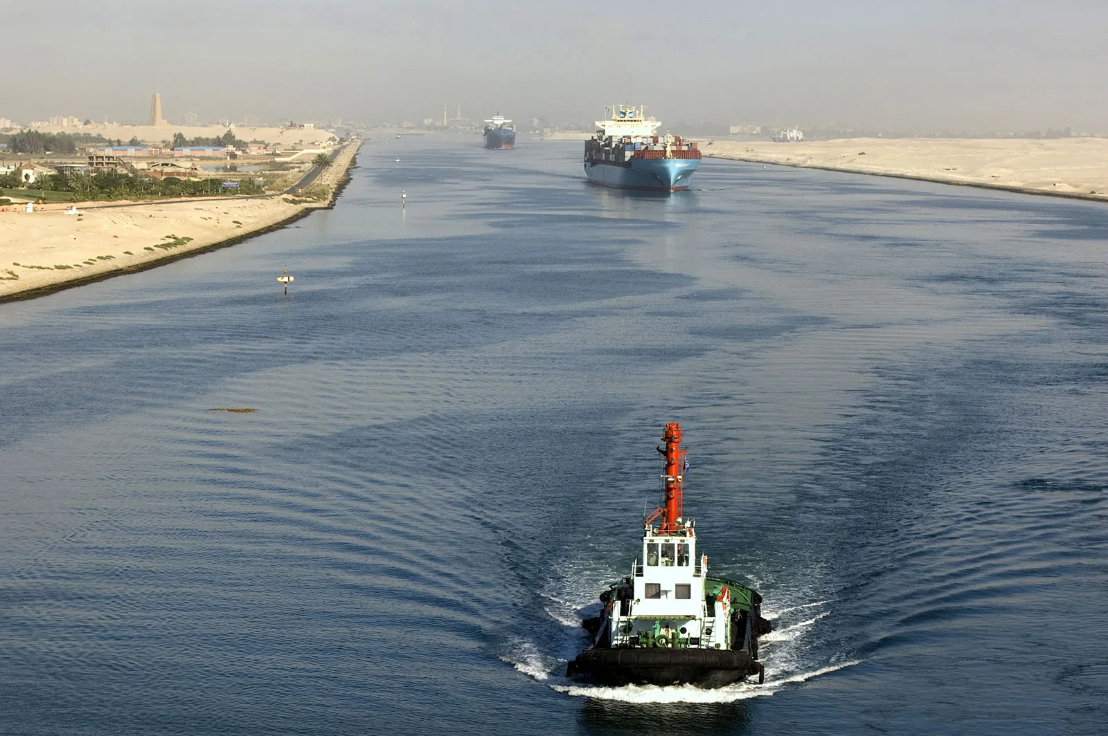
Port Said
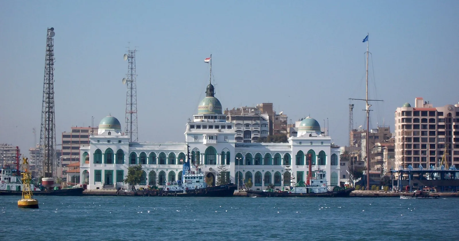
Port Said is a big port city in the north of Egypt, right at the entrance of the Suez Canal where it meets the Mediterranean Sea. It is very important for shipping, as many cargo ships pass through this area when moving between Europe and Asia. Port Said has many old buildings that show its rich history, and it’s also a duty-free city, which means some goods can be bought there without paying tax. This makes it a popular place for trade and business.
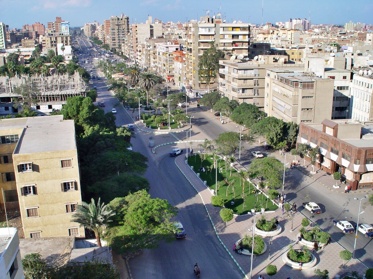
Ismailia
Ismailia is a quiet and green city that sits along the middle part of the Suez Canal. It has beautiful gardens and lakes, and many buildings were built during the time when the canal was first created. The city is also home to the headquarters of the Suez Canal Authority, which manages everything related to the canal. Ismailia is known for being clean and peaceful, and it plays a key role in running canal operations.
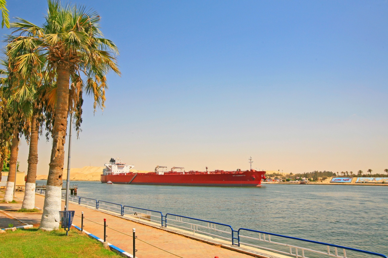
Suez
Suez is found at the southern end of the Suez Canal, where the canal connects to the Red Sea. This makes Suez one of Egypt’s most important cities for sea trade. Big oil refineries and factories are located in the city, helping Egypt produce and move fuel and goods. Suez has a long history, and it’s a key point for ships traveling between the Red Sea and the Mediterranean Sea.
Tanta
Tanta is one of the largest cities in Egypt and is found in the Nile Delta region. It is well known for growing and producing cotton, which is used to make clothes and fabrics. Tanta is also famous for being a religious city. Every year, thousands of people visit the shrine of a Muslim saint named Ahmed al-Badawi during a large festival called the “Moulid.” The city is also home to a university and several markets.
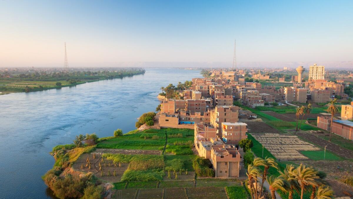
Mansoura
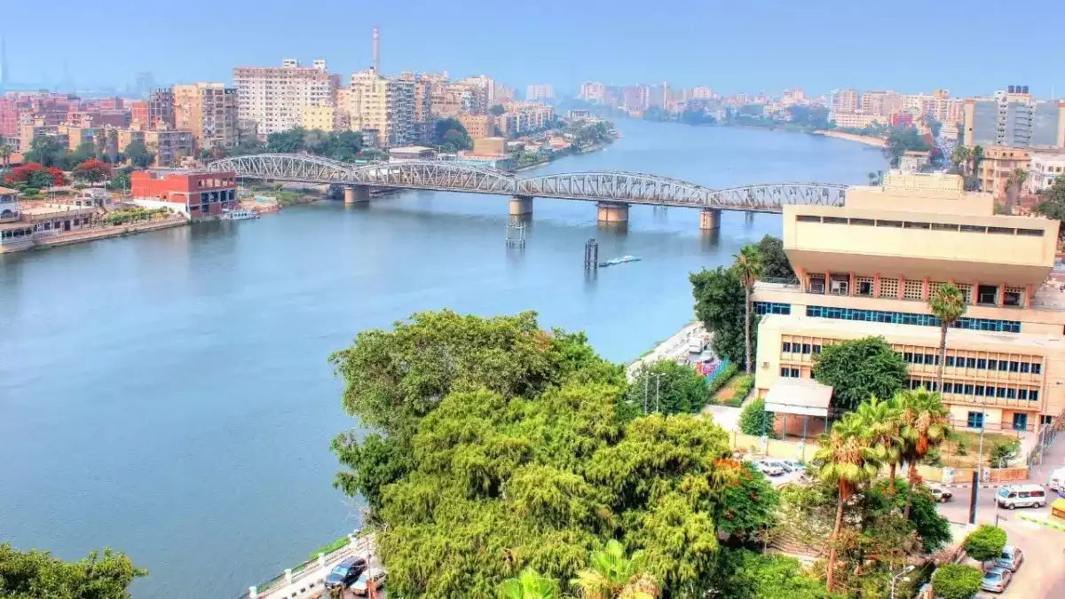
Mansoura is a busy and growing city in Lower Egypt. It sits along a branch of the Nile River called the Damietta branch. The city is well known for its hospitals and medical schools and is considered one of the top places in Egypt for healthcare. Mansoura also has a strong farming industry, and many people in the city work in agriculture. It is a city with a mix of education, healthcare, and farming.
Zagazig
Zagazig is the main city of the Sharqia Governorate in Lower Egypt. It is a farming center and is especially known for growing rice and cotton. The city is also home to Zagazig University, which brings many students from across the country. Zagazig is a smaller city compared to Cairo or Alexandria, but it plays an important role in Egypt’s agricultural and education systems.
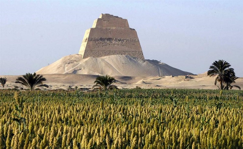
Faiyum
Faiyum is one of the oldest cities in Egypt and is located to the southwest of Cairo. It is close to the Faiyum Oasis, a natural area with water, palm trees, and farmland in the middle of the desert. The city is surrounded by lakes, such as Lake Qarun, and is known for growing crops and producing pottery. Faiyum also has ancient ruins and is a great place to learn about Egypt’s history and traditional rural life.
Minya
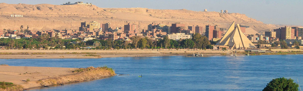
Minya is located in Upper Egypt, south of Cairo along the Nile River. It is an important agricultural city where many farmers grow crops like sugarcane and corn. Minya is also known for its ancient sites, including old tombs and ruins that date back to ancient Egypt. The city has a calm atmosphere and is a cultural center for the region, with schools, universities, and museums.
Qena
Qena is another city in Upper Egypt, sitting beside the Nile River. It is close to one of Egypt’s famous ancient temples; the Temple of Dendera. Qena is surrounded by green fields and farms, where crops like sugarcane are grown. The city is small but important for both farming and tourism. People visiting Luxor often pass through Qena on the way to historical sites.
Sohag
Sohag is a city in Upper Egypt that serves as a cultural and government center. It is known for having strong Christian heritage, with several old churches and monasteries. Sohag is also home to Sohag University and other schools, making it an educational hub. The city has a mix of modern life and traditional Egyptian culture, with many festivals and events held each year.
Beni Suef
Beni Suef is located along the Nile River, between Cairo and the cities of southern Egypt. It is known for making textiles like clothes and fabrics in its factories. The city also has a large farming area where crops are grown. Because of its location, Beni Suef is a transportation link that connects different parts of the country. It is growing steadily in both industry and education.
El-Arish
El-Arish is a coastal city in the northeastern part of Egypt, located in North Sinai along the Mediterranean Sea. It is a small but important city because it is close to Egypt’s border with Gaza and Israel. El-Arish has military importance and is used for border control. The city also has beaches, palm trees, and a small fishing industry. Although it has faced challenges in recent years, El-Arish remains a key town in the Sinai region.
Regions On The Map Of Egypt
Egypt is divided into several main regions. Each one has different types of land, weather, and ways of life. These regions help explain how people live, where they travel, and what kind of work they do in different parts of the country.
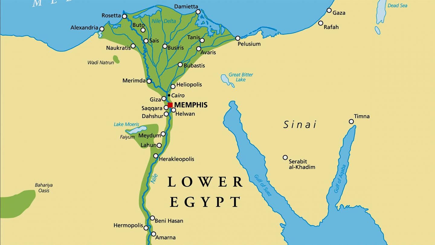
Lower Egypt
Lower Egypt is the northern part of the country where the Nile River spreads out into the Nile Delta before reaching the Mediterranean Sea. This area has flat land, rich soil, and plenty of farms. It is one of the most crowded parts of Egypt because the land is good for growing food. Big cities like Cairo and Alexandria are found here. The weather in Lower Egypt is cooler than in the south, and it gets more rain during the winter.
Upper Egypt
Upper Egypt is in the south, stretching along the Nile River from Cairo to Aswan. Even though it’s called "Upper," it is located in the southern part of the country. It has narrow strips of land along the river where people farm and live. Cities like Luxor and Aswan are in Upper Egypt. This region is hotter and drier than the north, but it is also full of ancient temples, tombs, and monuments that bring visitors from around the world. Many people here still farm close to the river.
Western Desert
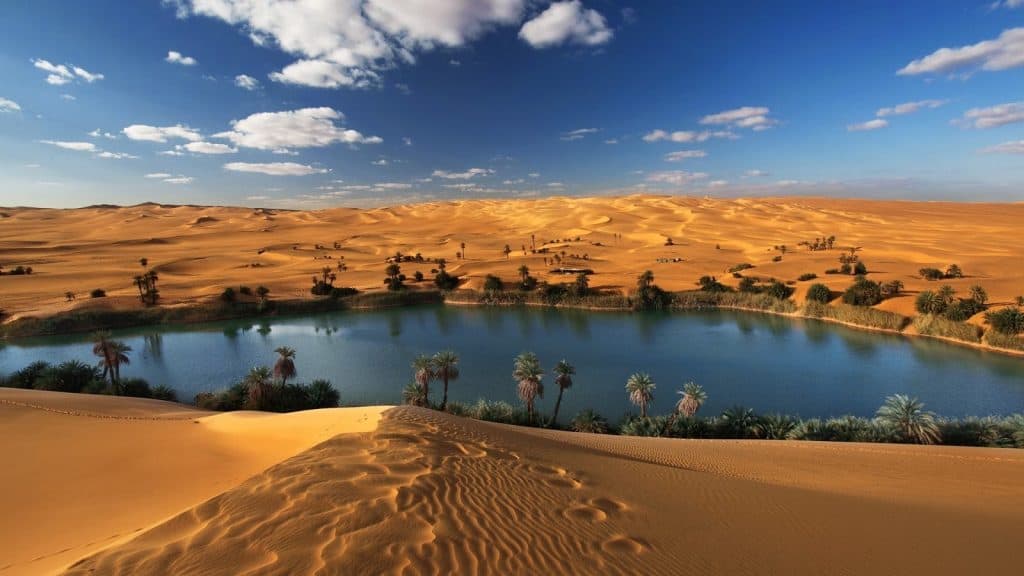
The Western Desert takes up most of Egypt’s land but has very few people. It lies west of the Nile and is filled with sand, rocks, and desert landscapes. Even though it is dry and empty, there are green spots called oases where water is found underground. People live in these oases and grow crops. Famous ones include Siwa and Bahariya. The Western Desert is peaceful and has natural beauty, but travel is harder because of the long distances and harsh climate.
Eastern Desert
The Eastern Desert lies between the Nile River and the Red Sea. It is full of rocky hills, mountains, and deep dry valleys. It is not as empty as the Western Desert because it has mines and small groups of people who live there. The Eastern Desert is known for its gold and mineral resources. It also has roads that lead to Red Sea cities like Hurghada. The coastline in this region is popular for beaches and sea life, which attract many tourists.
Sinai Peninsula
The Sinai Peninsula is in the northeast part of Egypt. It has a triangle shape and lies between the Mediterranean Sea and the Red Sea. The land here is made up of deserts and tall mountains, including Mount Sinai, a place important to several religions. In the southern part of Sinai, there are many beach towns like Sharm El-Sheikh and Dahab where people go to relax, swim, and dive. The Sinai region is also important because it borders other countries and is watched closely for security reasons.
Population Of Egypt
Egypt has a population of over 110 million people, making it the most populated country in the Arab world and the third most populated in Africa. Most people live near the Nile River and its delta, because these areas have water, jobs, and better living conditions.
Cities like Cairo, Alexandria, and Giza are very crowded, while the desert regions are mostly empty. The population includes a mix of people with different cultures, but the majority are ethnic Egyptians, and the Islamic religion is followed by most.
Total Area Of Egypt
Egypt covers a large area in North Africa and a small part of Southwest Asia (in the Sinai Peninsula). The total area of Egypt is about 1,001,450 square kilometers. This makes Egypt one of the largest countries in Africa and the Arab world.
Even though the country is large, most of it is covered by desert. People mostly live near the Nile River and the coastlines, where there is water and better land for farming. The rest of the country has wide open deserts, mountains, and sandy plains.
Egypt’s Borders And Neighboring Countries
Egypt is located in northeastern Africa and also has land in Asia through the Sinai Peninsula. It shares land borders with several countries:
- To the west, Egypt borders Libya.
- To the south, it borders Sudan.
- To the northeast, it borders Israel and the Gaza Strip (Palestinian territory).
Egypt also has coastlines:
- The Mediterranean Sea is to the north.
- The Red Sea is to the east.
The Suez Canal connects the Mediterranean Sea and the Red Sea. This waterway is very important for world trade and helps separate the African and Asian parts of Egypt.
These borders and seas make Egypt a key country for travel, trade, and military strategy.
Currency Of Egypt
The currency of Egypt is called the Egyptian Pound, written as EGP or ج.م in Arabic. It’s used for everything from shopping and transport to hotels and food.
Coins and banknotes come in different amounts, such as:
- Coins: 25, 50 piastres, and 1 pound.
- Banknotes: 5, 10, 20, 50, 100, and 200 pounds.
Prices in Egypt are usually listed in Egyptian pounds, and tourist areas often accept US dollars or euros, but local money is always better to use.
Dialing Code Of Egypt
Egypt’s international dialing code is +20. This code is used when calling a phone number in Egypt from outside the country.
For example, to call a mobile number in Egypt from another country, you would dial +20, followed by the local number (without the leading 0).
Example: +20 10 12345678.
Inside Egypt, you don’t need the +20 code just dial the number directly.
Language Of Egypt
The official language of Egypt is Arabic. The version spoken in daily life is called Egyptian Arabic, which is slightly different from the Arabic spoken in other countries.
In tourist areas, many people also speak English and sometimes French, especially those working in hotels, shops, or travel services. Street signs, menus, and museum labels often include English, making it easier for visitors.
Flag Of Egypt
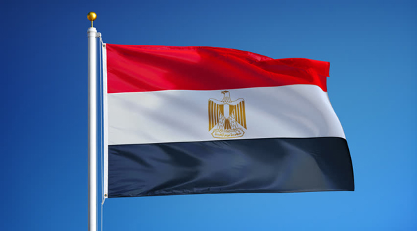
The flag of Egypt is made up of three horizontal stripes:
- Red on top
- White in the middle
- Black at the bottom
In the center of the white stripe is the Eagle of Saladin, a golden eagle with a shield and scroll. The red represents strength and bravery, the white stands for peace, and the black symbolizes Egypt’s past struggles.
The flag is a symbol of national pride and independence, and you’ll see it displayed on public buildings, schools, and during national celebrations.
Government Of Egypt
Egypt is a republic, which means it has a president elected by the people. The government of Egypt is made up of three main parts: the executive, the legislative, and the judicial branches.
- The President is the head of state and the most powerful person in the government. He is responsible for leading the country, signing laws, and working with other countries. The president is elected for a term of six years.
- The Prime Minister helps manage the daily running of the country. He works closely with other government ministers who are in charge of things like health, education, transport, and the economy.
- The Parliament (also called the House of Representatives) is where laws are discussed and approved. Members of Parliament are elected by the people from all over Egypt.
- The Courts make sure laws are followed and help settle legal problems. The highest court in Egypt is the Supreme Constitutional Court.
Egypt’s government is based in the capital city, Cairo. Like many countries, Egypt has both national and local governments. Local governments take care of cities and villages across the country.
Types Of Egypt Maps
Many types of maps show different things about Egypt. Each map has its own purpose and helps people learn or plan something specific.
1. Political Map
A political map shows Egypt’s borders, its major cities, and its 27 governorates (regions). It also shows where the capital and large towns are located.
2. Physical Map
This type of map shows the land features of Egypt. It highlights deserts, mountains, valleys, rivers, and seas. For Egypt, the Nile River, the Western Desert, and the Red Sea are clearly marked.
3. Climate Map
A climate map shows the weather in different parts of Egypt. It helps people understand which areas are hot, dry, or humid. Egypt’s climate maps often show hotter areas in the south and milder areas in the north.
4. Road And Transport Map
Road maps display the major roads, highways, and railway lines that connect Egypt’s cities. These are helpful for drivers and travelers.
5. Tourist Map
Tourist maps show popular places to visit, such as pyramids, temples, museums, beaches, and resorts. They help tourists find attractions and plan their trips.
6. Topographic Map
These maps show elevation and land height using lines and colors. They are used in construction, hiking, and scientific research.
Major Roads And Transportation In Egypt
Egypt has many ways to move around the country. A road map of Egypt shows the highways, train lines, airports, and seaports that connect the cities, villages, deserts, and coastal areas. These transport systems help both local people and visitors travel easily.
Cairo - Alexandria Desert Road
This is one of the busiest highways in Egypt. It connects Cairo, the capital, with Alexandria, a major city on the Mediterranean Sea. The road is wide and smooth, and thousands of cars, buses, and trucks use it every day. It is often used for business trips, deliveries, and travel between the two big cities.
Cairo - Aswan Road
This long road runs from Cairo to Aswan, a city in the south of Egypt. It follows the Nile River, passing through many towns like Luxor and Assiut. People use this road to visit famous temples, tombs, and other historical places along the river. It is also used to move goods between cities.
Suez Road
This important road connects Cairo to the Suez Canal and goes all the way to the Sinai Peninsula. It is used for trade because the Suez Canal is one of the world’s busiest shipping routes. Tourists also use this road to travel to beach resorts in places like Sharm El-Sheikh and Dahab.
Railway System
Egypt has one of the oldest railway systems in Africa. The trains connect large cities such as Cairo, Alexandria, Luxor, and Aswan. Train travel is often cheaper than flying or driving. It is a comfortable way to see the countryside, and many people use trains for long trips or daily travel between cities.
Airports In Egypt
Egypt has several airports, and the biggest one is Cairo International Airport. It is the main airport for both international and local flights. Other busy airports are in Alexandria, Sharm El-Sheikh, Luxor, and Hurghada. These airports help people travel quickly across the country and welcome many tourists each year.
Seaports
Egypt’s main seaports are in Alexandria, Port Said, and Suez. These ports are important for trade and shipping. Big cargo ships bring goods into the country and take Egyptian products to other countries. Some ports also receive cruise ships that bring visitors to Egypt by sea.
Egypt River Map - Life Along The Nile
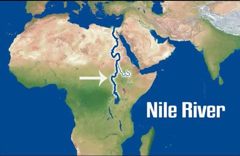
The Nile River is one of the most important features on any Egypt map. It runs like a long ribbon through the country and has supported life in Egypt for thousands of years. A river map shows how the Nile flows from south to north, starting near Aswan, passing through Luxor and Cairo, and finally reaching the Mediterranean Sea at the Nile Delta.
Maps of the Nile are useful because they show where towns, farms, and roads are built along its banks. These maps help people understand why most Egyptians live close to the river.
The Nile River Is The Longest In The World
The Nile River is the longest in the world, stretching over 6,600 kilometers (over 4,100 miles). It begins in central Africa and travels north through Sudan and Egypt.
In Egypt, the river is the main source of fresh water and has always been key to survival in the desert. The river map shows this long journey and how it brings life to dry areas along the way.
The Nile Supports Most Of Egypt’s Farming
Most of Egypt is desert, so farming is only possible near the Nile. River maps show green areas along the riverbanks where crops are grown. Farmers use the river to irrigate fields, growing crops like wheat, rice, corn, and vegetables.
These maps help explain why farming villages are built near the water and why this narrow green strip is so important to the country’s food supply.
Cruise Ships Travel Between Luxor And Aswan
The stretch of the Nile between Luxor and Aswan is famous for its river cruises. Tourists travel by boat to visit ancient temples, tombs, and villages along the way. River maps show this part of the Nile clearly because it includes many historical sites.
These cruises are popular because they offer a peaceful way to see Egypt’s history and culture.
The Nile Splits In The Delta Region
Near the north end of Egypt, the Nile divides into several branches before reaching the Mediterranean Sea. This area is called the Nile Delta. The Delta is wide and flat, with many canals and small rivers spreading out like a fan.
It is one of the most fertile parts of Egypt and is shown in detail on river maps. The Delta includes many farms, towns, and cities, including Alexandria, a major port.
Cities, Farms, And Villages Are Built Along The Riverbanks
If you look at a detailed Egypt river map, you’ll notice that most cities and towns are built next to the Nile. This is because water is needed for drinking, farming, and transportation. Places like Cairo, Luxor, Aswan, and many smaller villages are located close to the river.
These maps show how access to water has shaped Egypt’s population, with most people living in a narrow area beside the Nile while the rest of the land remains dry and empty.
Why Nile River Maps Are Important
Maps of the Nile River are important for many reasons:
- They help people understand where Egypt’s population and farmland are located.
- They guide travelers and tourists who want to visit important sites along the river.
- They show how water shapes life in a mostly desert country.
- They are used in planning, farming, and education.
Without the Nile, Egypt would be a dry desert with very little life. The river gives water, food, and history, and a map helps show just how important it really is.
Continue Reading - Nile Cruises In Egypt - Tips To Make It A Cruise To Remember
Egypt Climate Zones And Environmental Maps
Egypt has different climate zones, and special maps can help show these changes clearly. These maps are useful for learning about the weather, nature, and how people can prepare for travel or outdoor activities.
North Egypt (Mediterranean Coast) - Mild And Wetter Winters
The northern part of Egypt, close to the Mediterranean Sea, has a mild climate. Winters here are cooler than the rest of the country and can be slightly wet, with light rainfall during the colder months.
Cities like Alexandria and Port Said are in this zone. Summers are warm but not as hot as in southern areas, thanks to the sea breeze. This climate is more comfortable and supports farming and green spaces.
Central Egypt - Hot Days And Cool Nights
In the central part of Egypt, including cities like Cairo, the weather is mostly hot and dry. Summers can be very warm during the day, but at night, the temperature often drops, making it cooler and more pleasant.
There is very little rain throughout the year. This area lies between the Mediterranean coast and the southern desert zones, and the land is mostly flat and sandy. Because of the heat, people often plan outdoor activities in the early morning or late evening.
South Egypt (Luxor And Aswan) - Very Hot With Almost No Rain
The southern part of Egypt, including well-known places like Luxor and Aswan, is one of the hottest regions in the country. Summers can be extremely hot, with temperatures often rising above 40°C (104°F).
Rain is very rare, and the air is dry throughout the year. Despite the harsh weather, many tourists visit this area to see temples and other ancient sites. Maps of this region help travelers understand how to stay safe in such hot conditions.
Protected Areas - Shown On Environmental Maps
Egypt has several protected natural areas, and these are marked on environmental maps. Some popular ones include:
- Wadi El Rayan: A nature reserve near Fayoum with waterfalls, desert landscapes, and unique wildlife.
- Ras Mohammed National Park: Located near Sharm El-Sheikh, this park protects coral reefs, fish, and marine life in the Red Sea.
These maps help show where protected zones are, so people can visit without harming the environment.
Biodiversity Zones - Where Animals And Plants Live
Environmental maps also show biodiversity zones, where special plants and animals are found. Egypt’s deserts may look empty, but they are home to many species, such as foxes, gazelles, lizards, and desert plants that grow with very little water.
Along the Nile and in oases, you can find palm trees, birds, and green farmland. Maps like these help researchers and visitors know where to find and protect wildlife.
Sandstorm Regions - Areas With Seasonal Dust Storms
Some maps also highlight sandstorm-prone areas. These storms usually happen during the spring season, especially around March and April. They are known as "khamsin" winds and carry dust across the desert into towns and cities.
Areas in central and southern Egypt are often affected. These storms can make travel difficult, and environmental maps help people see which areas to avoid or prepare for during these months.
National Parks And Landscapes
Egypt has many beautiful natural places that are protected by the government. These areas are called national parks or protected areas. They are important because they protect rare plants, animals, and landscapes.
- Wadi El Rayan: Located in the desert near Faiyum, this park has two large lakes, sand dunes, and waterfalls. It’s home to many birds and desert animals.
- Ras Mohammed National Park: This park is near Sharm El-Sheikh at the southern tip of Sinai. It’s famous for its coral reefs, clear water, and sea life. Divers and snorkelers from around the world visit this spot.
- White Desert (Sahara el Beyda): This park is found in the Western Desert. It has strange white rock formations made by wind and sand over thousands of years. The area looks like a scene from another planet.
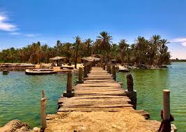
- Siwa Oasis: Though not a national park, this unique oasis in the Western Desert is known for its palm trees, salt lakes, hot springs, and ancient ruins.
- Saint Catherine Protectorate: This area includes Mount Sinai and Saint Catherine’s Monastery. It’s a sacred and mountainous region where people go for hiking and religious visits.
These parks help protect Egypt’s natural beauty and give people a place to learn about and enjoy the environment.
Egypt’s Natural Wonders On The Map
Egypt is not only famous for pyramids and temples, it also has amazing natural places. These natural wonders are easy to find when you look at a map of Egypt. They show the beauty of the desert, mountains, oases, and the sea.
- Siwa Oasis:Siwa Oasis is close to Egypt’s border with Libya. It is a green area in the middle of the desert. Siwa has palm trees, natural springs, and salt lakes. People have lived here for a very long time.
- Mount Sinai:Mount Sinai is in the Sinai Peninsula in northeast Egypt. It is a very tall mountain and an important religious place. Many believe that this is where Moses received the Ten Commandments.
- Red Sea And Coral Reefs:Along the coast of the Red Sea, especially near Ras Mohammed National Park and the city of Hurghada, you can find coral reefs under the water. These coral reefs are home to colorful fish, sea turtles, and other marine life.
Tourist Attractions On The Map Of Egypt
Cairo - Pyramids, Museums, And Historic Mosques
Cairo is the capital of Egypt and the largest city in the country. It’s located near the Nile River in the north and is full of history and culture.
On a tourist map, you’ll find:
- The Egyptian Museum, which holds thousands of ancient artifacts, including King Tutankhamun’s treasures.
- Islamic Cairo, an area with narrow streets, old mosques, and lively markets (souks).
- The Giza Plateau, just outside the city, is where you’ll see the Great Pyramids of Giza and the Sphinx.
Cairo is often the starting point for travelers, and tourist maps help you find your way through its busy streets and major attractions.
Luxor - Ancient Temples And Royal Tombs
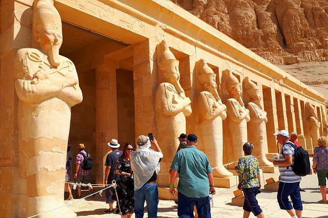
Luxor is in southern Egypt and is known as the world’s greatest open-air museum. It was once the ancient city of Thebes.
Tourist maps highlight:
- The Temple of Karnak, a huge temple complex with tall pillars and statues.
- The Temple of Luxor, beautifully lit at night and located in the center of the city.
- The Valley of the Kings, across the Nile, where many pharaohs were buried, including Tutankhamun.
Maps of Luxor show where these historical sites are and how to reach them by road or ferry.
Aswan - Temples, Villages, And The High Dam
Aswan lies further south along the Nile River and has a warm, peaceful atmosphere. It’s a popular spot for relaxing boat rides and cultural visits.
Tourist maps in Aswan include:
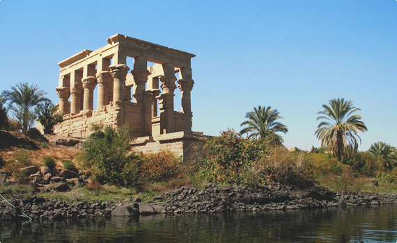
- The Temple of Philae, built on an island and dedicated to the goddess Isis.
- Nubian villages, where you can learn about local traditions, food, and colorful houses.
- The Aswan High Dam, an important structure that controls the flow of the Nile and provides electricity.
Maps also show the nearby Lake Nasser and boat trips to other historical sites.
Hurghada And Sharm El-Sheikh - Red Sea Beaches And Diving Spots
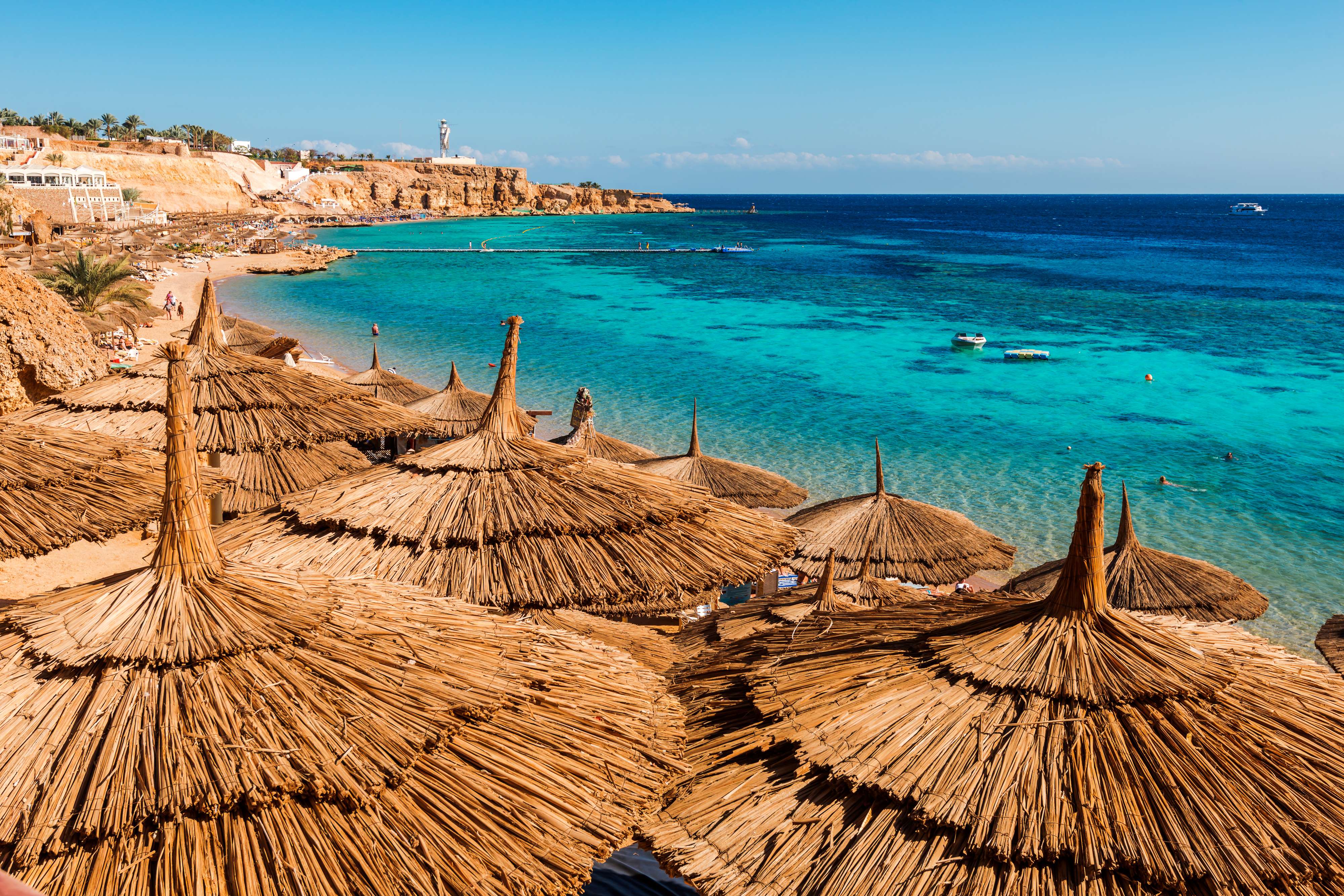
These two cities are located along the Red Sea coast and are famous for their beaches, resorts, and water activities.
A tourist map of this area will point out:
- Diving and snorkeling spots, where people can see coral reefs and colorful fish.
- Popular resort areas, with hotels, restaurants, and water parks.
- Boat tours and activities like windsurfing, kitesurfing, and dolphin watching.
Hurghada is on the western coast of the Red Sea, while Sharm El-Sheikh is on the southern tip of the Sinai Peninsula.
Siwa Oasis - A Peaceful Desert Retreat
Siwa Oasis is located in the western desert near the border with Libya. It’s one of Egypt’s most remote but special destinations.
Tourist maps of Siwa highlight:
- Hot springs and salt lakes, where visitors can relax and swim.
- Ancient ruins, such as the Temple of the Oracle, where it’s believed Alexander the Great once visited.
- Traditional mud-brick houses and palm groves, giving a look into life in the oasis.
This area is quieter than the big cities and offers a calm experience for those who love nature and history.
White Desert
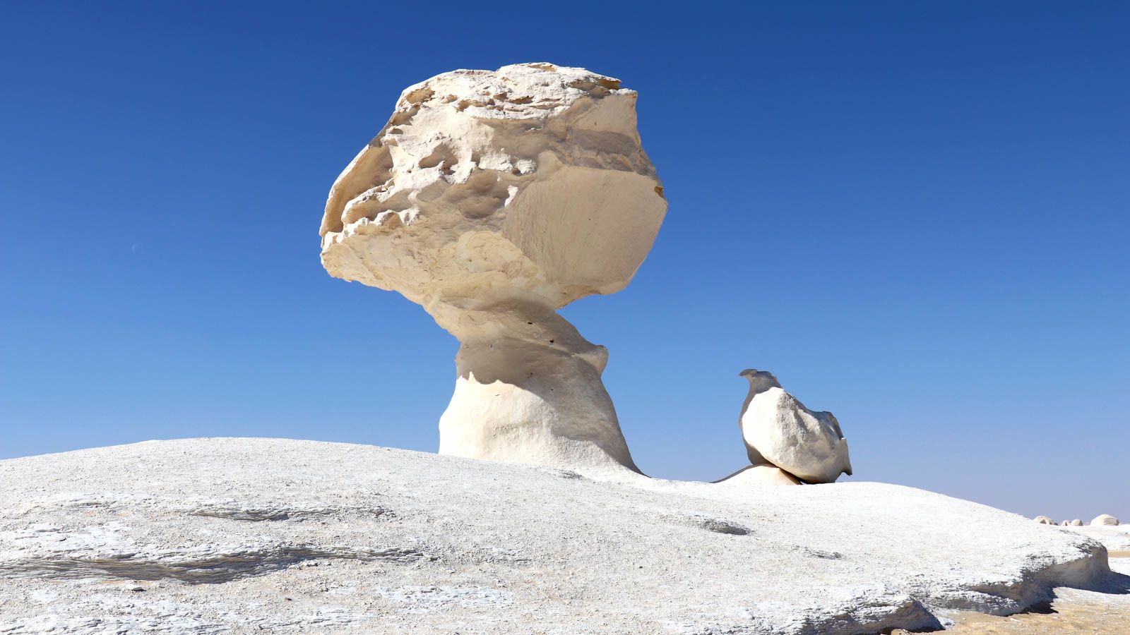
The White Desert is in the Western Desert of Egypt. It is known for its strange white rock shapes that look like animals, mushrooms, or towers. These rocks were shaped over many years by strong wind and sand.
Karnak Temple

Karnak is a massive temple complex in Luxor. It was built over many years by different pharaohs. The site includes huge stone columns, statues, and sacred pools. It was once a center for worship and one of the largest religious buildings ever built.
Valley Of The Kings
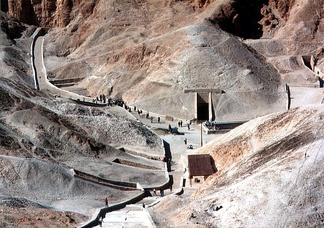
Also near Luxor, the Valley of the Kings is a desert area with more than 60 tombs of pharaohs and nobles. The tomb of Tutankhamun is the most famous. Visitors can enter some of the tombs and see walls covered with colorful drawings and carvings.
Abu Simbel Temples
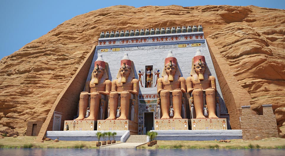
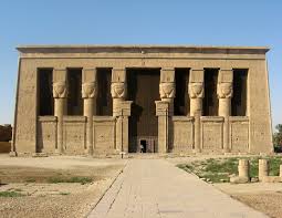
Located near Aswan, the Abu Simbel temples are carved into a mountainside. They were built by Ramses II and are known for the giant statues at the entrance. These temples were moved to higher ground in the 1960s to protect them from flooding when the Aswan Dam was built.
Philae Temple
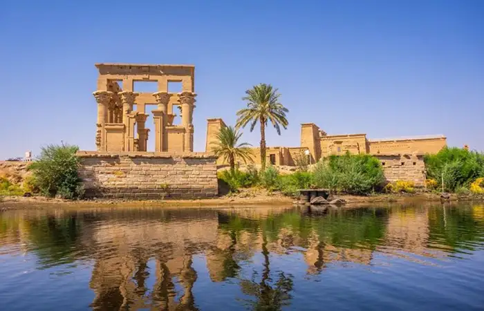
This beautiful temple sits on an island near Aswan. It was built in honor of the goddess Isis. Visitors take a short boat ride to reach the temple and enjoy its peaceful location surrounded by the Nile River.
Citadel Of Saladin

This large fortress in Cairo was built in the 12th century. It was used to protect the city and is now home to several museums and the Mosque of Muhammad Ali, also called the Alabaster Mosque. The Citadel offers great views of Cairo.
Bibliotheca Alexandrina
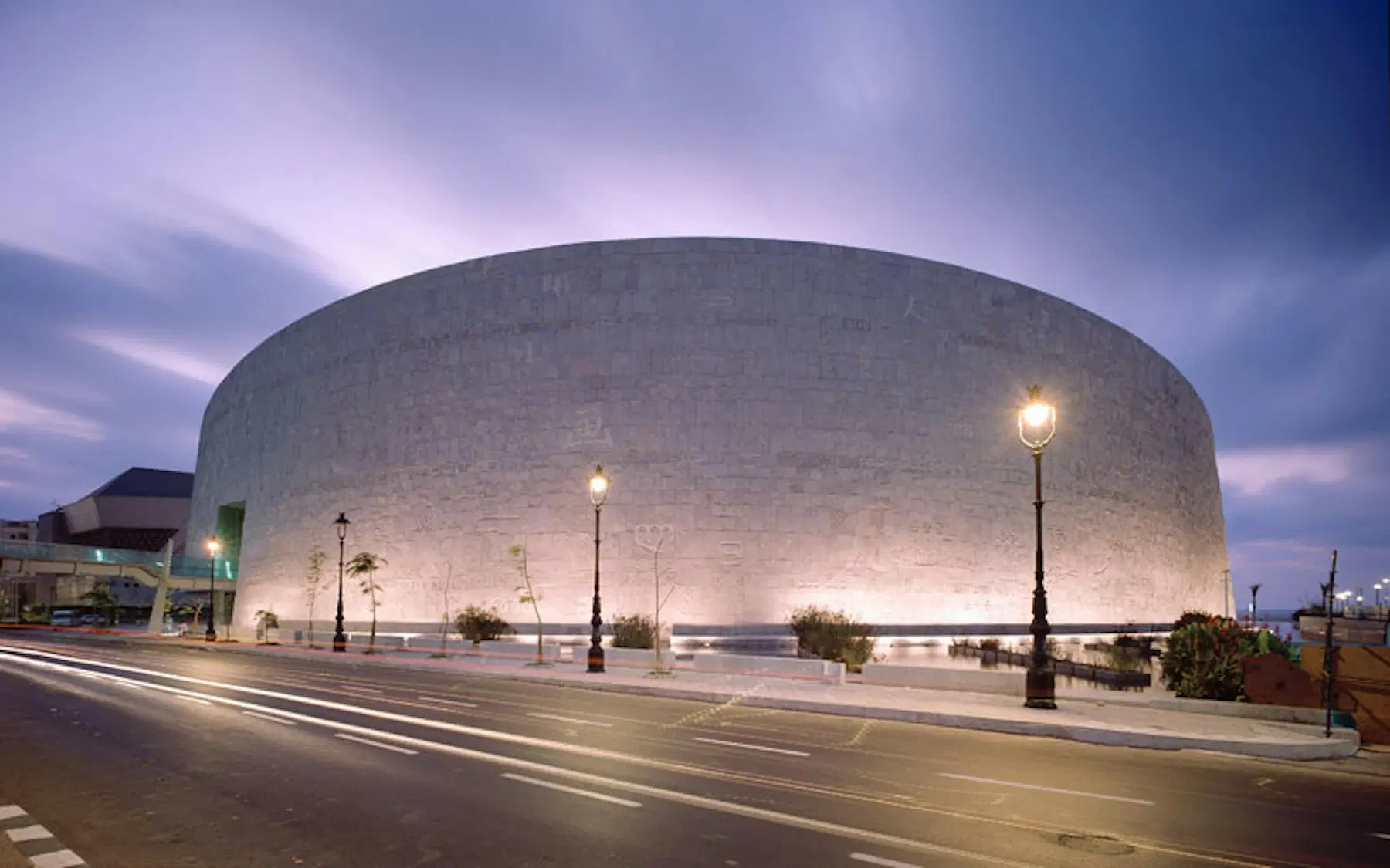
This modern library in Alexandria was built to honor the ancient Library of Alexandria, which was one of the largest in the ancient world. Today, the library holds millions of books and also has museums, art galleries, and a planetarium.
Saint Catherine's Monastery
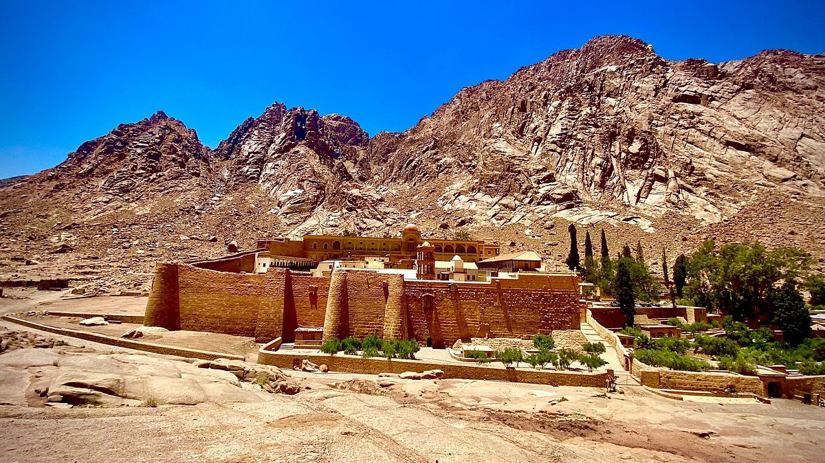
At the foot of Mount Sinai, this old Christian monastery has been in use for over 1,400 years. It has ancient manuscripts, icons, and a burning bush that some believe is linked to the Bible. Many people visit this area to climb the mountain and see the sunrise.
Avenue Of The Sphinxes
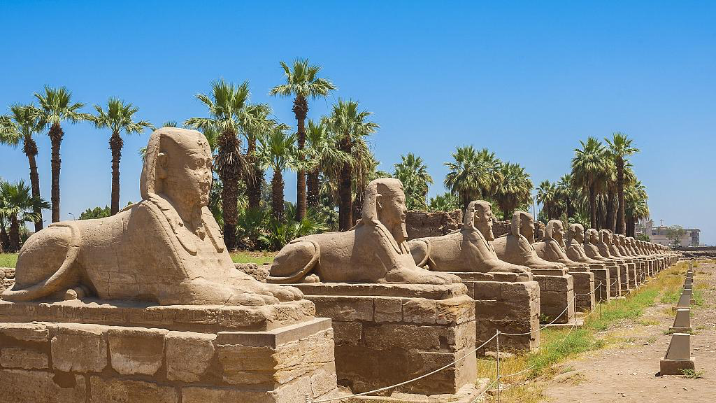
This newly restored ancient road connects Karnak Temple to Luxor Temple. It’s lined with hundreds of carved sphinx statues and shows how grand ancient Thebes (now Luxor) once was.
Dendera Temple Complex
About an hour from Luxor, Dendera is home to the Temple of Hathor, one of the best-preserved temples in Egypt. The ceiling still shows colorful ancient stars and zodiac signs.
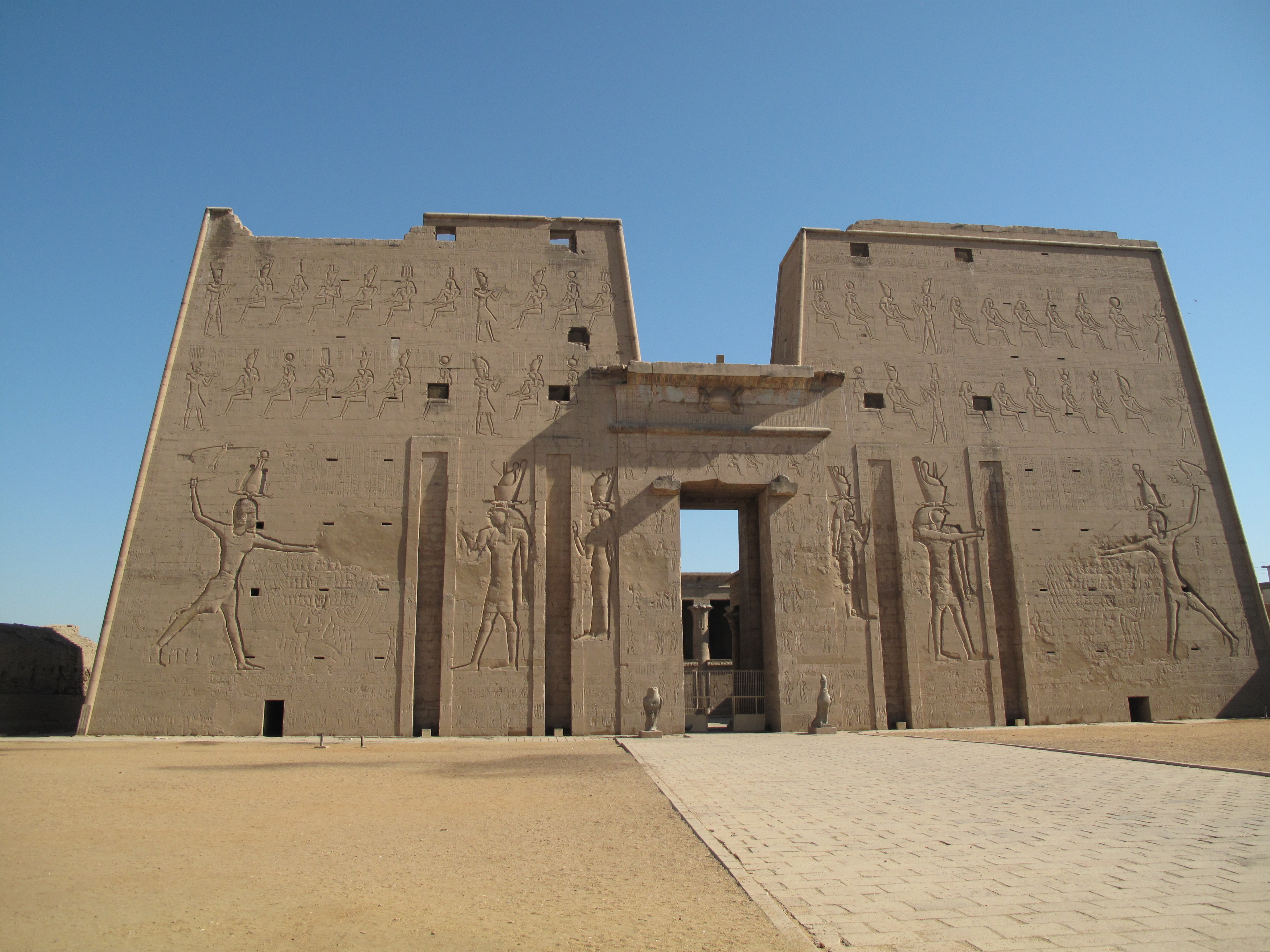
Temple Of Edfu
Kom Ombo Temple Luxor and Aswan, this temple is dedicated to the falcon god Horus. It’s one of the most complete temples from ancient Egypt and gives a great look into temple life and rituals.
Kom Ombo Temple
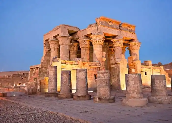
This unique riverside temple is dedicated to two gods at once: Horus and Sobek, the crocodile god. A small museum here even shows real mummified crocodiles.
Al-Muizz Street (Historic Cairo)
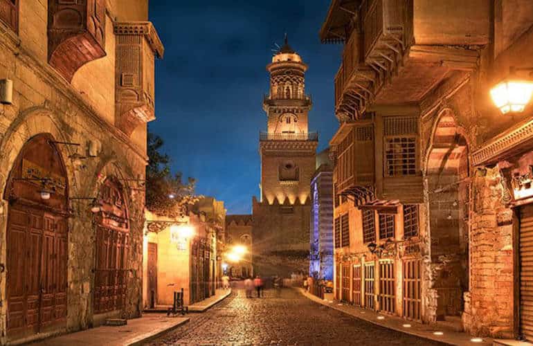
This old street in Islamic Cairo is full of ancient mosques, markets, palaces, and houses. It's like walking through history and is part of the UNESCO World Heritage Site of Historic Cairo.
Khan El Khalili Bazaar
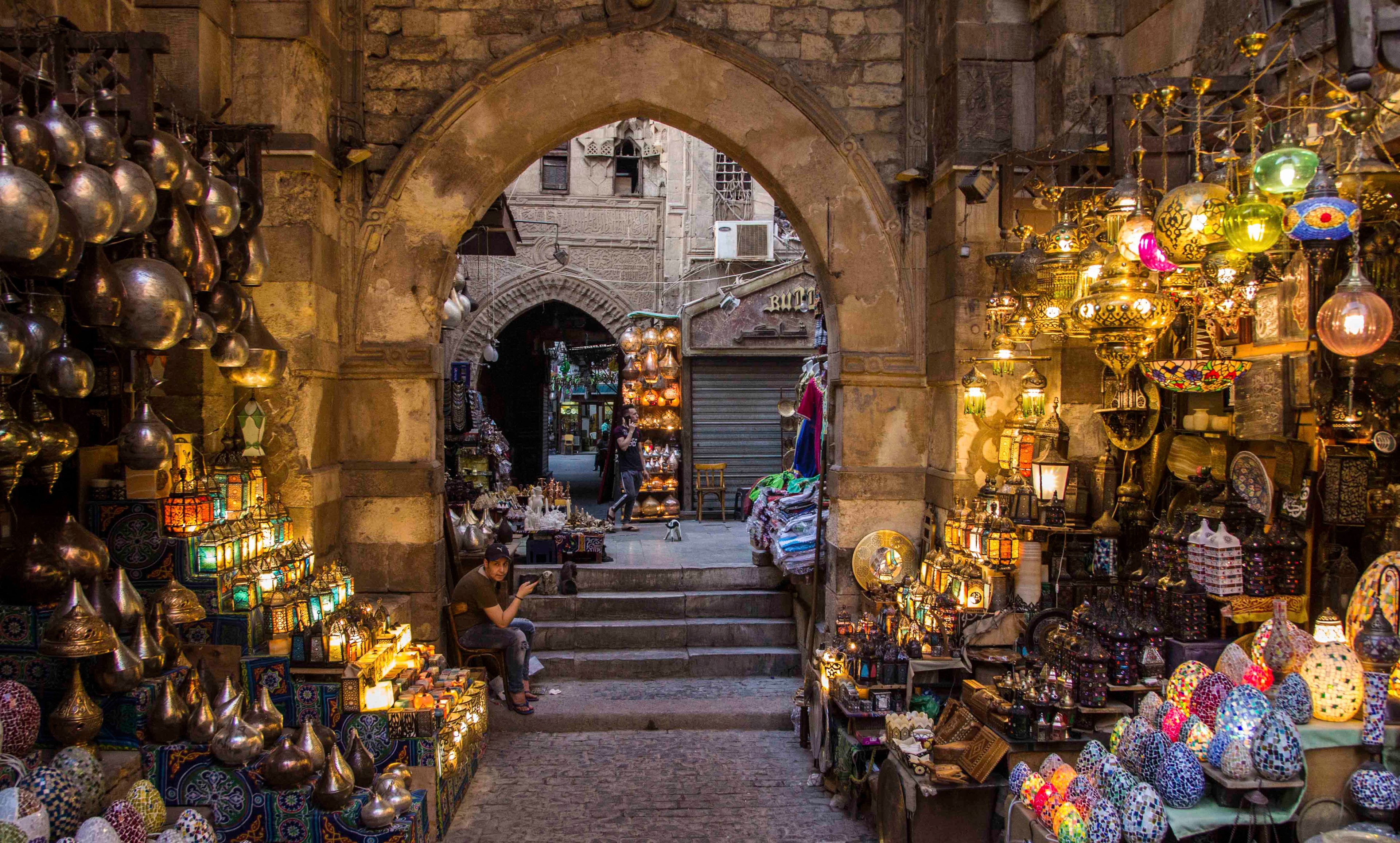
One of the oldest and most famous markets in the Middle East, this bazaar in Cairo is great for buying souvenirs, spices, handmade jewelry, and traditional clothes. It’s also a great place to enjoy a cup of tea or coffee.
The Red Sea Rivier

Cities like Hurghada, El Gouna, and Marsa Alam are located along the Red Sea coast. These places are popular for beach holidays, diving, snorkeling, and resorts with great views of the sea and coral reefs.
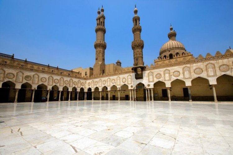
Al-Azhar Mosque
One of the oldest mosques in Cairo and also home to Al-Azhar University, one of the oldest universities in the world. The mosque is a symbol of Islamic learning and has beautiful Islamic architecture.
Mount Sinai And Sunrise Hikes
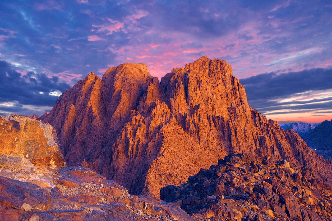
Many visitors enjoy climbing Mount Sinai overnight to reach the summit by sunrise. The mountain is sacred to several religions and offers a quiet and spiritual experience.
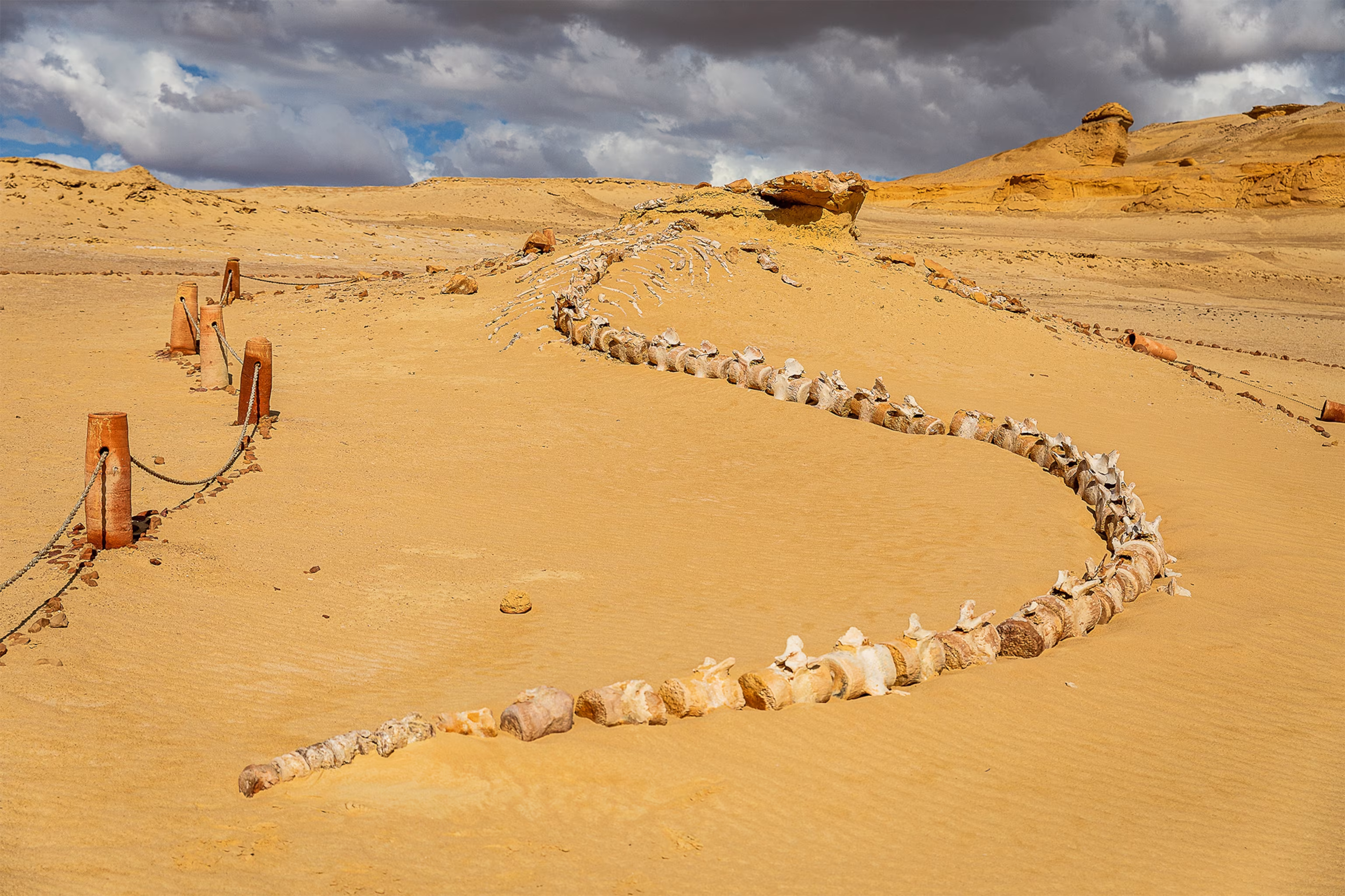
Wadi El-Hitan (Valley Of The Whales)
This UNESCO World Heritage Site in the Western Desert holds fossil remains of ancient whales that lived millions of years ago. It’s an important place for understanding Earth’s natural history.
Coptic Cairo
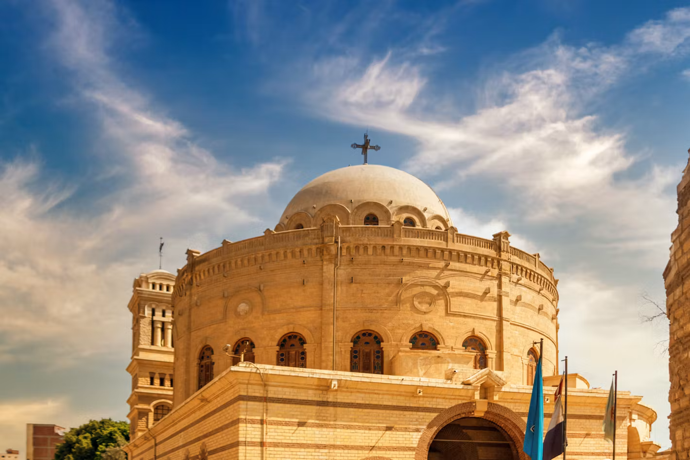
This area of Cairo includes ancient Christian churches, such as the Hanging Church, Saint Sergius and Bacchus Church, and the Coptic Museum. It shows Egypt’s Christian heritage and peaceful religious history.
Climate Map
A climate map of Egypt helps explain how weather and temperatures change across the country.
In Northern Egypt, near the Mediterranean coast, the weather is mild. Winters can be cool and a little rainy. Cities like Alexandria and Port Said are located here.
In the middle part of the country, including Cairo, the weather becomes hotter and drier. Days can be warm, but nights are usually cooler. Rain is very rare in this region.
In Southern Egypt, where cities like Luxor and Aswan are found, the weather is very hot, especially in the summer. Temperatures can go over 40°C (104°F). Rain hardly falls, making it a true desert area.
The Sinai Peninsula also has dry and hot weather, but the mountain areas can be cooler, especially at night.
Climate maps are helpful when planning a visit. For example, many people prefer to travel between October and March when the weather is more comfortable.
Egypt Economy
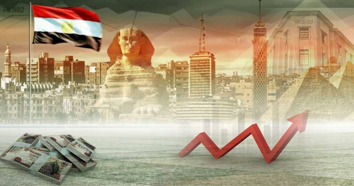
Egypt has a mixed economy with several important sectors, including tourism, agriculture, natural gas, oil, and the Suez Canal.
Tourism plays a big role in Egypt’s economy. Millions of people visit the country every year to see the pyramids, temples, and beaches.
Agriculture is important, especially along the Nile River, where the soil is rich and good for growing crops like wheat, corn, rice, and cotton.
Oil and gas are major resources found in parts of Egypt, including the Western Desert and the Gulf of Suez. These are exported to other countries and bring in a lot of money.
The Suez Canal is one of the world’s busiest waterways. It allows ships to travel between Europe and Asia without sailing around Africa. The canal earns Egypt billions of dollars each year.
Egypt also makes money from manufacturing, construction, and telecommunications, and more people are starting small businesses.
Despite progress, the country still faces challenges like poverty and high living costs. But the government is working on improving education, creating jobs, and investing in infrastructure.
How To Use A Map Of Egypt For Travel
Using a map of Egypt while planning or taking a trip can make your journey smoother and more enjoyable. It helps you understand distances, routes, and key landmarks so you can travel with more confidence. Here's how to use a map effectively when exploring Egypt:
1. Identify Key Cities And Regions
Start by locating major cities such as Cairo, Alexandria, Luxor, Aswan, and Sharm El-Sheikh. These are Egypt’s main travel hubs, and most tourist activities are connected to them. A good map will show where each city is and how far it is from the others.
Maps also show regions like Upper Egypt, Lower Egypt, the Sinai Peninsula, and the Western Desert. Understanding these areas helps you plan based on the type of trip you want: historical sites, desert adventures, beach resorts, or cultural experiences.
2. Check Transportation Routes
A detailed travel map will highlight major roads, railways, and domestic flight routes. This helps you choose the best travel options between cities. For example:
- Use the Cairo-Aswan road if you're traveling along the Nile.
- Take the Desert Road between Cairo and Alexandria.
- Follow coastal roads if heading to Red Sea resorts.
Maps also show train lines and stations, which are useful if you're using Egypt's rail network. Airports are marked too, making it easier to book flights within the country.
3. Locate Historical And Cultural Attractions
Tourist maps often mark key landmarks with icons or labels. Look for:
- Pyramids of Giza near Cairo
- Karnak and Luxor Temples in Luxor
- Valley of the Kings
- Abu Simbel near the Sudan border
- Mount Sinai
- Temples of Edfu and Kom Ombo
Knowing where each site is helps you plan your route to avoid backtracking or missing must-see places.
4. Use Maps For Time Planning
Maps help you estimate travel times between cities or sites. Egypt is a large country, and some areas can be far apart. By measuring distances on a map, you’ll know if a location is best reached by car, train, or plane.
For example:
- Cairo to Luxor takes about 9-10 hours by train or 1 hour by flight.
- Luxor to Aswan is around 3-4 hours by road.
5. Understand Terrain And Climate
Topographic and environmental maps show the terrain, such as deserts, rivers, mountains, and valleys. These features affect how you travel and what you need to prepare for.
- Desert maps show where you need extra water or supplies.
- Mountain areas (like Sinai) may require hiking gear or a guide.
- Nile Valley maps help if you're doing a river cruise.
6. Use Offline And Online Maps Together
Digital maps like Google Maps or Maps.me are helpful for live navigation. But printed or offline maps are also useful, especially in areas with poor internet, like the Western Desert or parts of Upper Egypt.
Use both to stay safe and on the right path, especially when exploring remote temples, oases, or national parks.
7. Mark Your Own Route
Before your trip, mark your stops and plan your travel route. You can do this with a pen on a printed map or use custom Google Maps. Mark:
- Hotels or places you’ll stay
- Sites you want to visit
- Rest stops, gas stations, or food areas
- Emergency locations (hospitals, police stations)
This gives you peace of mind and helps if you get lost or need help explaining your location.
10 Fun Facts About Egypt Everyone Should Know
1. Egypt Is Home To The Only Remaining Ancient Wonder
The Great Pyramid of Giza is the only one of the Seven Wonders of the Ancient World that still exists today. It’s over 4,500 years old and was built without modern tools.
2. The Nile Is The Longest River In The World
The Nile River flows through Egypt and is about 6,650 kilometers (4,130 miles) long. It has been the lifeline of Egypt since ancient times, helping with farming, fishing, and travel.
3. Ancient Egyptians Loved Cats
Cats were sacred animals in ancient Egypt. They were kept in homes, protected from harm, and even buried with their owners. The goddess Bastet was often shown with a cat's head.
4. Cairo Is The Largest City In Africa
Cairo, Egypt’s capital, is the largest city in Africa and also the Arab world’s most populated city. Over 10 million people live there, and it never really sleeps.
5. Egypt Has Over 100 Pyramids
There are more than 100 pyramids across Egypt. Most were built as tombs for kings and queens. The Step Pyramid of Djoser is the oldest one and was built before the Great Pyramid.
6. Egyptians Invented One Of The First Writing Systems
The hieroglyphs used in ancient Egypt were one of the earliest writing systems in the world. These symbols were carved into temple walls and tombs to tell stories and record history.
7. The Calendar We Use Today Came From Egypt
Ancient Egyptians created a 365-day calendar based on the flooding of the Nile and movements of the stars. It helped them plan farming and festivals and is similar to the calendar we use now.
8. Mummies Took Months To Make
Mummification was a long process in ancient Egypt. It could take up to 70 days to fully prepare a body for the afterlife. Special oils and wrappings were used to keep the body safe.
9. Egypt Has A City With No Streets
The Siwa Oasis in western Egypt has areas where people still live in ancient-style houses made of mud bricks. Some parts of the oasis have no roads, only narrow paths and alleys.
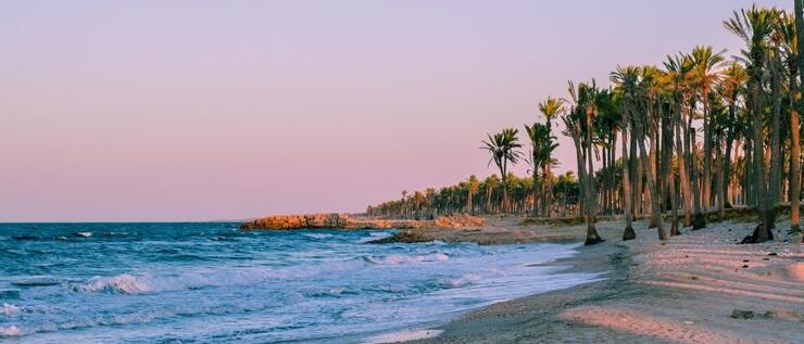
10. The Red Sea Is Great For Diving
Egypt’s Red Sea coast is one of the best places in the world for diving and snorkeling. It’s full of colorful coral reefs and rare sea life. Resorts like Sharm El-Sheikh and Hurghada are very popular with tourists.
People Also Ask
What Type Of Map Is Best For Traveling In Egypt?
A tourist map or interactive Google Map is best. It shows landmarks, roads, hotels, and routes clearly. Some apps also work offline.
Is Egypt Considered Part Of Africa Or The Middle East?
Geographically, Egypt is in Africa, but the Sinai Peninsula lies in Asia. Culturally and politically, Egypt is often linked to the Middle East.
Are There Maps Showing Ancient Ruins And Tombs?
Yes. Archaeological and historical maps mark pyramids, temples, tombs, and old cities. These are used by historians, tourists, and guides.
Final Thoughts
Looking at an Egypt map gives you more than directions; it helps you understand how the country is shaped, where its history lives, and how its people move and grow. From ancient cities to modern roads, maps show it all.
By using the right type of map, you can find famous landmarks, plan travel routes, and learn more about Egypt’s past and present. It’s a simple way to connect with one of the world’s most fascinating places.
You Might Also Like - Mauritius Map: A Comprehensive Guide For Travelers & Explorers
Jump to
Quick Facts About Egypt Map
History Of Egypt
Geographical Overview Of Egypt
Capital Of Egypt
Map Of Egypt Cities
Regions On The Map Of Egypt
Population Of Egypt
Total Area Of Egypt
Egypt’s Borders And Neighboring Countries
Currency Of Egypt
Dialing Code Of Egypt
Language Of Egypt
Flag Of Egypt
Government Of Egypt
Types Of Egypt Maps
Major Roads And Transportation In Egypt
Egypt River Map - Life Along The Nile
Egypt Climate Zones And Environmental Maps
National Parks And Landscapes
Egypt’s Natural Wonders On The Map
Tourist Attractions On The Map Of Egypt
Climate Map
Egypt Economy
How To Use A Map Of Egypt For Travel
10 Fun Facts About Egypt Everyone Should Know
People Also Ask
Final Thoughts

Michael Rachal
Author
Michael Rachal believes that luxury lies in the details. With over 20 years of experience in the luxury travel industry, he has crafted hundreds of bespoke itineraries for clients seeking personalized, unforgettable experiences.
Whether guiding clients through private cultural tours or curating culinary journeys with world-renowned chefs, Michael ensures that each trip is tailored to perfection.
His ability to anticipate needs and exceed expectations has earned him a reputation as a leading expert in luxury travel.

Finn Wilde
Reviewer
For Finn Wilde, the wilderness is more than just a destination - it’s a way of life. Over the past decade, he has led multiple expeditions in some of the world’s most remote regions, from the icy fjords of Greenland to the rugged trails of Patagonia.
Finn emphasizes sustainability in all of his adventures, helping participants connect with nature while promoting responsible exploration. His expeditions inspire individuals to explore the great outdoors while fostering a deep respect for the environment.
Latest Articles
Popular Articles