Brighton Map England | Areas, Landmarks, Regions & Routes
Find everything you need on Brighton Map England - top areas, seafront landmarks, walking routes, and travel tips to navigate the city like a local.
Author:Michael RachalReviewer:Finn WildeNov 05, 20255.6K Shares313K Views
Searching for a Brighton map reveals a city famous for its unique blend of Regency grandeur and vibrant, counter-cultural energy. Yet, to truly experience this coastal gem-from the historic alleyways of The Lanes to the tranquil promenades of Hove-you need more than a basic geographical outline. You need a strategic framework informed by location and history.
This guide provides a comprehensive map of Brighton, England. We detail the city’s precise location, the logic of its layout, the distinct character of its Brighton map Englandareas, and the practical transport links that connect everything, ensuring you can navigate the City of Brighton and Hove like an expert.
Quick Facts About Brighton, England
- Location: South coast of England, in East Sussex
- Full Name: City of Brighton and Hove (joined in 2000)
- Population: Around 290,000 people
- Known For: Brighton Pier, pebbled beach, Royal Pavilion, and LGBTQ+ friendly culture
- Closest Major City: London(about 1 hour by train)
- Type of City: Unitary authority with its local council
- Seafront: Long promenade with cafes, amusement rides, and beach huts
- Universities: University of Brighton and University of Sussex
- Transport: Well-connected by trains, buses, and bike routes
- Climate: Mild, with cool summers and wet winters
- Tourism: One of the most visited seaside cities in the UK
- Famous Areas: The Lanes, North Laine, Kemptown, and Hove
- Events: Brighton Pride, Brighton Festival, Brighton Marathon
- Economy: Tourism, education, retail, digital media
- Nickname: Often called “London by the Sea”
Geographical Overview Of Brighton Map England
Understanding the city's position on the larger England map and its history is essential to grasping its layout and relationship with surrounding Brighton map England towns.
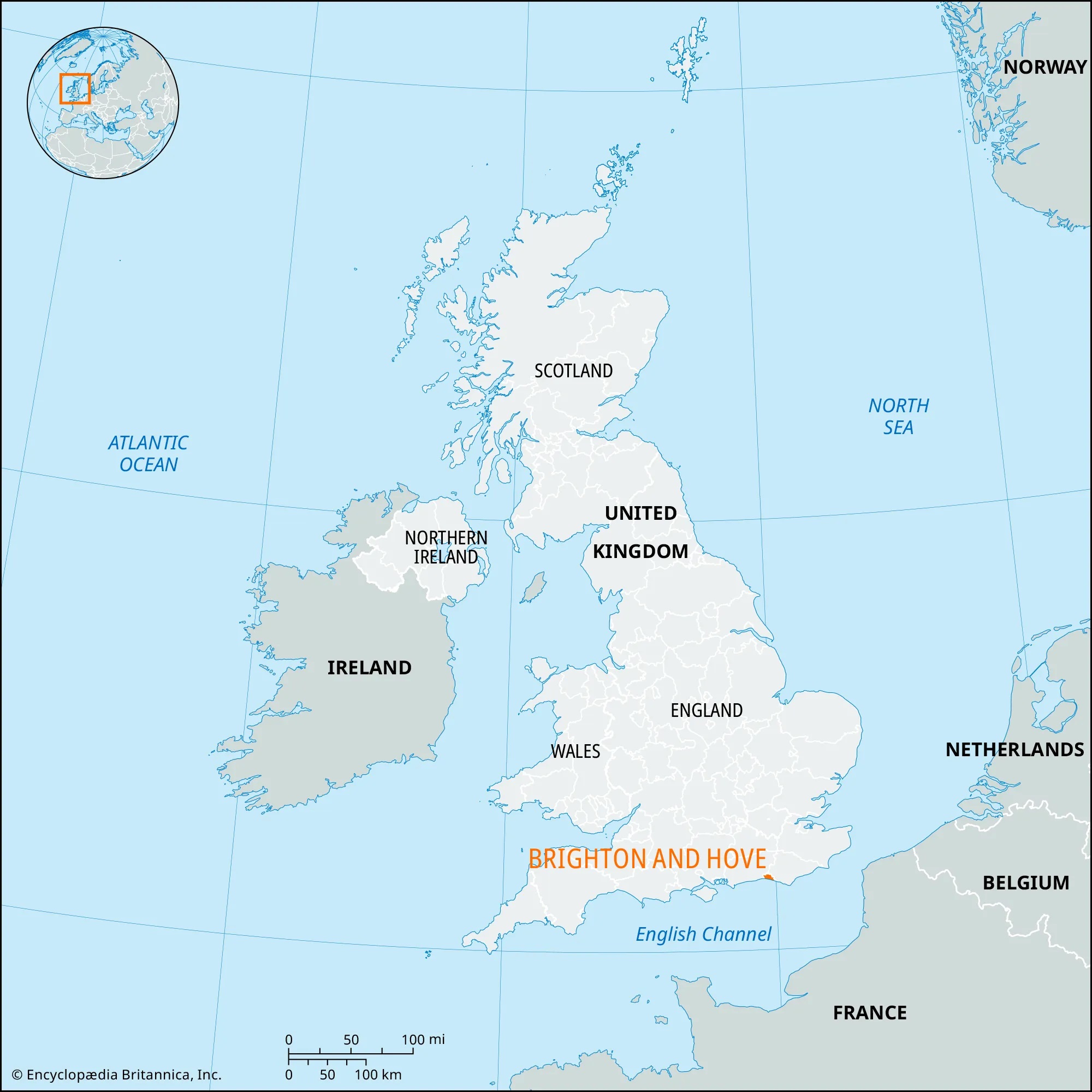
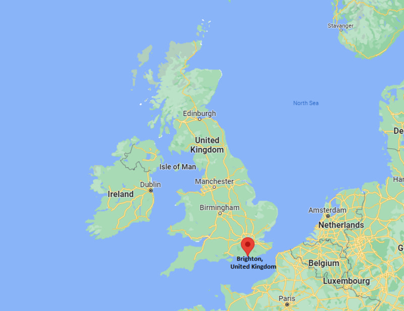
Brighton is located on the southern coast of England, along the English Channel. It sits in the county of East Sussex and is part of the South East England region. The city is about 47 miles (76 km) south of London and is easy to reach by train or car.
On a map, Brighton stretches along the coastline with the beach and seafront running from east to west. Inland, the city climbs gently uphill, with residential areas and parks spreading northward.
The map also shows nearby towns like Hove, which is closely linked with Brighton and often considered part of the same urban area. To the east, you’ll find areas like Rottingdean and Saltdean.
To the north lies the South Downs National Park, a wide area of green hills and walking paths. The layout of Brighton is compact, and many of its most popular areas are within walking distance. The city is known for its blend of historic streets, open spaces, and seaside views, all clearly visible when looking at a detailed Brighton map.
History Of Brighton, England
Early Origins
Brighton began as the small fishing village of Brighthelmstone (named after a Saxon settler, Beorthelm). By the Domesday Book in 1086, it had a population of about 400. The narrow, irregular streets of The Lanes remain the physical footprint of this original medieval town.
The Seaside Cure (18th Century)
Growth started in the 1700s after Dr. Richard Russellpromoted sea bathing as a cure for health problems. This brought wealthy visitors from London, transforming the town into a fashionable seaside resort.
Royal Endorsement And Rail (19th Century)
Prince Regent (later King George IV) cemented Brighton’s status by building the famous Royal Pavilion-a grand palace with unique Indo-Saracenic design. The arrival of the railway in 1841 made access easy for thousands of visitors, fueling massive expansion and the development of the more organized, elegant architecture found in Hove.
Modern City Status
In the year 2000, Brighton officially joined with neighboring Hove to form the City of Brighton and Hove, recognized for its progressive culture, strong support for diversity, and digital economy.
Related Reading - Map Of England - Detailed Guide With Cities, Regions, & History
Area, Population & Language Of Brighton, England
- Total Area:The City of Brighton and Hove covers about 82.67 square kilometers (31.9 square miles). Although not large, it is densely packed.
- Population:The City of Brighton and Hove has a population of around 290,000 people. The population is densest in central Brighton and along the seafront.
- Diversity and Language:While English is the main language, Brighton is a highly diverse and international city, largely due to its two universities. Common languages you might hear in certain areas include Polish, Arabic, French, Spanish, and Chinese.
Key Cities And Towns Around Brighton On The Map
The city’s compact layout allows for easy walking between its distinct zones and defines its relationship with neighboring Brighton map England cities and towns.
Hove
Hove sits directly next to Brighton on the western side. Although it used to be a separate town, Hove is now officially part of the City of Brighton and Hove. It’s known for its peaceful streets, wide beaches, and grand buildings. Compared to busy central Brighton, Hove is quieter and more relaxed. The seafront here is popular with walkers and families.
Shoreham-by-Sea
Just six miles west of Brighton, Shoreham-by-Sea combines a working harbour, sandy estuary beaches, and a historic town centre. The Adur Ferry Bridge and St. Mary de Haura Church are local highlights. It’s easily reached by train (10–12 minutes) or bike along the National Cycle Network Route 2.
Worthing
Worthing is a larger coastal town about 11 miles west of Brighton. It also faces the sea and has long beaches, theatres, and a calm atmosphere. Many people from Brighton travelto Worthing for a quieter day out. It’s easy to reach by train or bus, and often shown on maps of the wider Brighton area.
Eastbourne
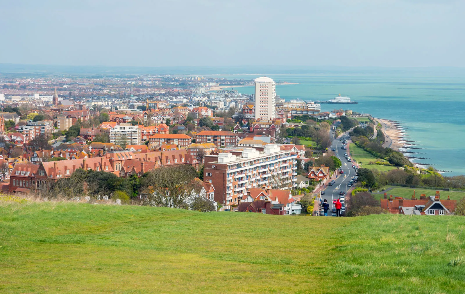
Eastbourne is found to the east of Brighton, about 20 miles away along the coast. It is famous for its long pier, flower-filled gardens, and the nearby white chalk cliffs at Beachy Head. Like Brighton, it’s a popular seaside town, but it has a more traditional feel. A good road and train connection links the two towns, so Eastbourne is often included on Brighton-area maps.
Lewes
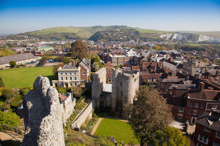
Lewes is a small town located northeast of Brighton, surrounded by green countryside. It has a strong history, with a Norman castle, cobbled streets, and many old buildings. Lewes is also known for its large bonfire night celebration in November. It’s easy to visit by train, and it’s often shown on maps because it’s the county town of East Sussex.
London
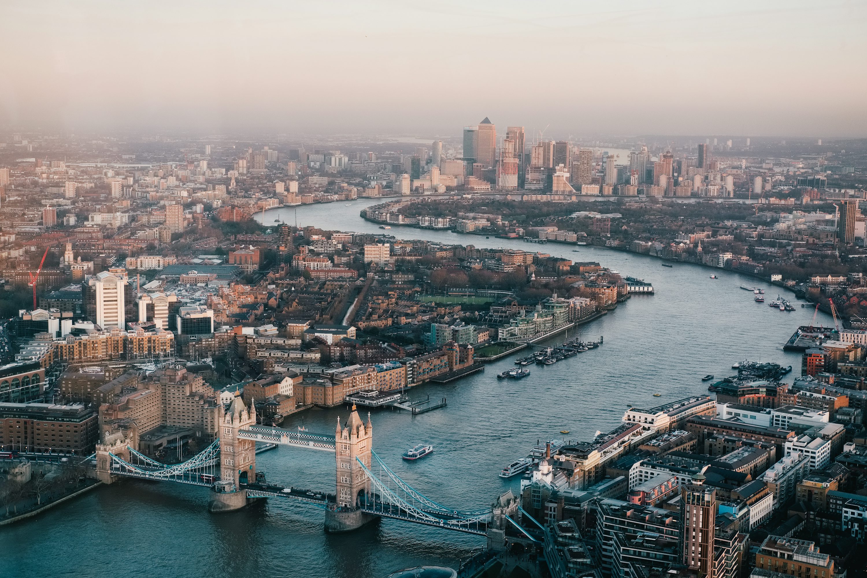
Although London is not very close, it’s often shown on larger-scale maps that include Brighton. This helps people understand Brighton’s location in relation to the capital. London is about one hour away by train, which makes Brighton a popular place for weekend trips and even daily commuting.
Rottingdean & Saltdean
Just a few miles eastof Brighton Marina lie Rottingdeanand Saltdean, small coastal villages that offer quieter beaches and local character. The scenic Undercliff Walklinks these villages to Brighton along the base of the cliffs.
Regions And Neighbourhoods On The Brighton Map England
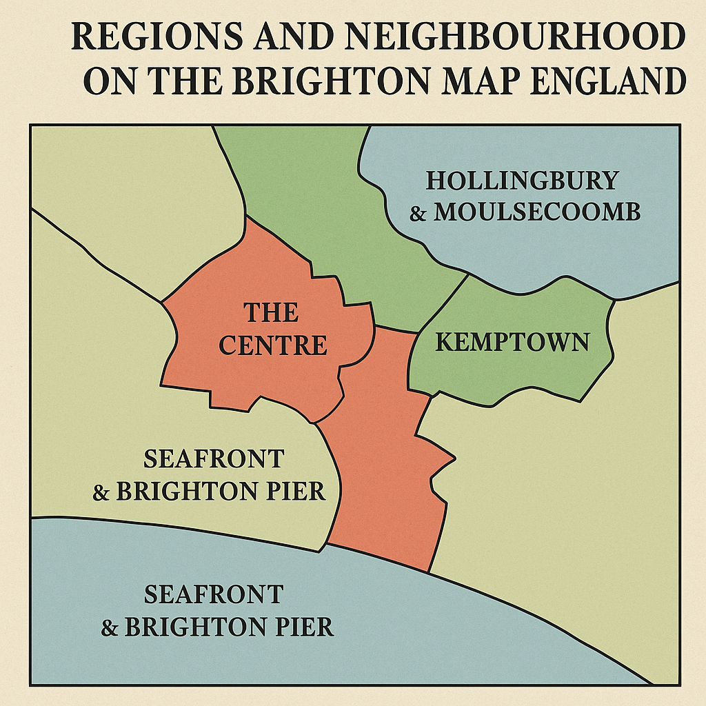
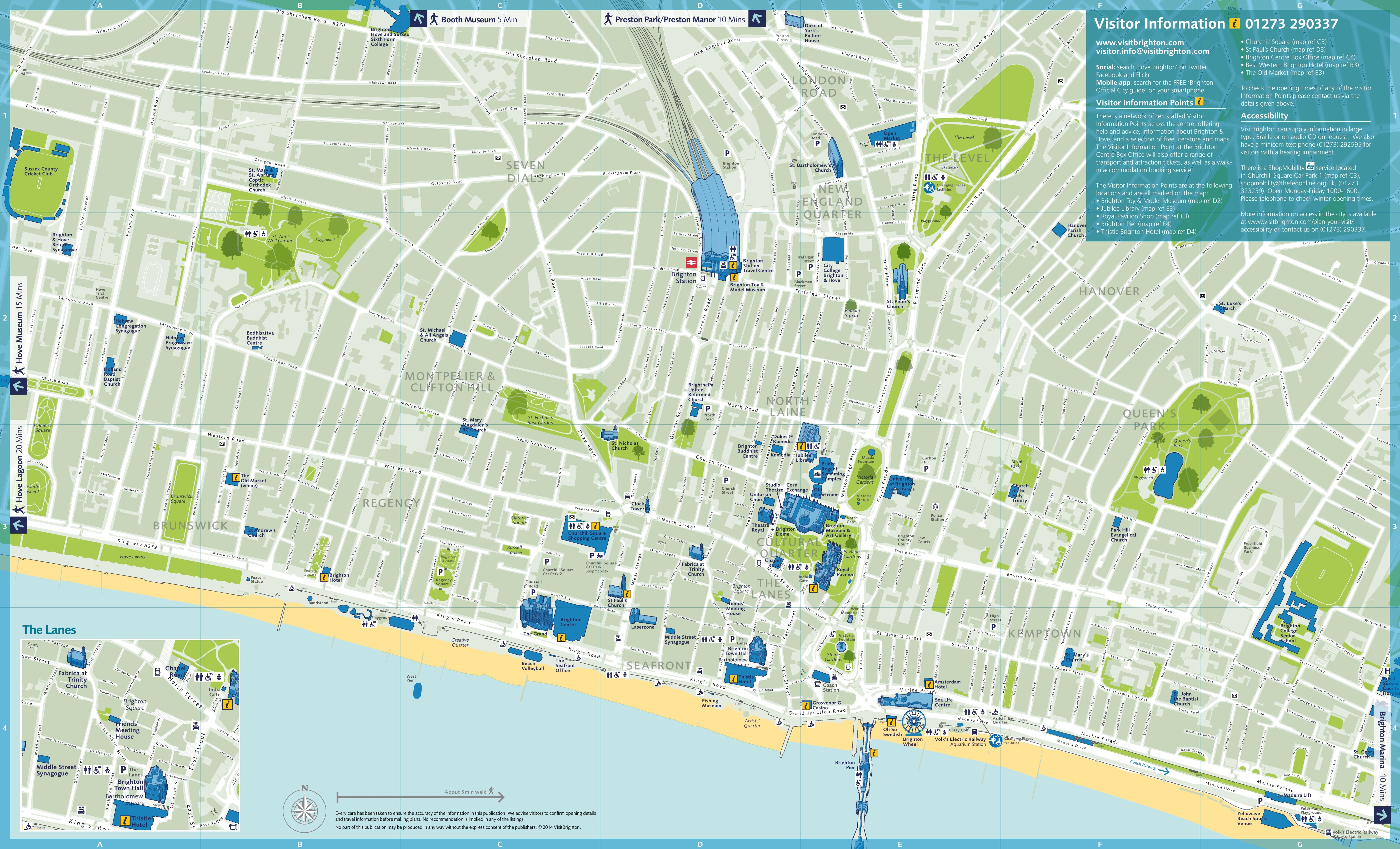
City Centre
The city centre is the busiest part of Brighton. It includes the main shopping streets, Brighton Station, and attractions like the Royal Pavilion. You’ll find lots of restaurants, cafes, shops, and entertainment venues here. It’s also a main point for public transport. Many visitors start their journey in the city centre.
The Lanes And North Laine
The Lanes represent Brighton's historic heart, featuring a maze of narrow streets filled with antique shops, jewelry stores, and traditional pubs. These medieval lanes can confuse even experienced visitors due to their irregular layout and similar-looking passages. The key to navigating The Lanes is to use North Street as your main reference point - it runs along the northern edge of this district.
Kemptown And Hanover
Kemptown extends east from the Old Town toward Brighton Marina. This area includes some of Brighton's most impressive Regency architecture, particularly around Kemp Town Enclosures and Sussex Square. The streets here follow a more planned layout than the Old Town, with many running parallel to the seafront.
Preston Park And Fiveways
Preston Park marks Brighton's main northern residential area, centered around the large park of the same name. This district features tree-lined streets and Victorian terraced houses. The area uses Preston Road as its main north-south artery, connecting to London Road and providing easy access to the city center.
Hollingbury & Moulsecoomb
Located further north, these areas are mainly residential, with schools, parks, and community centres. Moulsecoomb is home to part of the University of Brighton and has a younger student population. Hollingbury is known for housing estates, local shops, and easy access to the South Downs countryside.
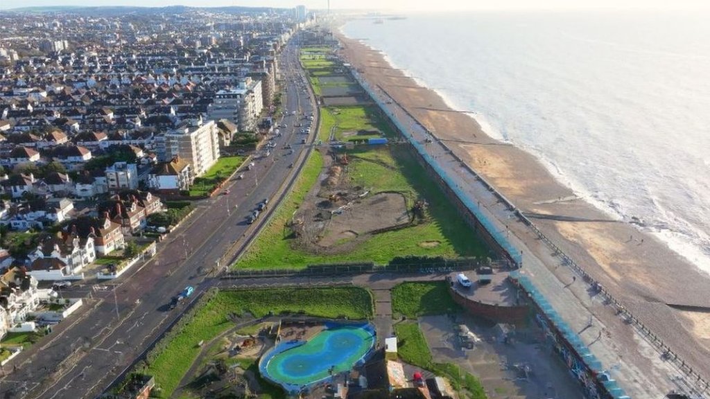
Seafront & Brighton Pier
The seafront runs along the beach and includes popular spots like the Brighton Palace Pier, i360 tower, and the long promenade. It’s perfect for walking, relaxing, or enjoying seaside attractions. Maps often highlight this area because it’s one of Brighton’s most visited parts.
Must-Visit Landmarks And Their Exact Locations
Royal Pavilion - Church Street, BN1 1EE
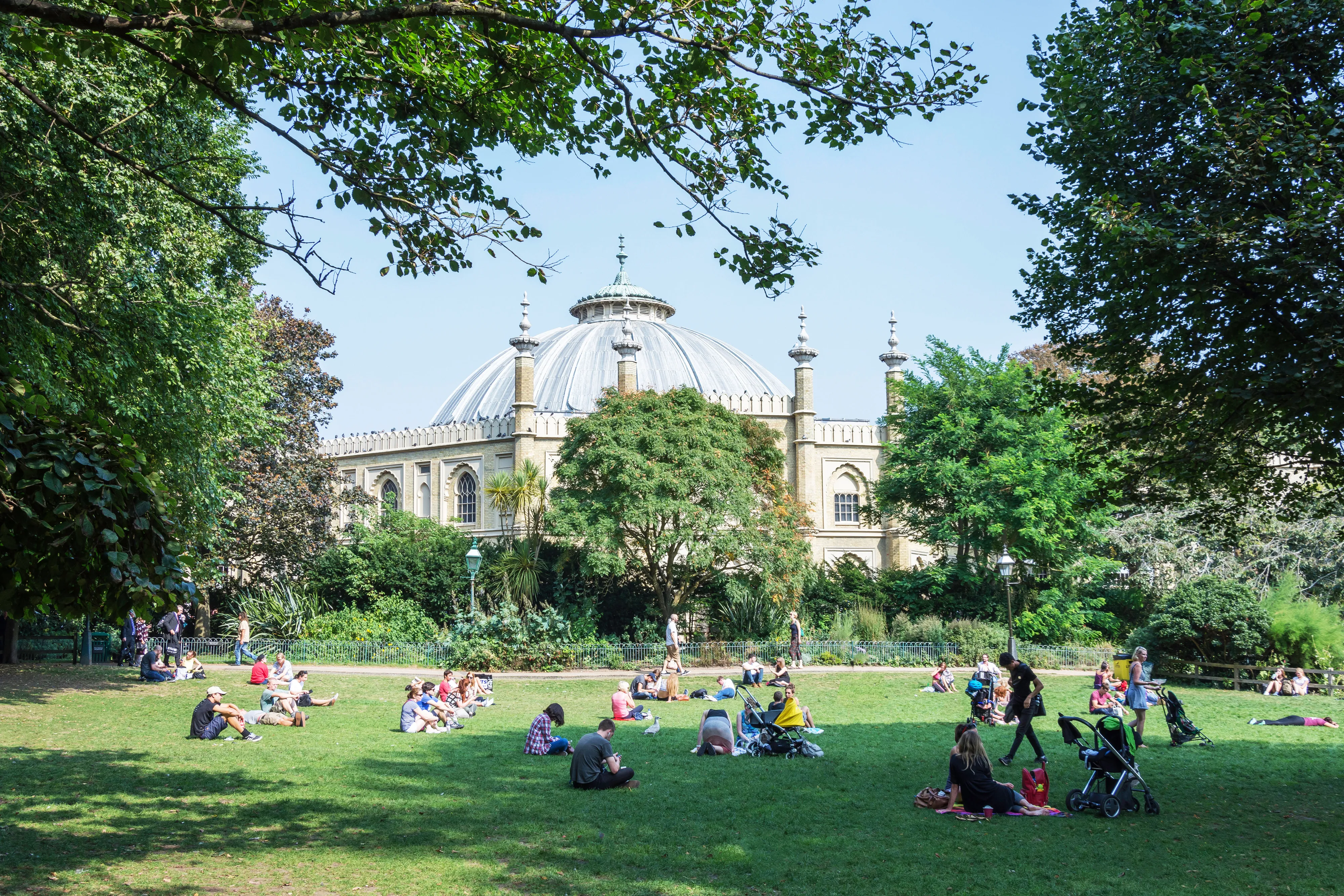
The Royal Pavilionstands as Brighton's most iconic landmark, located in the heart of the city center just north of the Old Steine. This extraordinary Indo-Saracenic palace sits in its own gardens, surrounded by Church Street, North Street, and New Road. The building's distinctive onion domes make it visible from several directions, serving as an excellent navigation reference point.
Approaching the Royal Pavilion from Brighton station requires a 10-minute walk south down Queen's Road, then turning left onto North Street. From the seafront, walk north from Brighton Pier along the Old Steine - the pavilion's gardens will appear on your right after about 300 meters.
Brighton Pier - Madeira Drive, BN2 1TW
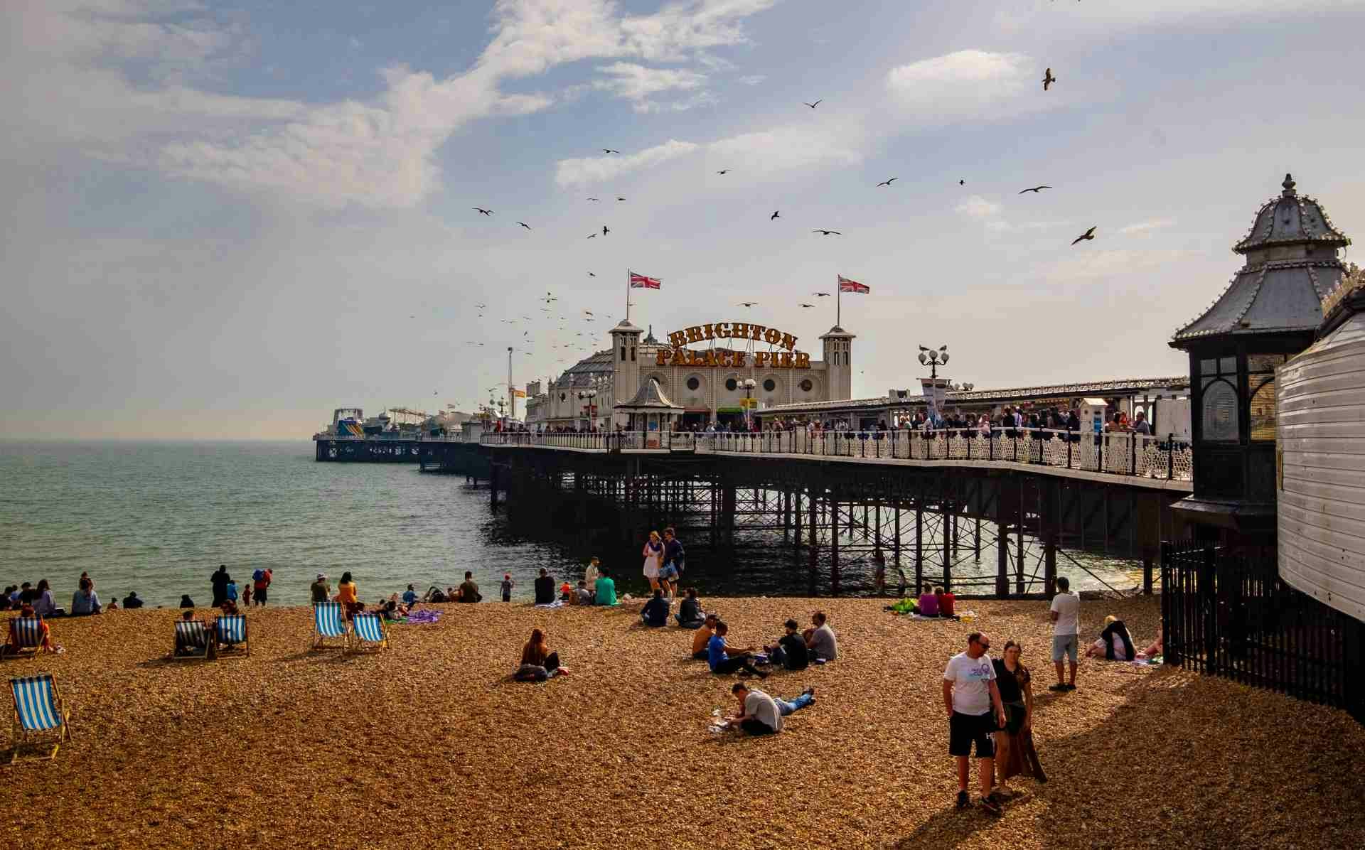
Brighton Palace Pier extends into the English Channel from the seafront at the bottom of the Old Steine. This Victorian pleasure pier features amusement arcades, rides, and food stalls, making it Brighton's most visited attraction. The pier's distinctive white structure and prominent signage make it impossible to miss when walking along the seafront.
From Brighton station, follow Queen's Road south until it becomes West Street, then continue straight to the seafront. Turn left along the promenade and Brighton Pier will be visible ahead. The walk takes approximately 15 minutes and passes through Brighton's main shopping and entertainment district.
The Lanes - Between North Street And King's Road
The Lanes occupy the historic core of old Brighton, bounded by North Street to the north, King's Road to the south, East Street to the east, and West Street to the west. This network of narrow medieval streets contains dozens of individual lanes, each with its own character and selection of shops, restaurants, and pubs.
Navigation within The Lanes requires patience and a willingness to explore. The main access points include entrances from North Street near the Clock Tower, from East Street near the seafront, and from several points along King's Road. Many lanes interconnect, but some end in courtyards or lead back to the same street, so keeping track of your general direction helps prevent confusion.
Brighton I360 - Lower Kings Road, BN1 2LN
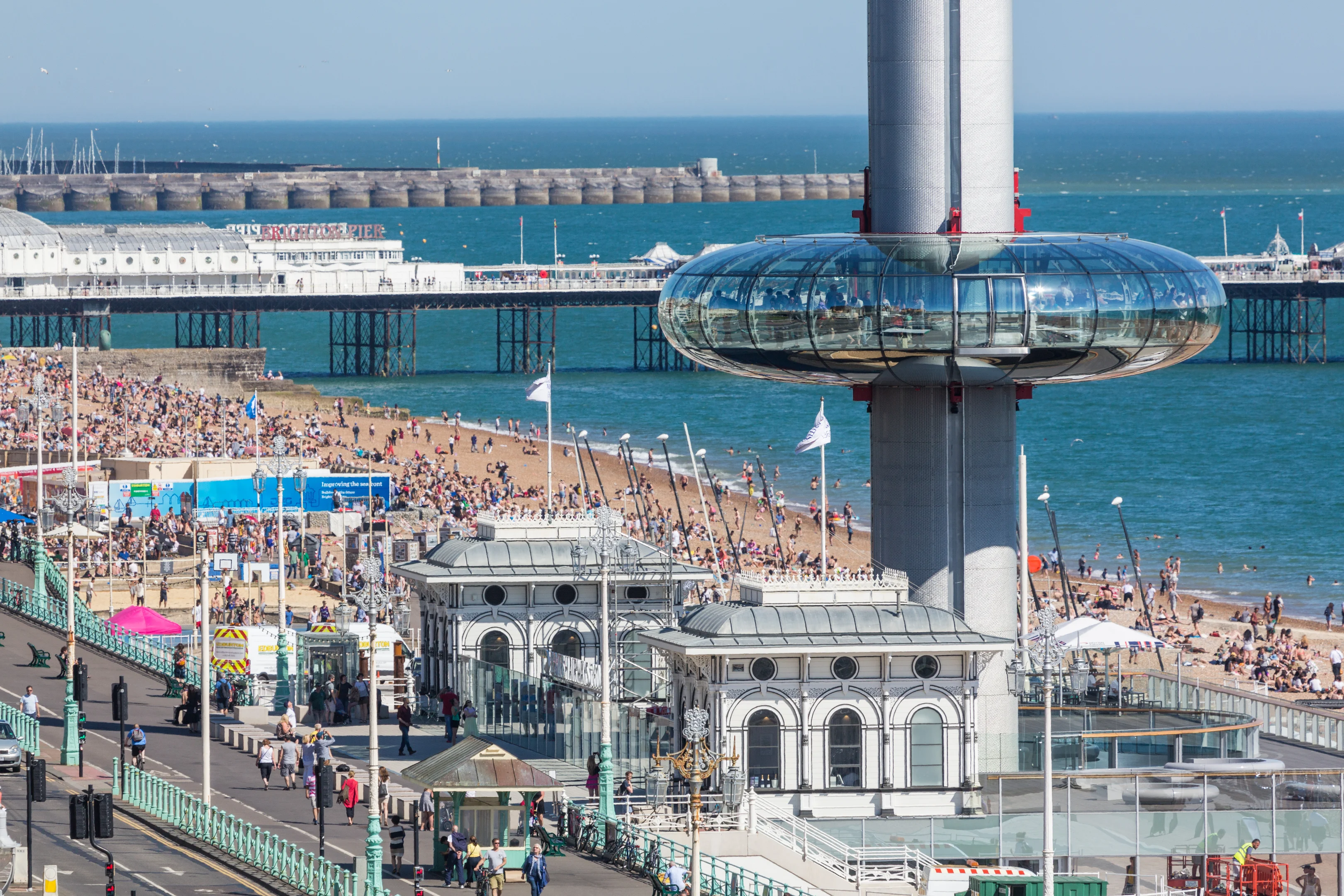
The British Airways i360represents Brighton's newest landmark - a 162-meter observation tower that opened in 2016. This striking cylindrical tower sits on the seafront between the ruins of the West Pier and Hove, offering 360-degree views over Brighton and the surrounding countryside.
The i360 sits about one mile west of Brighton Pier along the seafront promenade. Walking from the city center takes 15-20 minutes along King's Road Arches or the upper promenade. Several bus routes serve the area, with stops near the tower entrance on Kings Road.
Brighton Marina - Marina Way, BN2 5WA
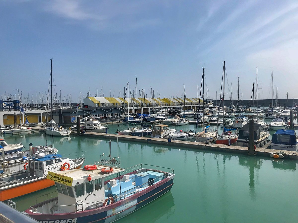
Brighton Marina creates an impressive sight from both land and sea, featuring hundreds of yachts and boats alongside shopping, dining, and entertainment facilities. The marina sits approximately two miles east of Brighton city center, built within artificial harbor walls that extend into the English Channel.
Reaching Brighton Marina requires either a 30-40 minute walk along the seafront from Brighton Pier, or a bus journey using routes 7, 14, or 47. The seafront walk offers excellent views but includes some steep sections as the path follows the natural cliff line. The Volks Railway provides a scenic alternative during summer months.
Devil's Dyke - Devil's Dyke Road, BN1 8YJ
Devil's Dyke represents one of England's deepest and longest dry valleys, located about five miles north of Brighton city center on the South Downs. This dramatic landscape feature offers spectacular views over Brighton, Hove, and the English Channel, making it a popular destination for both tourists and locals.
Reaching Devil's Dyke requires either a car journey via the A23 and local roads, or bus route 77 which operates seasonal services from Brighton city center. The walk from Brighton to Devil's Dyke covers approximately five miles and includes significant uphill sections, but follows well-marked public footpaths through beautiful downland scenery.
Hidden Gems Only Locals Know
Rottingdean Village
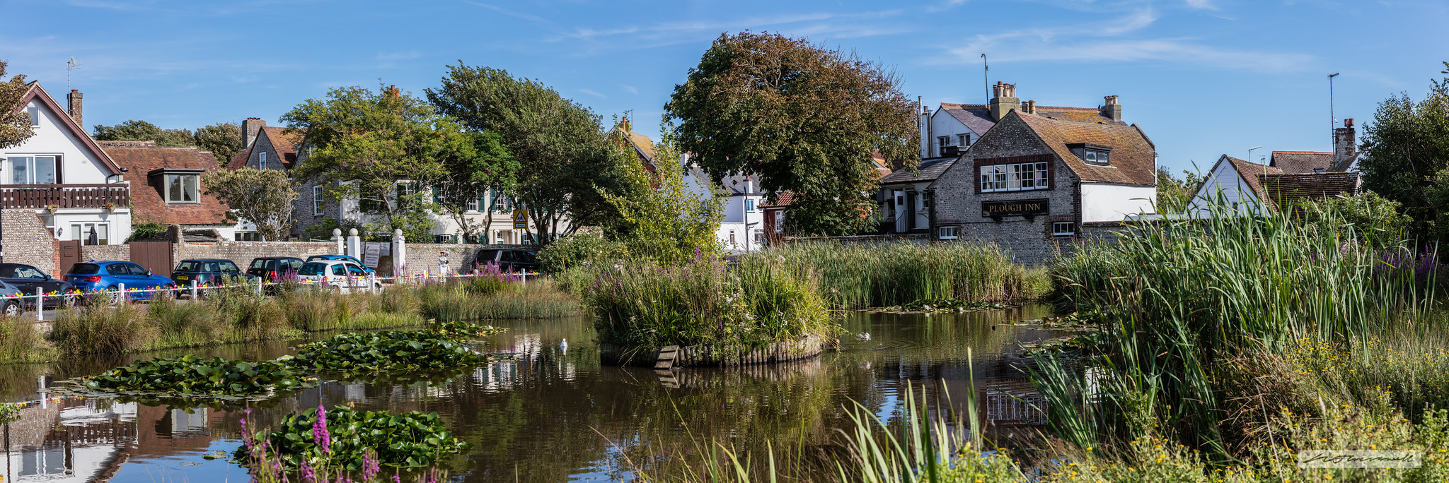
Rottingdean sits three miles east of Brighton Marina, offering a glimpse of traditional Sussex village life that most tourists never see. This picturesque village features a historic windmill, village pond, and the former home of author Rudyard Kipling. The village sits in a valley that leads to the sea, with dramatic chalk cliffs on either side.
Getting to Rottingdean requires bus route 2A or 2B from Brighton city center, or a pleasant walk along the Undercliff Walk from Brighton Marina. The coastal path offers stunning views but includes several steep sections and can be challenging in bad weather.
Preston Manor And Park
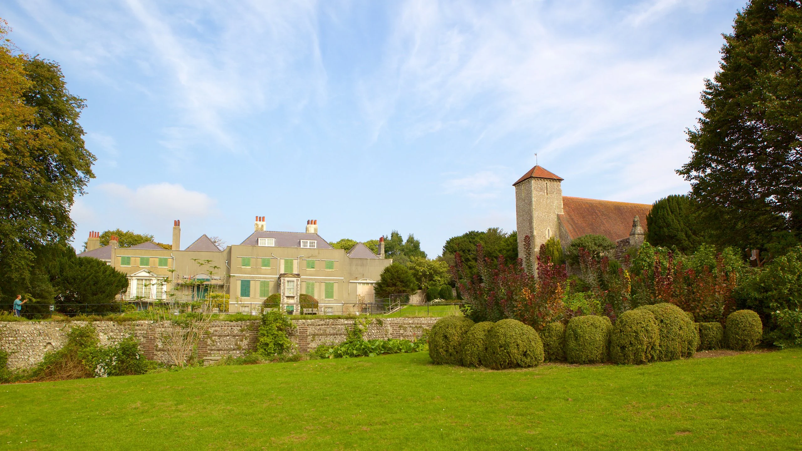
Preston Manor provides one of Brighton's best-preserved Edwardian houses, complete with original furnishings and a fascinating servant's quarters. The manor sits within Preston Park, Brighton's largest green space, but many visitors focus only on the park while missing the historic house entirely.
The manor sits on Preston Drove, easily reached by bus routes along London Road or Preston Road. Alternatively, a 20-minute walk north from Brighton station via Preston Road provides good exercise and passes through some of Brighton's most attractive residential areas.
The Level Skate Park

The Level represents one of Europe's most impressive concrete skate parks, hidden away in a former Victorian park between London Road and Union Road. This free facility attracts skateboarders from across the country but remains unknown to most tourists, despite its central location.
Walking to The Level from Brighton station takes about 10 minutes north along Queen's Road, then turning right onto Union Road. The park also features children's play areas, basketball courts, and plenty of green space for picnics or relaxation.
Undercliff Walk
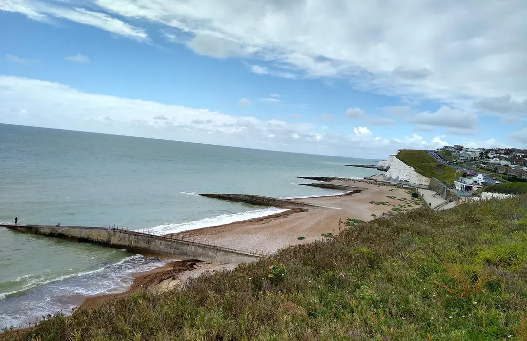
The Undercliff Walk provides a spectacular clifftop path between Brighton Marina and Saltdean, offering views that rival any in southern England. This three-mile path passes through several nature reserves and provides access to secluded beaches that few visitors discover. It's also a peaceful alternative to the busy Brighton beach england, giving walkers a more natural and quiet coastal experience.
Starting the walk from Brighton Marina requires finding the path at the eastern end of the harbor development. The route can be challenging in places, with steep steps and narrow sections, but rewards walkers with incredible coastal scenery and wildlife viewing opportunities.
Black Rock Swimming Pool Ruins
The remains of Brighton's former open-air swimming pool sit on the shore between Brighton Marina and Rottingdean. Built in the 1930s and destroyed by storms in the 1970s, the concrete structures create an atmospheric ruins that photographers and history enthusiasts love to explore.
Reaching the ruins requires walking east from Brighton Marina along the beach or coastal path for about one mile. The area can only be accessed at low tide, and the concrete structures can be slippery, so caution is essential when exploring.
Stanmer Park And Village
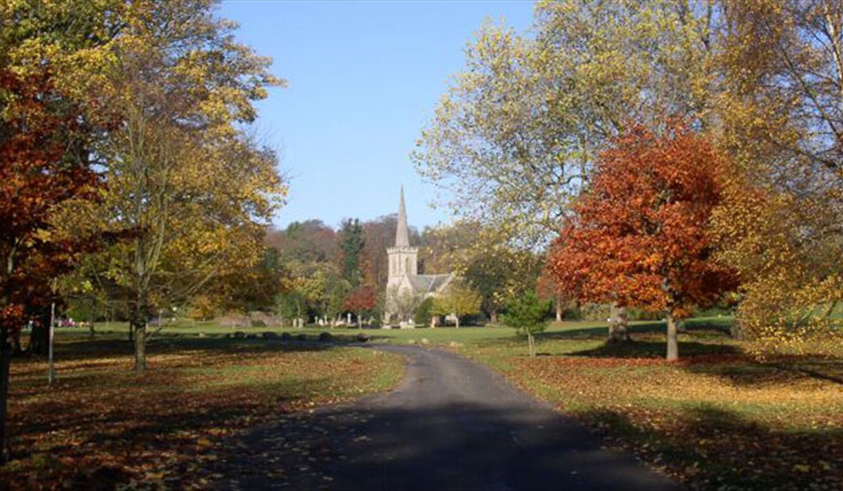
Stanmer Park covers 200 hectares of downland, woodland, and farmland just four miles north of Brighton city center. The park includes a preserved medieval village, organic farm, and extensive walking trails that provide excellent views over Brighton and the surrounding countryside.
Bus route 78 provides regular services to Stanmer Park from Brighton city center, or adventurous visitors can walk from the city via various public footpaths. The park offers excellent mountain biking trails and hosts regular events throughout the year.
Types Of Brighton Map England
There are many types of maps you can use to find your way around Brighton. Each map is made for a different purpose, so choosing the right one depends on what you need. Below are the most useful types of Brighton maps:
1. Street Map
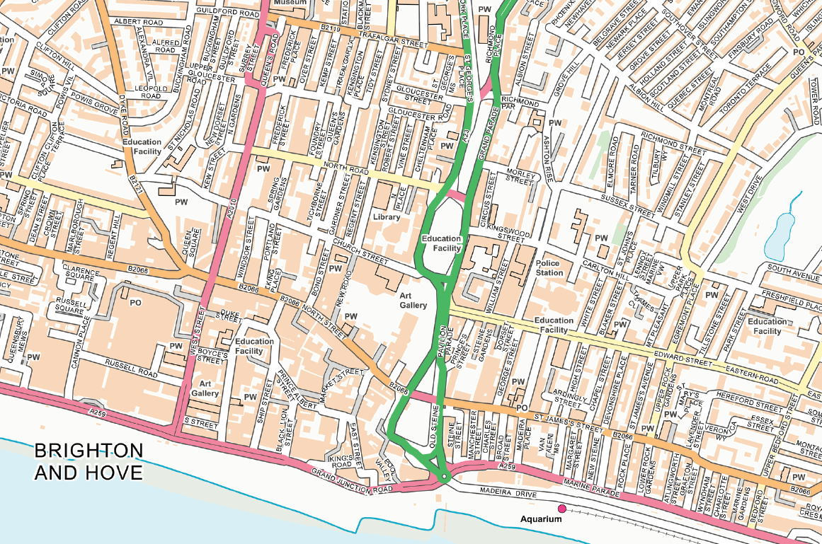
A street map shows the roads, buildings, parks, and important places in the city. It helps you:
- Find specific addresses
- Locate schools, hospitals, shops, and hotels
- Understand how areas are connected
- Navigate by foot, car, or public transport
2. Tourist Map
Tourist maps highlight popular places to visit, such as:
- Brighton Pier
- The Royal Pavilion
- The Lanes
- Museums and parks
They usually include icons and colours to make it easy for visitors to find attractions, toilets, transport, and food spots.
3. Transport Map
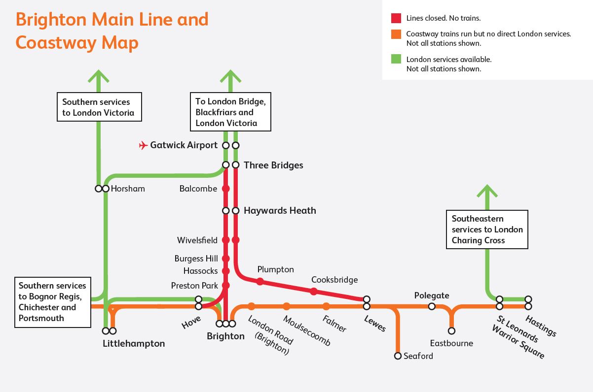
A transport map shows:
- Bus routes and numbers
- Train stations
- Bike lanes and rental stations
- Park & Ride locations
- Walking routes to key areas
These maps help you plan how to move around Brighton without getting stuck in traffic or lost.
4. Walking Map
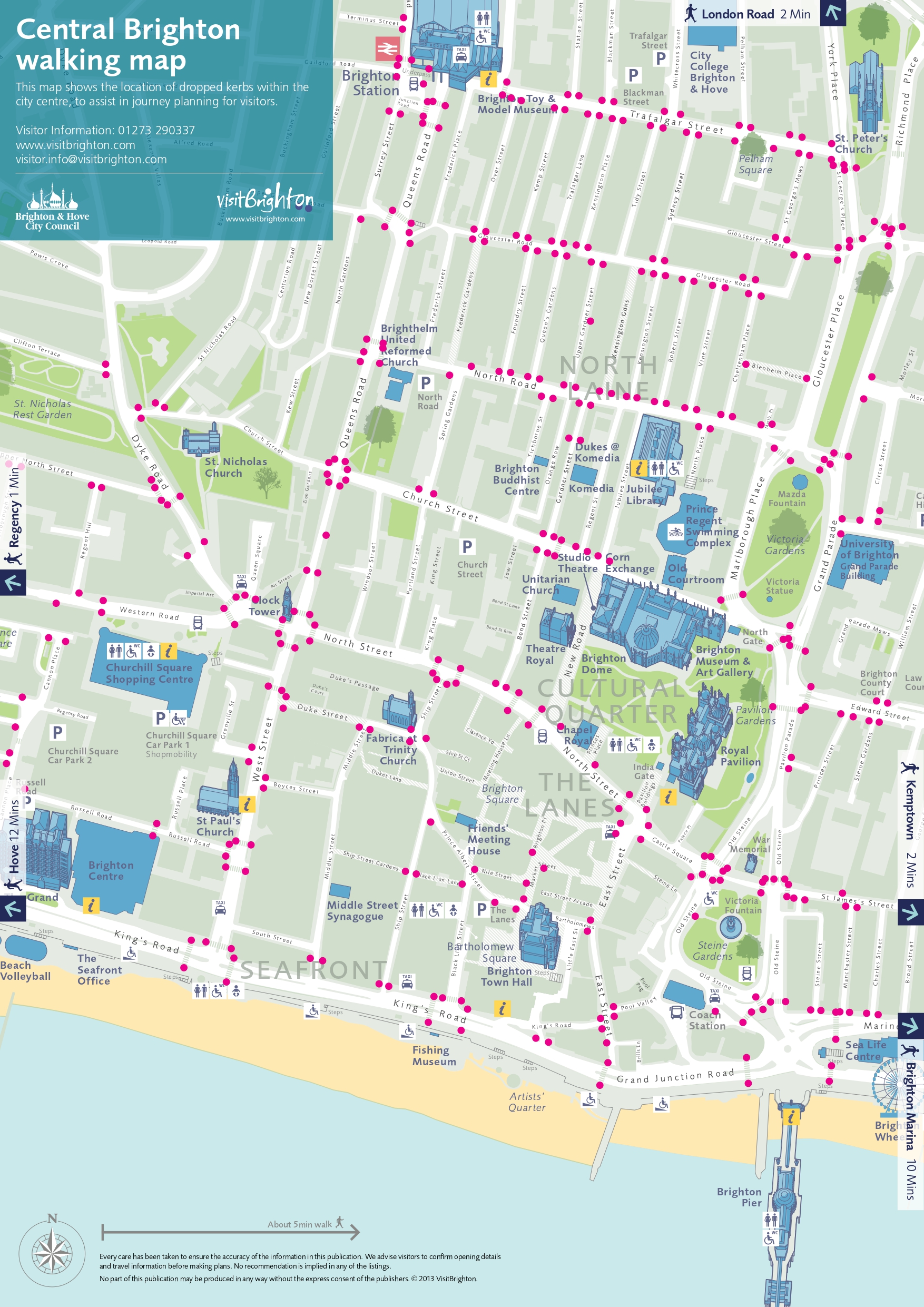
Walking maps focus on:
- Pedestrian paths
- Walking tours
- Scenic routes along the beach
- Historical or cultural trails
They are perfect if you want to enjoy the city on foot and take in the sights at your own pace.
5. Cycling Map
Brighton is a bike-friendly city. Cycling maps include:
- Dedicated cycle paths
- BTN BikeShare stations
- Bike-friendly streets
- Parks and seafront cycle routes
They help cyclists avoid busy roads and find the safest and easiest routes.
6. Accessibility Map
Accessibility maps show:
- Step-free routes
- Lifts and ramps
- Accessible toilets
- Disabled parking areas
- Mobility support services
These maps are useful for people using wheelchairs, prams, or those with limited mobility.
7. Digital Map
Digital maps are apps like:
- Google Maps
- Apple Maps
- Citymapper
- Maps.me
- OpenStreetMap
They offer live directions, traffic updates, and location sharing. Many can be used offline if downloaded in advance.
8. Historical Map
Historical maps show what Brighton looked like in the past. They are useful for:
- Students and researchers
- Understanding how the city has changed over time
- Exploring old buildings and forgotten streets
9. Brighton Maps For Events And Seasonal Attractions
During peak periods, special maps are critical for navigation.
- Brighton Festival (May):Event maps help locate performance venues across the city.
- Brighton Pride (August):Detailed maps show the parade route, stage locations, and street closures due to the massive crowds.
- Brighton Marathon (April):Race day maps guide spectators and help non-participants avoid traffic blockages along the course.
- Temporary Closures:The city shares updated transport maps online before and during events to help locals and visitors find alternative routes and avoid blocked roads.
You can find some of these at local libraries or online archives.
Strategic Navigation: Roads, Transport Hubs, And Parking
Effective movement is key to enjoying Brighton. This section details the major road networks, central transport hubs, and crucial parking information needed for navigating the street map of Brighton and the surrounding region.
External Road Network And Access
Brighton is strategically connected to the UK via two principal trunk roads:
- A23 (North-South Artery):This is the main corridor to London, running directly north from the city center and transitioning into the M23 motorway. It serves as the primary route for traffic, coaches, and commuters.
- A27 (Coastal Bypass):This road runs east-west along the edge of the city, acting as a crucial bypass that links Brighton to major surrounding towns like Lewes (east), Eastbourne, and Worthing (west), facilitating regional travel across Sussex.
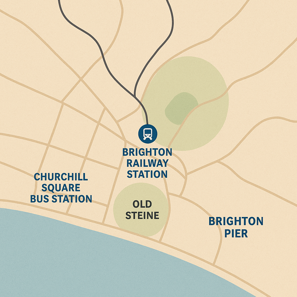
Key Transportation Hubs And Navigation Tips
Brighton Railway Station: The primary arrival point for visitors. It sits about half a mile north of the seafront. Tip:The main entrance faces north, not the sea. Queen's Road leads directly south toward the seafront; the walk is mostly downhill and takes approximately 12–15 minutes.
The Old Steine: Brighton’s central bus interchange. This large open space is located just inland from the Pier, and most city bus routes either pass through or terminate here. It's a key point of reference near the Royal Pavilion.
Churchill Square Bus Station: The main terminal for local and long-distance services, situated beneath the shopping center. Tip:Clear signage from Western Road and North Street guides pedestrians, but check departure points in advance as some local routes use nearby street-level stops.
Hove and Preston Park Stations: These serve as secondary railway stations, providing useful alternative access to the western side of the city (Hove) and the northern residential neighborhoods (Preston Park).
Brighton Marina: Features its own transport interchange, serving buses (e.g., Route 7) and the seasonal Volks Electric Railway connection to the seafront.
Internal Routes And Traffic Flow
- Major Internal Streets:Include London Road, Lewes Road, Western Road, and King's Road (along the seafront). These roads carry the bulk of daily traffic and public transport services.
- Driving Complexity:Central Brighton utilizes many complex one-way systems, especially in the city centre. A reliable map, GPS, or digital map app is highly recommended for drivers to avoid congestion and detours.
- Sustainable Travel:Public transport (buses) follows these main arteries. Walking and cycling paths often run alongside or near major roads, offering safe, popular, and scenic alternatives for getting around without a car.
Parking Zones And Restrictions
Parking is tightly controlled across the city, making prior planning essential.
- City Center Parking Zones (CPZ):Most streets within a mile radius of Brighton Pier are subject to comprehensive restrictions, typically operating Monday through Saturday (8:30 AM to 6:00 PM), with some areas extending to evenings and Sundays.
- Seafront Options:Madeira Drive offers extensive on-street parking with great sea views, but demand and pricing are high, especially on weekends and in summer.
- Alternative Solutions:Several multi-story car parks (like Churchill Square) offer better availability and competitive pricing for longer stays, often providing direct access to shopping and attractions.
- Park and Ride Services:To reduce city center congestion, the Withdean Park and Ride site (located north near the A23) offers frequent bus services directly into the city center, with journey times of approximately 15–20 minutes.
Fun Facts About Brighton, England
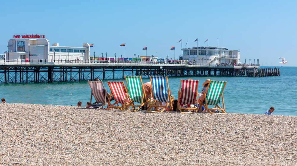
- Brighton’s beach is made of pebbles, not sand: Unlike many seaside towns, Brighton has a unique shingle beach no sand between your toes.
- It has the world’s oldest electric railway: The Volks Electric Railway, opened in 1883, still runs along the seafront today.
- Brighton once had a glass dolphin pool: The old Brighton Aquarium had a dolphinarium with glass walls where dolphins performed shows in the 1960s.
- There’s a secret tunnel under the Royal Pavilion: : Built for King George IV, it allowed him to walk privately from the palace to the stables (now Brighton Dome).
- It was nearly called “Brighthelmstone”: Brighton’s original name before it was shortened in the 19th century.
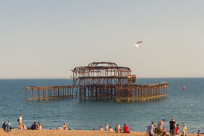
- Brighton Pier isn’t the first pier: The West Pier, built in 1866, came before but it was destroyed by fire and storm damage. Its remains still stand.
- The city hosts a 'naked bike ride' every year: It’s part of a global protest for cleaner transport yes, many ride completely nude.
- Brighton has its currency: The Brighton Pound was launched to encourage: spending in local businesses.
- More than 8 million people visit every year: Despite its small size, Brighton is one of the UK’s most-visited coastal cities.
- It’s a hotspot for filming: TV shows and movies, like Quadrophenia and Brighton Rock, were filmed in the city’s streets and along the beach.
People Also Ask
Which Part Of England Is Brighton?
Brighton is situated on the south coast of England, facing the English Channel. It lies within the ceremonial county of East Sussex.
Is Brighton Close To London?
Yes, geographically and culturally. It is located approximately 50-60 miles (80-95 km) south of central London.
Why Is Brighton Famous?
It’s among the UK’s best-known seaside cities-Royal Pavilion, Palace Pier, beach culture, independent shopping in The Lanes/North Laine, and easy day-trip access from London.
Is Brighton, UK A Good Area To Live Or Visit?
Brighton and Hove is widely considered a highly desirable place to live and an excellent area to visit. It boasts a high quality of life, cultural diversity, and excellent transport links (especially to London). Its reputation for inclusivity and its proximity to both the sea and the South Downs offer a rare balance of urban life and natural escape.
How Long Does It Take To Walk From Brighton Station To The Seafront?
Walking from Brighton railway station to the seafront typically takes 12-15 minutes via the most direct route down Queen's Road and West Street. The route is mostly downhill and passes through Brighton's main shopping district, making it an pleasant introduction to the city.
How Can I Find Bike Routes In Brighton?
BTN BikeShare has a digital map showing bike lanes and docking stations. Google Maps and OpenCycleMap also show cycling-friendly roads.
Final Thoughts
Getting around Brighton is easier when you know where things are. A reliable map gives you more time to enjoy the city and less time worrying about directions or missed turns.
Maps are useful not just for reaching places but for understanding the layout and rhythm of the city. With the right one, you can move confidently through Brighton’s streets, parks, and seafront with a better sense of what’s around you.
Jump to
Quick Facts About Brighton, England
Geographical Overview Of Brighton Map England
History Of Brighton, England
Area, Population & Language Of Brighton, England
Key Cities And Towns Around Brighton On The Map
Regions And Neighbourhoods On The Brighton Map England
Must-Visit Landmarks And Their Exact Locations
Hidden Gems Only Locals Know
Types Of Brighton Map England
Strategic Navigation: Roads, Transport Hubs, And Parking
Fun Facts About Brighton, England
People Also Ask
Final Thoughts

Michael Rachal
Author
Michael Rachal believes that luxury lies in the details. With over 20 years of experience in the luxury travel industry, he has crafted hundreds of bespoke itineraries for clients seeking personalized, unforgettable experiences.
Whether guiding clients through private cultural tours or curating culinary journeys with world-renowned chefs, Michael ensures that each trip is tailored to perfection.
His ability to anticipate needs and exceed expectations has earned him a reputation as a leading expert in luxury travel.

Finn Wilde
Reviewer
For Finn Wilde, the wilderness is more than just a destination - it’s a way of life. Over the past decade, he has led multiple expeditions in some of the world’s most remote regions, from the icy fjords of Greenland to the rugged trails of Patagonia.
Finn emphasizes sustainability in all of his adventures, helping participants connect with nature while promoting responsible exploration. His expeditions inspire individuals to explore the great outdoors while fostering a deep respect for the environment.
Latest Articles
Popular Articles