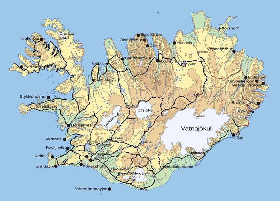
Map Of Iceland: The Essential Travel Guide & Iconic Landmarks
To discover Iceland's magic, you need a thorough map. A country of striking differences can be seen on the map, from the magnificent Vatnajökull glaciers to the energetic capital of Reykjavik.
Author:Finn WildeReviewer:Maya ReyesJun 25, 202515.7K Shares275.6K Views
A unique combination of natural wonders may be found in Iceland, a land of fire and ice. The island nation enthrals tourists with its untainted beauty and striking scenery, which include glaciers, volcanoes, geothermal hot springs, and tumbling waterfalls. To get the most out of your trip, you must be aware of the country's topography.
Geographical Overview Of Iceland's Map
A region of striking contrasts, Iceland is home to numerous hot geysers that offer a special kind of geothermal energy that can be used to heat homes and even enable year-round farming in this northern country. The Gulf Stream also contributes to this island nation's relatively mild temperature, despite its remote location from the European continent.
Iceland has a rich history, having been founded more than a thousand years ago during the Viking Age of exploration. The settlers of this isolated island were Norse explorers and mariners, whose bold journeys brought them to Greenland and possibly the North American coast. Despite its remote location, Iceland has always remained connected to European culture.
Situated on the border between the North American and Eurasian tectonic plates, Iceland is an island republic in the North Atlantic Ocean that offers a strikingly different scenery. With it's abundant hot springs that offers a distinctive source of geothermal energy, while glaciers such as Vatnajokull cover the landscape. Despite its northerly location, the Gulf Stream moderates the climate, resulting in a very pleasant environment.
It is the island itself that demonstrates this geological activity. The new island of Surtsey, formed by a volcanic eruption in the 1960s, is a vivid example of the dynamic forces shaping this magical area.
The average elevation of the varied landscape is around 1,640 feet. The wild mountains, such as Vatnajokull's tallest peak, Hvannadalshnúkur, stand in stark contrast to the country's expansive plains and lush valleys. This stunning and memorable island nation is the product of the incredible combination of geological forces.
Map Of Iceland's Cities
1. Reykjavík
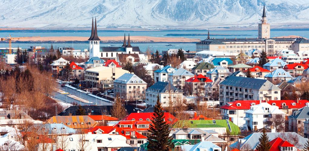
Reykjavík, the world's northernmost capital, is a bustling city located on the southwestern coast of Iceland. The nation's cultural, political, and economic center is Reykjavík, which is prominent for its vibrant architecture and strong arts scene.
The metropolitan skyline is adorned with landmarks like the recognizable Hallgrimskirkja Churchand the eye-catching Harpa Concert Hall, while geothermal baths offer a special chance to unwind and feel the island's inherent warmth. Reykjavík draws tourists from all over the world because it provides a distinctive fusion of adventure, culture, and natural beauty.
2. Akureyri
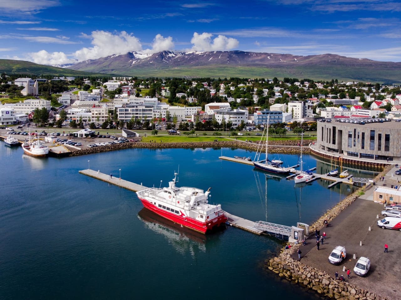
Known as the "Capital of North Iceland," Akureyri is a quaint town tucked away at the foot of Iceland's largest fjord, Eyjafjörður. Known for its charming location, Akureyri is home to a thriving cultural scene, charming cafés, and breathtaking floral gardens that flourish in the area's special microclimate.Lake Mývatn, the Goðafoss Waterfall, and the Arctic wildness are just a few of the northern attractions that can be reached from the town. Both residents and tourists adore Akureyri because of its welcoming attitude, fascinating history, and closeness to the natural world.
3. Ísafjörður
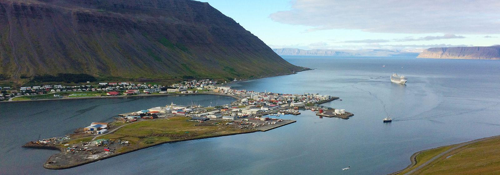
The largest town in Iceland's Westfjords, Ísafjörður (Ice Fjord), is a charming community encircled by high mountains and magnificent fjords. The well-preserved wooden houses from the 18th and 19th centuries in Ísafjörður, a town renowned for its rich maritime history and picturesque old town, are a testament to its legacy.The town is a hive for nature lovers, providing quick access to amazing hiking routes, kayaking experiences, and opportunities to see wildlife, like as seals and puffins. In this isolated and breathtaking area of Iceland, Ísafjörður is a lively and unforgettable destination because it also holds cultural festivals like the Aldrei Fór Ég Suður music festival.
4. Húsavík
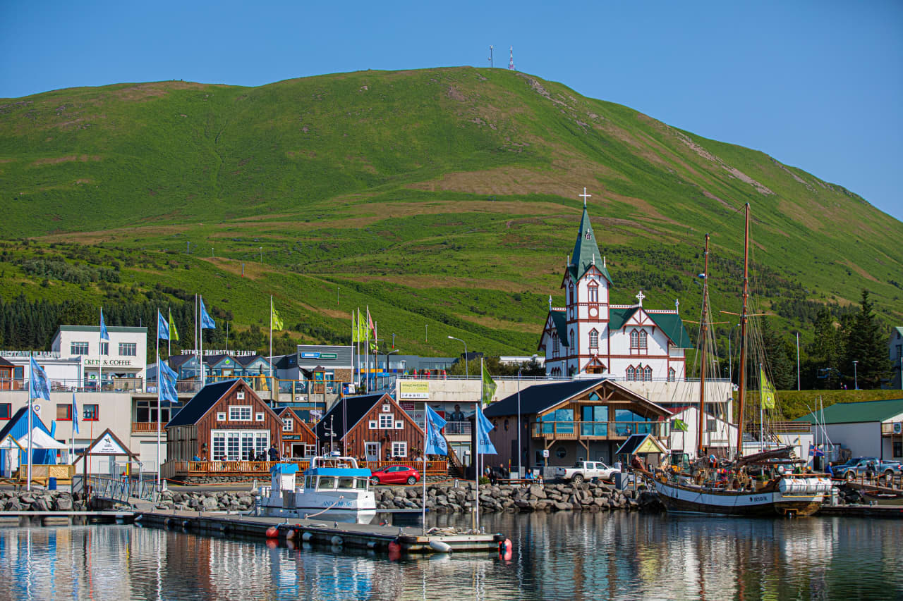
Often called the "Whale Watching Capital of Iceland," Húsavík is a quaint seaside village in northern Iceland situated on Skjálfandi Bay. It is well known for providing outstanding chances to see several kinds of whales, including as blue and humpback whales, in their native environment.The Húsavík Whale Museum offers intriguing insights into marine life and the history of whaling, while the town's charming port and colorful homes contribute to its allure. Húsavík is also the location of the famous wooden Húsavík Church, which was constructed in 1907 and provides a peaceful starting point for seeing neighboring sites like Ásbyrgi Canyon and Lake Mývatn.
5. Selfoss
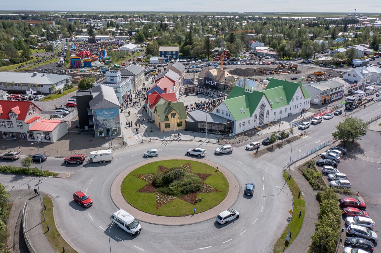
Known as one of the region's main metropolitan regions. Selfoss is a town in southern Iceland, located on the Ölfusá River, it acts as a hub for the near by agricultural area.
With its blend of contemporary amenities, scenic surroundings, and close proximity to natural treasures like the pingvellir National Park, the Gullfoss waterfall, and the Geysir geothermal area, the town is well-known for its quaint ambience.There are many cultural and recreational activities available in Selfoss, including as hiking, fishing, and visiting neighboring hot springs.
Population Of Iceland
Iceland is one of the least populous nations in Europe, with a population of roughly 380,000 and still expanding. Reykjavík, the capital city, is home to the majority of Icelanders.
The people live in farms, small towns, and rural areas.With its rough topography and harsh weather climate, the North, East, and West fjords are less populated.
With a rowing numbers of immigrants, particularly from Poland, Lithuania, and the Philippines, have contributed to the nation's increased cultural diversity.

Regions On The Map Of Iceland
1. Höfuðborgarsvæðið (The Capital Region)
The heart of Iceland Reykjavík, is located in the Capital Region, a bustling center where breathtaking natural beauty and urban life collide. Discover the vibrant city, stop by quaint towns like Hafnarfjörður and Kópavogur, and take in a singular fusion of contemporary conveniences and stunning landscapes.
2. Sudurland (South Iceland)
The allure of South Iceland, where verdant farmlands juxtapose with striking scenery. Explore the Golden Circle, which includes the historic Pingvellir National Park, the geothermal wonders of Geysir, and famous waterfalls like Gullfoss and Seljalandsfoss. Encounter volcanic terrains. glaciers, and black sand beaches-a haven for nature lovers and adventurers.
3. Vesturland (West Iceland)
From the stunning Snaefellsnes Peninsula to expansive lava fields and waterfalls, West Iceland offers a variety of scenery. This region, known as "Iceland in Miniature," features volcanic craters, glacier-topped mountains, and lovely fishing villages. Within its breathtaking natural beauty, the region also provides a strong link to Icelandic history and tradition.
4. Vestfirðir (Westfjords)
Escape to the remote and unspoiled Westfjords. This region boasts rugged terrain with steep cliffs, deep fjords, and breathtaking waterfalls like Dynjandi. A paradise for birdwatchers and hikers, the Westfjords offer a tranquil escape with dramatic coastal views and untouched nature.
5. Norðurland (North Iceland)
North Iceland is known for its geothermal wonders and volcanic activity. This region is characterized by the vibrant city of Akureyri, the whale-watching destination of Húsavík, and natural treasures like Lake Mývatn and the Dettifoss waterfall. It provides a distinctive fusion of tradition and natural beauty with its magnificent landscapes and rich cultural past.
6. Austurland (East Iceland)
Stunning natural beauty may be found in East Iceland, where rocky mountains and deep fjords create breathtaking scenery. The environment is made more appealing by lush forests and tumbling waterfalls. Discover hidden treasures and vibrant seaside communities in Austurland, a tranquil sanctuary for nature lovers.
7. Suðvesturland (Southwest Iceland)
Southwest Iceland is well-known for its famous landmarks, such the Blue Lagoon, and geothermal activity. Keflavík International Airport is located on the Reykjanes Peninsula, which is known for its breathtaking coastlines and volcanic landscapes. This area serves as a starting point for exploring Iceland's natural treasures.
8. Hálendið (The Highlands)
The vast, desolate wildness of the Icelandic Highlands is characterized by colorful mountains, volcanic deserts, and glaciers. This remote area is best accessed in the summer and offers rocky paths and breathtaking scenery, making it the perfect destination for daring tourists looking for peace and the unadulterated splendor of nature.
Read Also: Exploring Scotland's Famous Culture
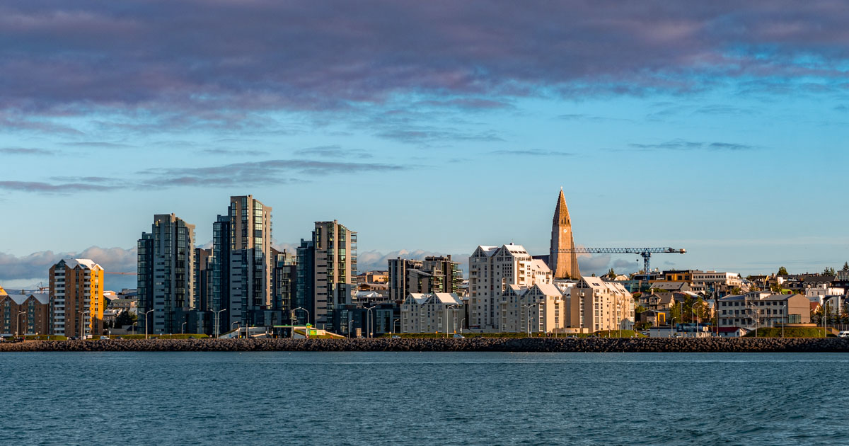
Capital Of Iceland - Reykjavík
Iceland's largest city, Reykjavík, is the political, economic, and cultural hub of the nation. It is the world's northernmost capital city and is situated on the southwest coast.
With a diversified economy fueled by tourism, finance, renewable energy, and seafood processing, the city is a booming center. Reykjavík, the nation's financial hub, is home to important banks and is essential to Iceland's economic expansion.
It is a diverse city with a strong emphasis on culture and the arts. Home to numerous museums, theaters, galleries, and music venues, it serves as Iceland's cultural epicenter.
The city hosts renowned events like the Iceland Airwaves Festival, attracting international artists and showcasing Icelandic talent. Reykjavík also boasts a progressive and inclusive society, with a growing immigrant population contributing to its multicultural identity.
The government of Iceland is based there. In addition to being the official residence of the President and Prime Minister, the city is home to the Alpingi, the Icelandic Parliament.
Reykjavík, the nation's capital, hosts conferences and summits on international concerns and is a center for international diplomacy. It also plays a significant role in national decision-making.
Types Of Maps Of Iceland
1. Topographic Maps
Insight into Iceland's dynamic environment, where natural processes like tectonic movement and volcanic eruptions play a vital part in forming the terrain, is also provided by their assistance in visualizing geological formations.
They aid in the visualization of geological formations, providing insight into Iceland's dynamic environment, where the land is shaped in large part by natural processes including volcanic eruptions and tectonic movement.
2. Political Maps
The political maps draw attention to the administrative divisions of the country by showing clear borders between municipalities and provinces (or regions). These maps show Reykjavík, the capital, as well as a number of other significant cities, including Akureyri, Reykjanesbaer, and Keflavík.They are useful for elections, policy-making, and administrative planning because they also depict the primary highways connecting cities and villages.
3. Physical Maps
Physical maps show its varied and remarkable landscapes, emphasizing natural features including mountain ranges, glaciers, waterfalls, volcanic eruptions, and coastal areas. On physical maps, elevation is indicated by differences in color and shade; lighter colors indicate lower elevations, while deeper hues indicate higher topography.
4. Tourist Maps
The Ring Road and Golden Circle are well-known routes that connect popular locations including Gullfoss Waterfall, the Blue Lagoon, and Þingvellir National Park. It provides understanding of these routes. It promotes attractions including museums, cultural landmarks, and visitor centers in addition to housing, dining alternatives, and other services. They are essential for planning itineraries, identifying travel routes, and ensuring that tourists can enjoy the full range of travel experiencesIceland's natural splendors offer.
5. Climate Maps
The North Atlantic position of Iceland results in relatively mild winters and chilly summers when compared to other regions at similar latitudes. With variations in temperature, precipitation, winds, and seasons, this provides thorough data on the country's weather patterns. Many climate zones are depicted on these maps, such as the drier and colder inner highlands, the colder coastal parts, and the wet and pleasant coastal districts.
6. Geological Maps
The maps are crucial for scientific research and hazard assessments because of Iceland's dynamic geology, which provides insight into potential seismic or volcanic activity in the region. A region of strong volcanic activity created by the collision of the North American and Eurasian tectonic plates, the Mid-Atlantic Ridge is where Iceland is situated. Geological maps additionally pinpoint areas susceptible to earthquakes, volcanoes, and landslides.
7. Road Maps
The extensive nationwide road network, which includes secondary roads, highways, and scenic routes like the Ring Road, is detailed on road maps. These maps show the roads that connect towns and cities, as well as important rest areas, service stations, and filling stations. Road maps also show bridges, ferries, and tunnels because these are essential for navigating Iceland's rural and wild terrain.
8. Satellite Maps
They also emphasize the utilization of natural resources, agriculture, and urban growth. These maps are useful resources for government organizations, scholars, and environmentalists because they are regularly updated. With the use of remote sensing technology, satellite maps provide an aerial perspective of Iceland, capturing real-time photos of the country's landscape.
9. Historical Maps
Historical maps of Iceland contain information about the country's settlements, territorial changes, and historical events. Through the development of roads, infrastructure, and property ownership over time, these maps chart the expansion of Reykjavík and surrounding communities.
They can also draw attention to Viking settlements, colonial influences, and important historical events in Iceland's past, like the founding of the Alpingi (parliament) or important trade and military routes. Researchers can track the effects of urbanisation, industrialisation, and population increase on Iceland's terrain by comparing historical maps to present ones.
National Parks In Iceland
1. Thingvellir National Park (Þingvellirþjóðgarður)
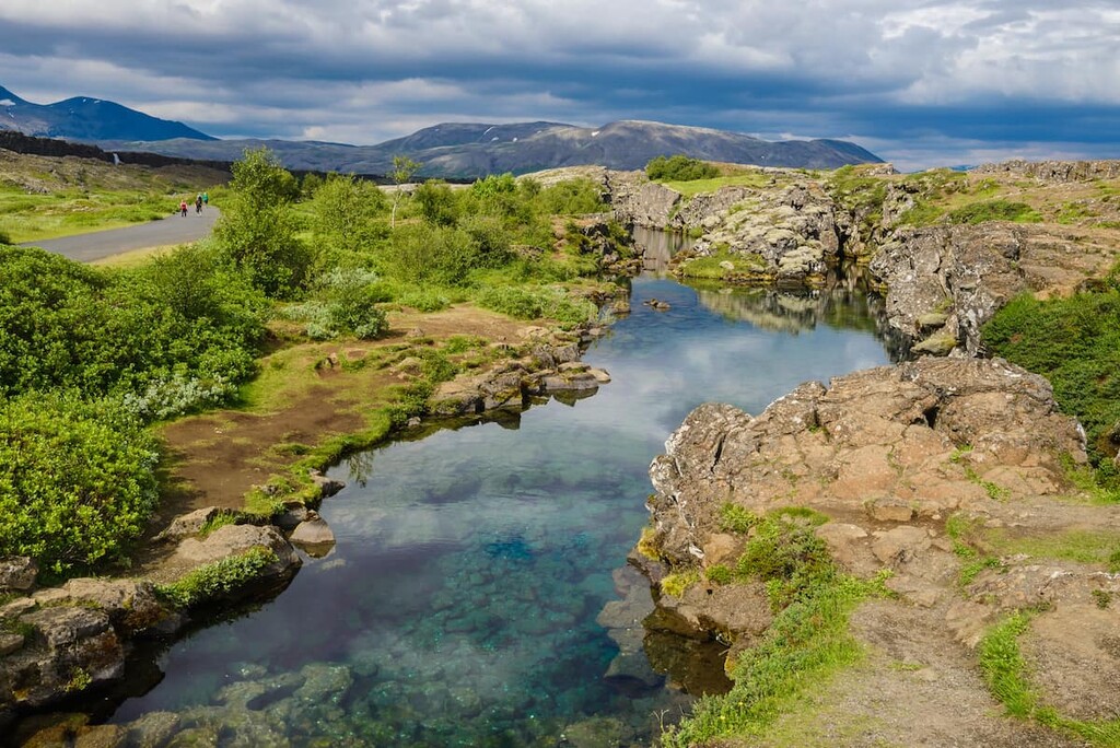
Welcome to one of the most important geological and historic sites in Iceland! Southwest Iceland's Thingvellir National Park is a UNESCO World Heritage Site and the site of the 930 AD founding of the oldest parliament in the world, Althing. Admire the striking vistas of Lake Thingvallavatn, lava fields, and waterfalls as you explore the Silfra fissure and marvel at the distinctive landscapes created by the collision of the North American and Eurasian tectonic plates.
2. Vatnajokull National Park (Vatnajökulsþjóðgarður)
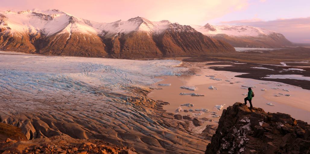
The continent's largest protected places, the magnificent Vatnajokull National Park. Vatnajokull, Iceland's largest glacier, and a variety of scenery, such as volcanic peaks, glacial lakes like Jokulsarlon, and breathtaking ice caves, may be found in this park in southeast Iceland. The highest peak in Iceland, Hvannadalshnukur, can be explored, along with geothermal features, waterfalls, and natural pathways. For hiking, glacier tours, and taking in the untamed beauty and majesty of nature, this park is a sanctuary.
3. Snaefellsjokull National Park (Snæfellsjökulsþjóðgarður)
In western Iceland, on the Snaefellsnes Peninsula, the enigmatic Snaefellsjokull National Park. This park, is dominated by the glacier-capped volcano Snaefellsjokull, is well-known for its association with Jules Verne's Journey to the Center of the Earth.
The lava fields, tunnels, and beaches with black sand says it all when admiring the diverse wildlife, which includes seagulls and seals. With its breathtaking scenery and tales, Snaefellsjokull National Park offers an amazing experience for both nature lovers and adventurers.
Major Routes And Highways In Iceland
Iceland's transportation system captures the distinct personality of this island nation, which is influenced by its low population and striking surroundings. Let's look at several ways you can travel throughout this amazing nation.
By Road
The Ring Road, a 1,332-kilometer wonder that connects Iceland's major cities and offers stunning vistas at every bend, is the entryway to Iceland's natural treasures. It passes by towering glaciers, waterfalls, and volcanic landscapes. In some places, particularly in the highlands, be ready for dirt roads.
By Air
Air travel is an essential component of Iceland's transportation system due to its untamed landscape. Keflavík International Airport is the primary entry point to Iceland and attracts tourists from all around the world. Domestic flights connect major cities and towns, making it simple to travel to even the most remote areas of the nation.
By Sea
The ports of Iceland, such as Reykjavík, Seyðisfjörður, and Akureyri, are thriving centers for both local and foreign shipping. Ferry services provide a distinctive view of the Icelandic coastline by connecting the mainland with smaller islands.
Top Attractions On The Map Of Iceland
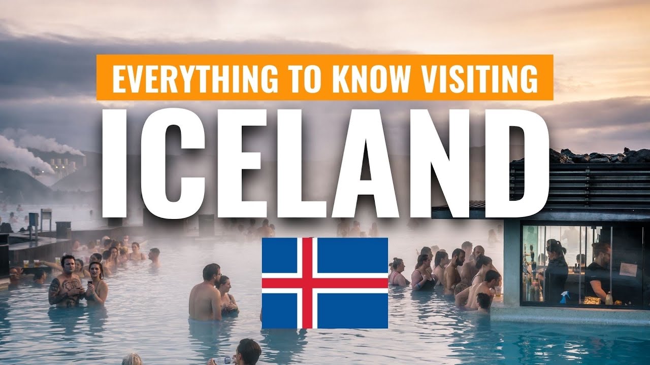
Iceland Travel Guide: Everything You NEED TO KNOW Visiting Iceland
1. The Blue Lagoon
The world-renowned geothermal spa known as the Blue Lagoon is situated close to Reykjavik and is renowned for its milky-blue waters that are abundant in minerals like sulfur and silica. Visitors come here to unwind and take advantage of its healing qualities while taking in the breathtaking views of the surrounding volcanic environment.
2. Gullfoss Waterfall
One of Iceland's most famous waterfalls, Gullfoss (Golden Falls), is a part of the Golden Circle. On sunny days, the Hvita River produces a stunning display of mist and rainbows as it plunges sharply into a canyon.
3. Thingvellir National Park
Iceland's first parliament, the Althing (the National Assembly), was founded in 930 AD on Thingvellir, a UNESCO World Heritage Site. With its striking rifts and fissures, the meeting point of the North American and Eurasian tectonic plates is also a geological wonder.
4. Geysir Geothermal Area
This region, which is another highlight of the Golden Circle, is home to mud pots, boiling hot springs, and the well-known Strokkur geyser, which shoots water skyward every few minutes.
5. Jokulsarlon Glacier Lagoon
This glacial lagoon in southeast Iceland is teeming with floating icebergs that have broken off from the Braidamerkurjokull glacier. The nearby Diamond Beach is a gorgeous black sand beach with diamond-like ice crystals.
6. Reynisfjara Black Sand Beach
Reynisfjara, a captivating black sand beach encircled by sea stacks, basalt columns, and crashing waves, is located close to the village of Vik. It is a must-see for photographers because of the breathtaking surroundings.
7. Akureyri
The quaint town of Akureyri, sometimes referred to as the "Capital of the North," has botanical gardens, cultural attractions, and easy access to whale-watching excursions and neighboring natural wonders like Lake Mývatn.
8. Dettifoss Waterfall
Europe's strongest waterfall, Dettifoss, is situated in Vatnajokull National Park. The untamed landscape and its immense power leave tourists in awe.
9. Snaefellsjokull National Park
Jules Verne's Journey to the Center of the Earth mentions the glacier-covered volcano Snaefellsjokull, which is located in this park. Lava fields, caverns, and breathtaking views of the shore are all available.
10. Husavik
Recognized as the "Whale Watching Capital of Iceland," Husavik offers unmatched chances to see blue whales, humpback whales, and other marine creatures in their native environment.
11. Vatnajokull National Park
Covering about 14% of Iceland, this park features a variety of landforms, including glaciers, volcanoes, and geothermal sites. It is also home to Vatnajokull, the largest glacier in Europe.
12. Landmannalaugar
A haven for nature lovers, this geothermal region is situated in the Icelandic Highlands and is well-known for its hiking routes, hot springs, and vibrant rhyolite rocks.
13. Westfjords
The Westfjords are a secluded and untamed area with breathtaking fjords, bird cliffs, and waterfalls like Dynjandi. For those looking for peace and pristine nature, it's the perfect place to go.
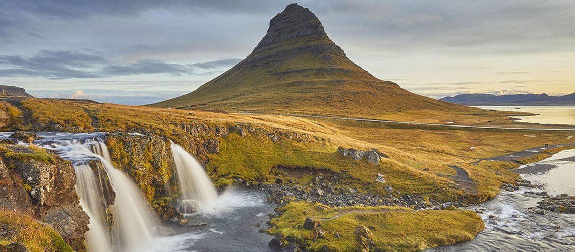
14. Kirkjufell Mountain
Kirkjufell, also called "Church Mountain," is one of Iceland's most photographed sites, particularly when combined with the neighboring Kirkjufellsfoss waterfall.
15. Thorsmork
Trails leading to stunning vistas and undiscovered treasures can be found in Thorsmork, a verdant valley encircled by mountains and glaciers. The region is named for the Norse god Thor and is renowned for its varied terrain, which includes woods, volcanoes, and glaciers. Those looking for adventure and a chance to get in touch with nature will love this place.
Dialing Code Of Iceland
In order to connect foreign callers to Icelandic phone numbers, the country code for Iceland is +354. Start by entering "+354," then the local number, when calling an Icelandic number from outside the nation (for instance, dial +354 555 1234 for a number situated in Reykjavik).In Iceland, calls are usually formatted using a seven-digit format, which does not require an area code. The call can be completed with just the local number. In Iceland, mobile numbers usually start with "8" or "9."
Currency Of Iceland
Iceland's currency is the Icelandic króna (ISK), which is frequently abbreviated as ISK in international banking. The Icelandic króna replaced the Icelandic crown, which served as its predecessor, as the nation's official currency in 1874. It is solely used in Iceland and is not a part of any global currency union.
The Icelandic krona is divisible into 100 aurar, despite the fact that aurar coins are no longer in circulation. One krónur, five krónur, ten krónur, fifty krónur, and one hundred krónur coins are among the various denominations of the króna. The banknotes are divided into five denominations: 500, 1,000, 2,000, 5,000, and 10,000 krónur. The Icelandic krona is used for all transactions and is generally accepted for a range of purchases in Iceland.
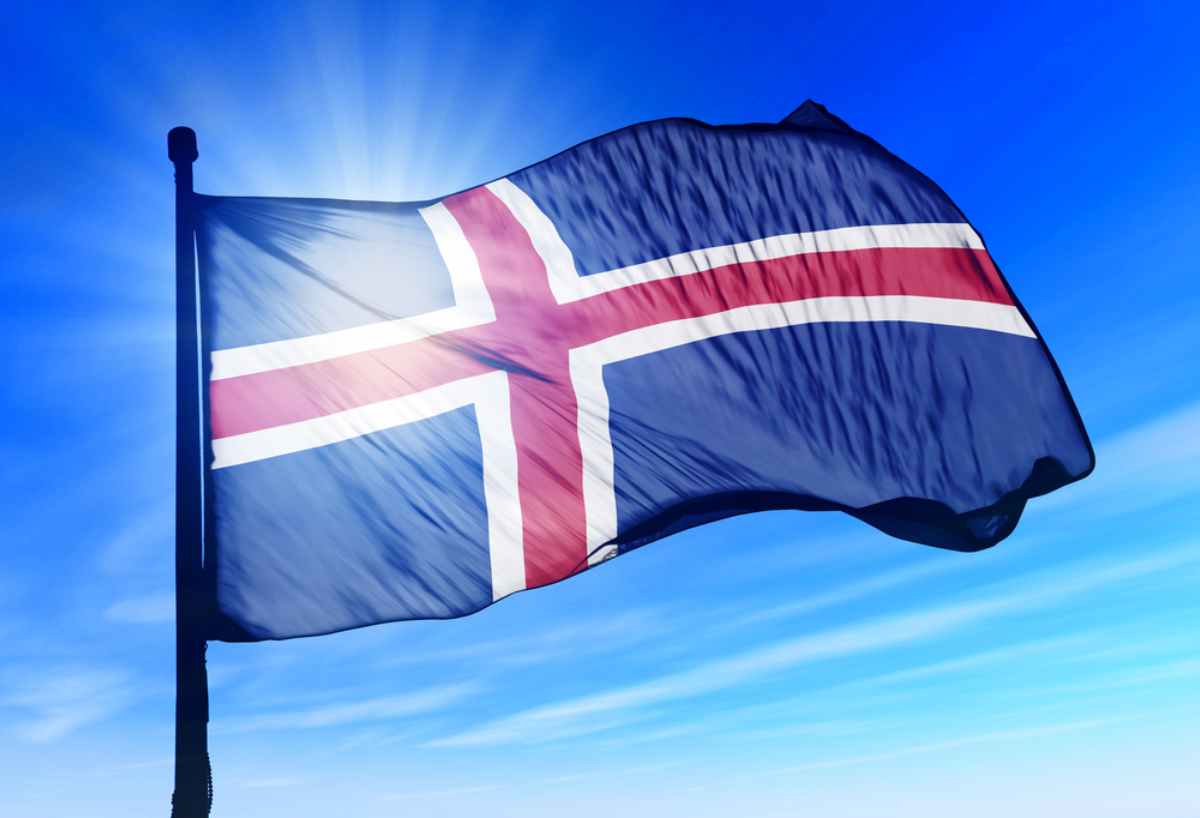
Flag Of Iceland
The cross design on Iceland's flag consists of a red cross, a blue field, and a white border around the cross. The red cross stretches to the boundaries, while the white border defines the blue field that forms the background. The flag was officially established on June 17, 1944, when Iceland became a republic.
Each color of the flag has a symbolic meaning; blue symbolizes the ocean that surrounds Iceland, white the snow and ice that cover much of the country, and red the volcanic flames that shape Iceland's landscape. The flag, which is flown on public buildings and at official events, is an important national emblem that symbolizes Iceland's geological activity and natural beauty.
10 Interesting Facts About Iceland
1. In Iceland, there are roughly thirty active volcanoes. The country's geology is constantly being shaped by volcanic activity, which includes eruptions like the well-known Eyjafjallajökull eruption in 2010.
2. Due to the deforestation caused by early immigrants, a significant area of Iceland that was formerly covered in forests is now treeless. Reforestation initiatives are ongoing.
3. Leading the way in geothermal energy is Iceland. The nation generates power and heats homes and greenhouses using its plentiful geothermal resources.
4. Iceland has midnight suns in the summer, when the sun doesn't set for weeks, and polar nights in the winter, when the sun doesn't rise for weeks, due to its proximity to the Arctic Circle.
5. Icelandic is one of the oldest languages continuously spoken in Europe, having changed very little since the Middle Ages. Icelanders still have access to classic Old Norse literature.
6. The Alpingi (Althing), Iceland's national parliament, is the oldest in the world, having been established in 930 AD.
7. Iceland is a fantastic place for summertime outdoor activity since, despite its large number of lakes and rivers, it is mosquito-free.
8. The Icelandic horse is a unique breed due to its tiny stature and five gaits, when most horses only have three or four. They are strictly protected and cannot be imported or exported.
9. Lack of Forests, but Abundant Waterfalls: Located all around the country, Iceland is known for its stunning waterfalls, which include Skógafoss, Gullfoss, and Seljalandsfoss.
10. First Country to Elect a Female President: Vigdís Finnbogadóttir, the first female president of Iceland, was elected in 1980 and held the office for 16 years.
FAQs
What Is The Best Time To Visit Iceland?
The best time to visit Iceland depends on what you want to experience. Summer (June to August) offers the midnight sun, lush landscapes, and warmer weather, while winter (November to February) provides the chance to see the Northern Lights and enjoy winter activities like ice caving and skiing.
Is Iceland Expensive To Travel To?
Iceland can be expensive, especially in terms of accommodation, food, and activities. However, budget options exist, such as camping, self-catering accommodations, and exploring the natural wonders that don’t require paid entry.
Do I Need A Visa To Visit Iceland?
Iceland is a member of the Schengen Area. If you are from a country in the Schengen Area or a country with visa-free agreements, you do not need a visa for short stays (90 days or less). However, travelers from other countries may need to apply for a Schengen visa.
What Is The Food Like In Iceland?
Icelandic cuisine is based on fresh, local ingredients, including fish, lamb, and dairy. Popular dishes include skyr (a yogurt-like dairy product), hákarl (fermented shark), and lamb stew. Iceland is also known for its wide variety of seafood.
What Language Do They Speak In Iceland?
The official language of Iceland is Icelandic, a North Germanic language closely related to Old Norse. English is widely spoken, especially in tourist areas, and many Icelanders are fluent in other languages such as Danish and German.
Conclusion
Comprehending A better view of Iceland's topography, including its coastline and volcanic regions, can be obtained via its map. It improves trip planning by assisting people in locating the main sites and areas that contribute to Iceland's exceptional tourist experience.
You Might Also Like: How The Great Wall Of China Became A World Wonder
Jump to
Geographical Overview Of Iceland's Map
Map Of Iceland's Cities
Population Of Iceland
Regions On The Map Of Iceland
Capital Of Iceland - Reykjavík
Types Of Maps Of Iceland
National Parks In Iceland
Major Routes And Highways In Iceland
Top Attractions On The Map Of Iceland
Dialing Code Of Iceland
Currency Of Iceland
Flag Of Iceland
10 Interesting Facts About Iceland
FAQs
Conclusion

Finn Wilde
Author
For Finn Wilde, the wilderness is more than just a destination - it’s a way of life. Over the past decade, he has led multiple expeditions in some of the world’s most remote regions, from the icy fjords of Greenland to the rugged trails of Patagonia.
Finn emphasizes sustainability in all of his adventures, helping participants connect with nature while promoting responsible exploration. His expeditions inspire individuals to explore the great outdoors while fostering a deep respect for the environment.

Maya Reyes
Reviewer
Maya Reyes’s wanderlust was sparked in the temples of Luang Prabang, where the scent of lemongrass and the chants of monks revealed the transformative power of travel.
Since then, her journey has been defined by cultural immersion and authentic connections. From learning batik in Indonesia to sharing meals with nomadic families in Mongolia, Maya seeks experiences that highlight the human stories behind each destination.
Travel for her is a way to weave her narrative into the world’s cultural tapestry, creating bridges across diverse ways of life. Maya has traveled to 15 countries and shares her insights through writing and storytelling.
Latest Articles
Popular Articles