Islands Of Tahiti - Discover This Earthly Paradise Country
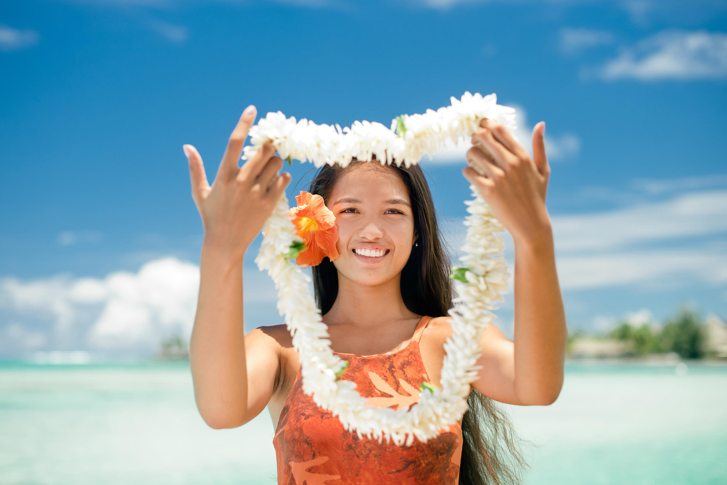
Tahiti is the largest and most inhabited island. Islands of Tahiti serves as everyone's starting point. International planes arrive at Faa'a Airport in Papeete, the capital city. Visitors are greeted with a traditional Tahitian welcome, complete with fragrant tiare flowers and Tahitian music.
Author:Maya ReyesReviewer:Finn WildeJun 01, 20222.2K Shares765.3K Views
Tahiti is the largest and most inhabited island. Islands of Tahitiserves as everyone's starting point. International planes arrive at Faa'a Airport in Papeete, the capital city. Visitors are greeted with a traditional Tahitian welcome, complete with fragrant tiare flowers and Tahitian music.
How Many Islands Are In French Polynesia?
French Polynesia is much more than that. The republic consists of 118 islands and atolls spread across an area of ocean nearly the size of Europe.
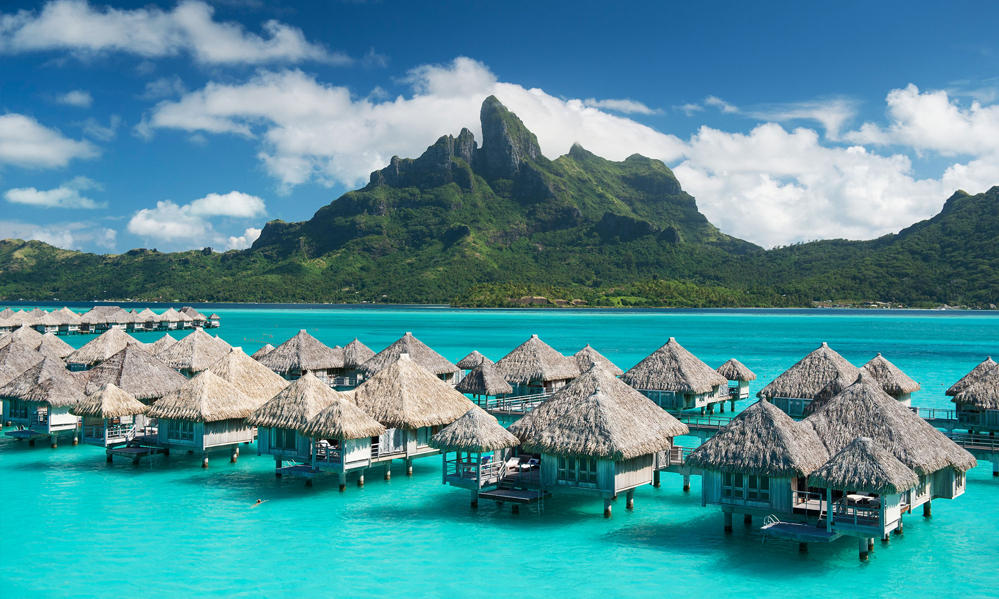
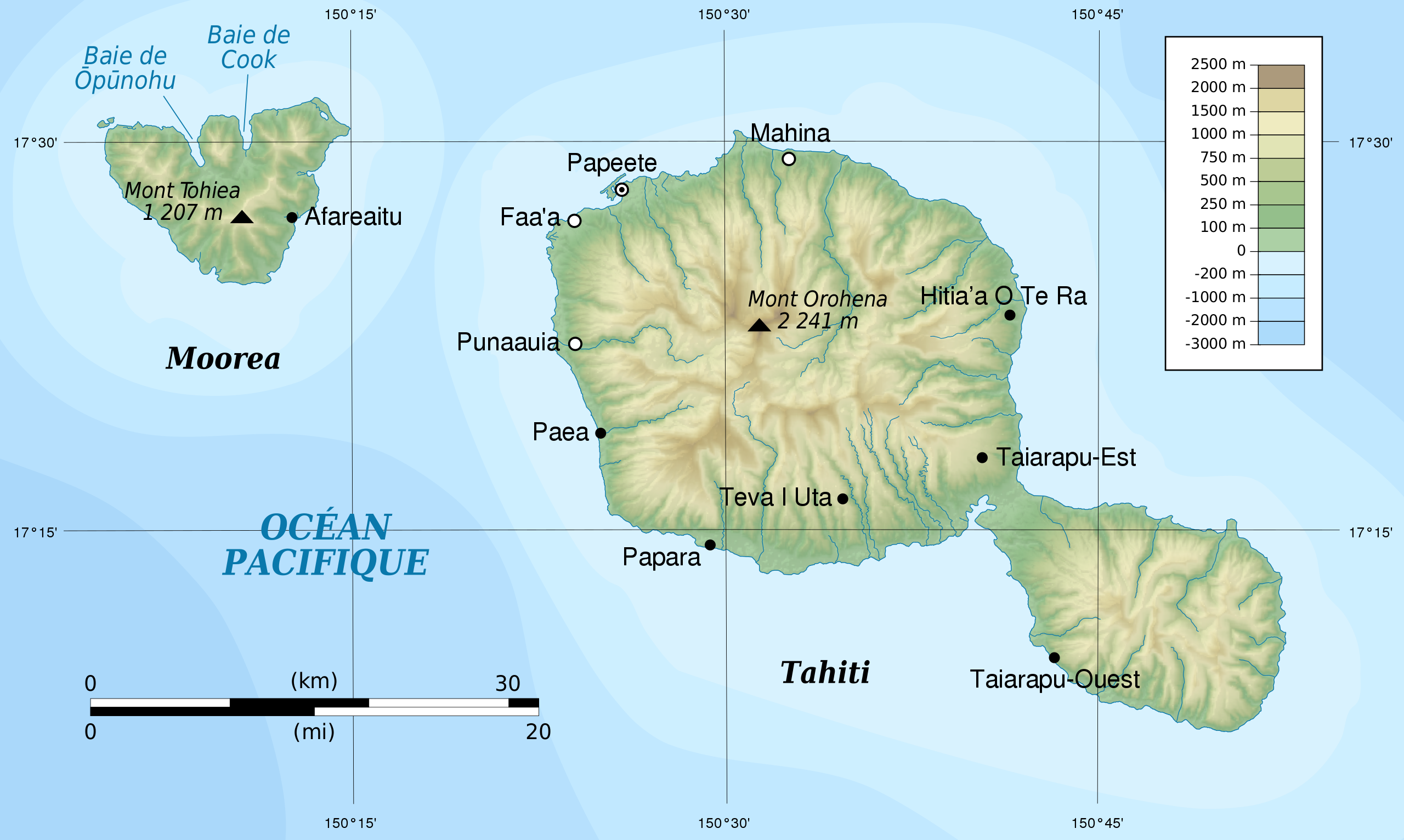
Tahiti, which is made up of two ancient volcanic cones, is notable for its stunning silhouette that rises 7,352 feet (2,241 meters) above sea level. The mountains are devoid of human settlement, with habitation and agriculture restricted to the island's coastline strip and valley outlets.
Moorea, which is separated from Tahiti by a channel 8.5 miles (14 kilometers) wide, is also a mountainous island surrounded by dazzling white coral sand beaches. Because of the thriving tourism economy in Tahiti, it is well-connected by boat and taxi plane.
The Îles Sous le Vent are a group of five volcanic islands and four atolls located about 75 miles (120 kilometers) west of Tahiti. In appearance, they are similar to the Îles du Vent.
Raiatea is the largest and most heavily populated of the Îles Sous le Vent, consisting of two islands. Raiatea and its northern neighbor, Tahaa, are located on the same mountain range and are separated by a waterway about 2 miles (3 kilometers) wide.
Both have coastal plains suited for raising animals and cultivating coconut palms. Vanilla is grown as well. Uturoa, located on Raiatea, is the group's primary port. Huahine, a volcanic formation bisected by a shallow arm of the sea, is to the east of Raiatea.
Islands Of Tahiti Map
The Society archipelago is a volcanic hotspot chain made up of eleven islands and atolls. The chain runs along to the migration of the Pacific Plate along the N. 65° W. direction.
The age of the islands drops from 5 Ma at Maupiti to 0 Ma at Mehetia as a result of plate movement over the Society hotspot, with Mehetia being the inferred present location of the hotspot based on recent seismic activity.
Maupiti, the chain's oldest island, is a heavily eroded shield volcano with at least 12 thin aa flows that accumulated relatively quickly between 4.79 and 4.05 Ma. Bora Bora is another heavily eroded shield volcano composed of basaltic lavas deposited between 3.83 and 3.1 Ma.
Post-shield dikes cut through the lavas. Tahaa is composed of shield-stage basalt that dates back 3.39 Ma, with subsequent eruptions occurring 1.2 Ma later. Raiatea is made up of shield-stage basalt followed by post-shield trachytic lava flows that occurred between 2.75 and 2.29 Ma.
Huahine is made up of two consolidated basalt shield volcanoes, Huahine Nui and Huahine Iti, with multiple flows and post-shield trachyphonolitic lava domes dating from 3.08 to 2.06 Ma.
Moorea is made up of at least 16 flows of shield-stage basalt and post-shield lavas ranging in age from 2.15 to 1.36 Ma. Tahiti is made up of two basalt shield volcanoes, Tahiti Nui and Tahiti Iti, with ages ranging from 1.67 to 0.25 million years.
Top 5 Must Visit Places In Tahiti Islands
Tahiti, the largest island in French territory, is sometimes disregarded by tourists looking for white sand beachesand overwater bungalows, but the island offers plenty of thrills for nature enthusiasts, both along the coast and in its mountainous interior.
Tahiti Island Moana ( Tetiaroa )
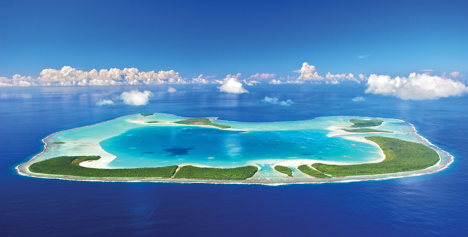
The imaginary island of Motunui from the movie Moana was inspired by the private island of Tetiaroa and the peak of Bora Bora. It's no surprise that The Islands of Tahiti inspired Moana, with its 118 similarly stunning islands.
Mt. Tohivea
Mt Tohivea, at 3,960 feet (1207 meters), is Moorea's highest point. It's a dormant volcano that can be viewed from Tahiti's capital, Papeete, like many others in French Polynesia. Mt Tohivea is surrounded by hiking trails, however climbing it is believed to be nearly impossible.
Nuku Hiva
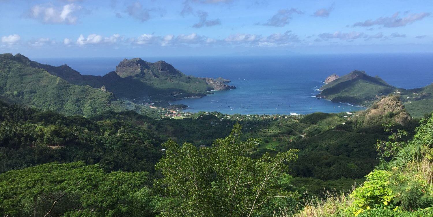
The largest of the Marquesas Islands, it is home to numerous natural beauties ranging from waterfalls to natural basins and canyons. The Vaipo Waterfall on Nuku Hiva is the world's third highest waterfall, falling 1148 feet (350 metres).
Tikehau Atoll
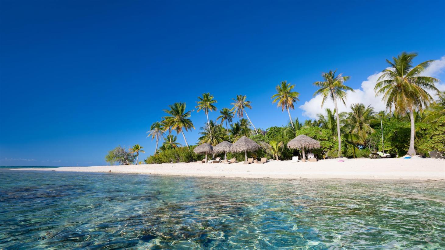
This Tuamoto Archipelago atoll is the entryway to some of the best diving in French Polynesia, with more marine life than people. The postcard-perfect lagoon vistas showcase white and pink powdery sand, and there is a sense of complete remoteness, with the northeastern section of the atoll practically uninhabited.
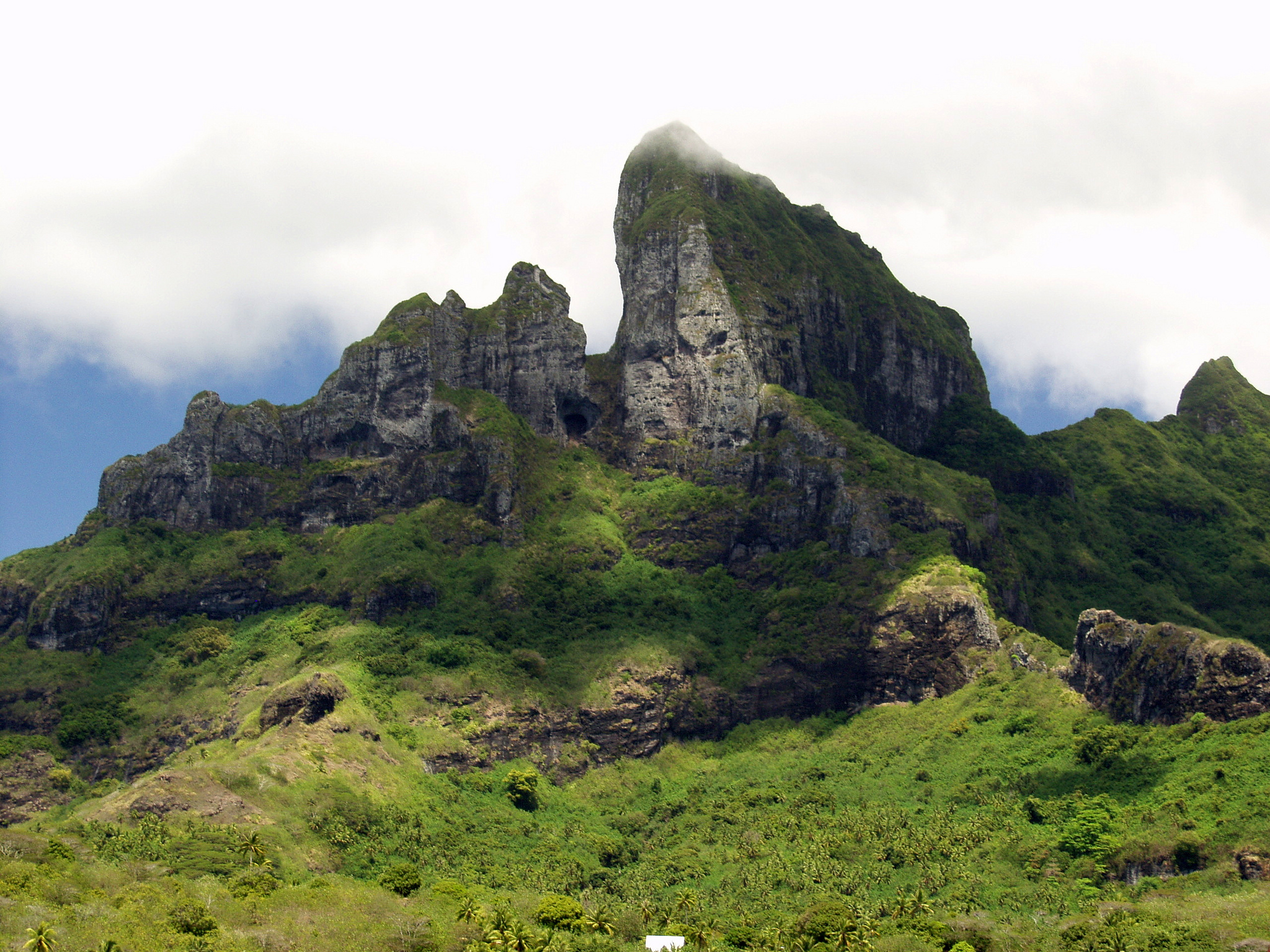
Mt Otemanu
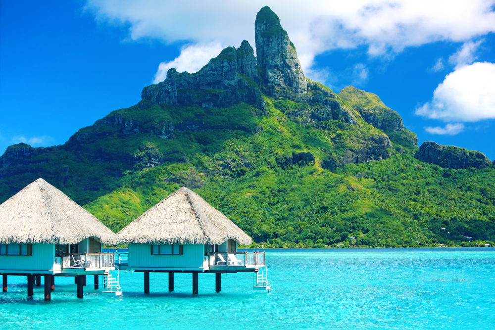
While most people envision a beautiful seaside view, Mt Otemanu is another magnificent sight in Bora Bora. This magnificent peak stands in stark contrast to the lagoon's flat sanctuary, but it is every bit as impressive. Hire a helicopter to gain an aerial perspective of the former volcano, or hire a guide and sweat your way up as high as you can.
People Also Ask
How Many Tahiti Islands Are There?
French Polynesia, often known as The Islands of Tahiti, is a collection of 118 islands and atolls spread across an amazing nautical surface area the size of Western Europe. Nonetheless, these little islands, many of which are deserted, cover a total size of only 1,600 square miles.
Which Islands Make Up Tahiti?
The Society Islands contain Tahiti, the country's main and largest island, Moorea, Marlon Brando's Tetiaroa paradise atoll, and numerous smaller world-class islands in between.
Is Tahiti Or Bora Bora Better?
Tahiti is a more urbanized island, and while its beaches aren't as well-known as those in Bora Bora, it has wonderful shopping, nightlife, cultural events, and incredible outdoor activities. When you think about paradise, the image that comes to mind is Bora Bora. It is a more intimate and upscale island.
Conclusion
Tahiti is more than simply a means to an end for vacationers keen to see the distant islands. It is up to you how much time you spend here, but give yourself a chance to experience everything the island has to offer, beyond the initial look from the plane.

Maya Reyes
Author
Maya Reyes’s wanderlust was sparked in the temples of Luang Prabang, where the scent of lemongrass and the chants of monks revealed the transformative power of travel.
Since then, her journey has been defined by cultural immersion and authentic connections. From learning batik in Indonesia to sharing meals with nomadic families in Mongolia, Maya seeks experiences that highlight the human stories behind each destination.
Travel for her is a way to weave her narrative into the world’s cultural tapestry, creating bridges across diverse ways of life. Maya has traveled to 15 countries and shares her insights through writing and storytelling.

Finn Wilde
Reviewer
For Finn Wilde, the wilderness is more than just a destination - it’s a way of life. Over the past decade, he has led multiple expeditions in some of the world’s most remote regions, from the icy fjords of Greenland to the rugged trails of Patagonia.
Finn emphasizes sustainability in all of his adventures, helping participants connect with nature while promoting responsible exploration. His expeditions inspire individuals to explore the great outdoors while fostering a deep respect for the environment.
Latest Articles
Popular Articles