Map Of Zacatecas Mexico - Now And Its Bloody History
Looking at the map of zacatecas mexico, you could definitely agree how strategic its location is. Zacatecas is the tenth-largest state in Mexico, and it is located in the center-north of the country. It is divided into 58 municipalities and 4,882 towns, cities, and other localities and borders the states of Nayarit, Jalisco, Aguascalientes, San Luis Potosi, Coahuila, and Durango.
Author:Michael RachalReviewer:Finn WildeMay 30, 202210K Shares629.9K Views
Looking at the map of zacatecas mexico, you could definitely agree how strategic its location is. Zacatecas is the tenth-largest state in Mexico, and it is located in the center-north of the country. It is divided into 58 municipalities and 4,882 towns, cities, and other localities and borders the states of Nayarit, Jalisco, Aguascalientes, San Luis Potosi, Coahuila, and Durango.
Zacatecas Fast Facts
Soon after the Spanish conquest, the state's mineral richness, particularly silver, was discovered. Since the mid-16th century, the mines there have been one of the most important sources of wealth in the Spanish colonies, second only to Upper Peru's Cerro Rico (now in Potos, Bolivia).
Agriculture (cereals, alfalfa, sugarcane, and maguey, from which the alcoholic beverage pulque is created) is also a significant occupation, but crop yields are limited by poor rainfall, and only a tiny percentage of the state's cropland is irrigated.
Cattle are raised, and the processing of meat is essential. Mineral products, sugar refining, beverages (particularly rum, pulque, and mescal), and woolen and cotton textiles are the primary industries.
A governor leads the state government and is elected for a single six-year term. Members of the State Legislature's unicameral body are elected for three-year terms. Zacatecas, like other Mexican states, is divided into local governmental entities known as municipios (municipalities).
In the late twentieth century, Zacatecas became part of Mexico's so-called "hollow core," as many of its citizens relocated to the United States, along the US-Mexico border, or in the Federal District, in search of work.
The Map Of Zacatecas Mexico
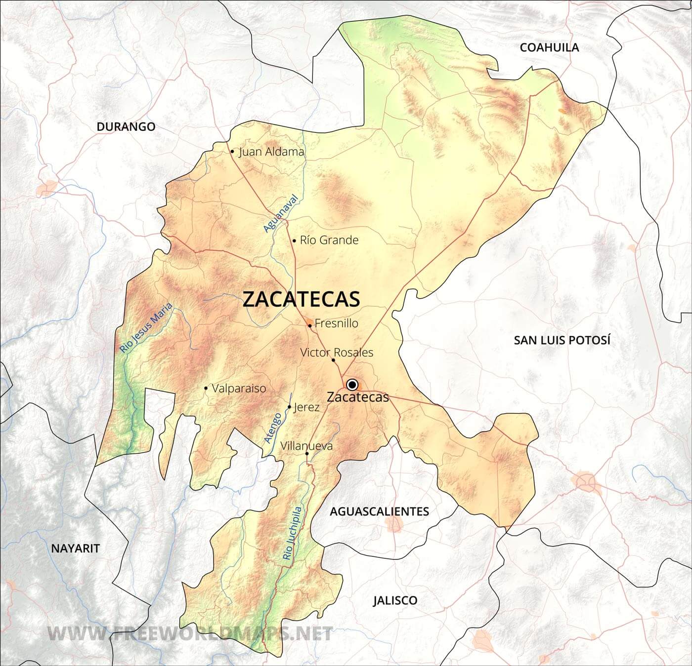
It is located in the northern part from Coahuila, to the east by San Luis Potosi, to the south by Jalisco and Aguascalientes, and to the west by Nayarit and Durango. Zacatecas is its capital city.
The state's land is mostly within the arid Mexican Plateau, with the Sierra Madre Occidental running through the southwest and the Sierra Madre Oriental reaching the northeastern corner.
The plateau's average elevation is at 7,700 feet (2,350 meters); the climate is dry and warm in the valleys and temperate in the mountains. The major rivers of the state include the Atengo, Jerez, Juchipila, San Andrés, Tlaltenango, and Valparaso. The annual precipitation averages about 20 inches (500 mm).
Local Climate
Daytime temperatures in Zacatecas are normally pleasant and dry all year. The climate is suitable for participating in a range of outdoor sports and activities, as well as seeing local culture, architecture, and beauty.
The rainy season lasts from May to October, with summer storms being severe and fleeting in the late afternoon.
Since it is in the desert ,the combination of its remoteness and altitude means that mornings and evenings can be cold, especially in the winter, so bringing thick clothing layers in addition to lighter garments for warmer daytime temps is a must.
Must-Visit In Zacatecas
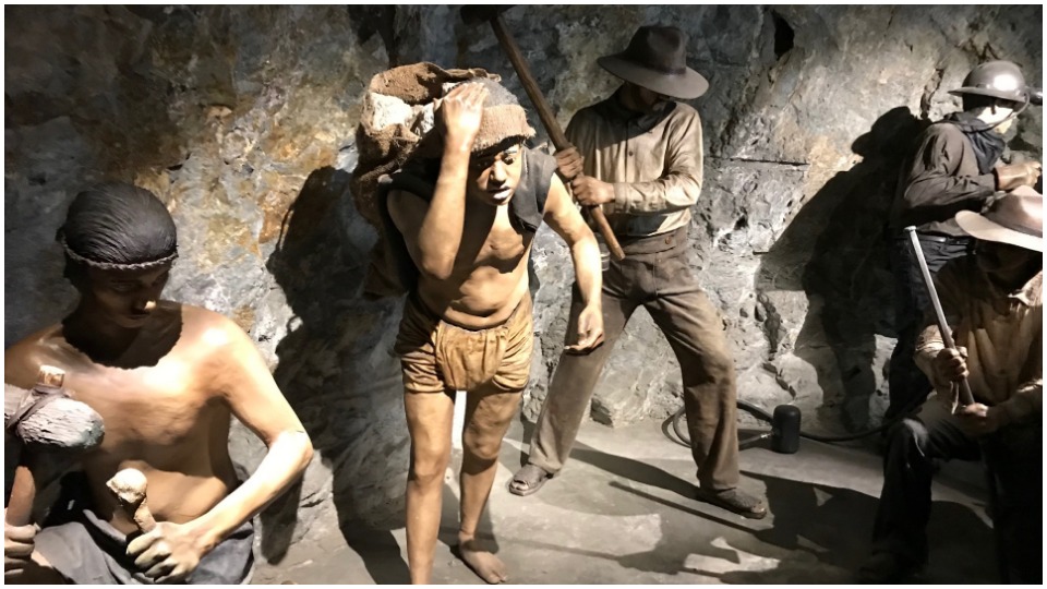
Mina El Eden
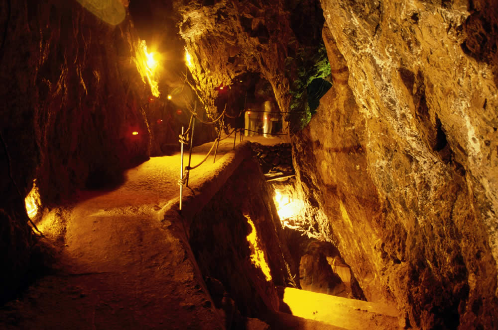
This abandoned mine, which was formerly a thriving colonial mine, now offers tours of the ancient mining infrastructure as well as an underground nightclub.
Cerro De La Bufa
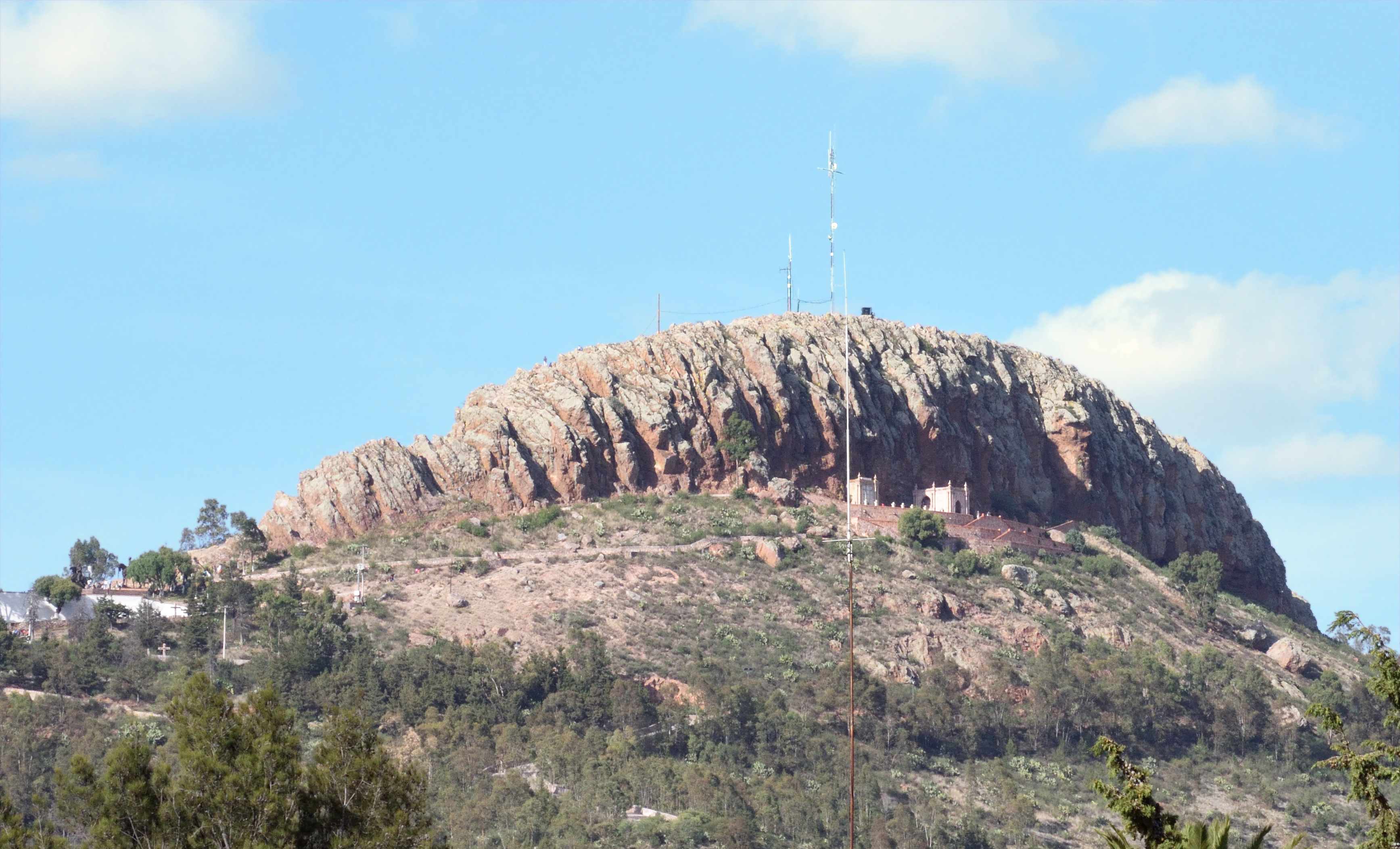
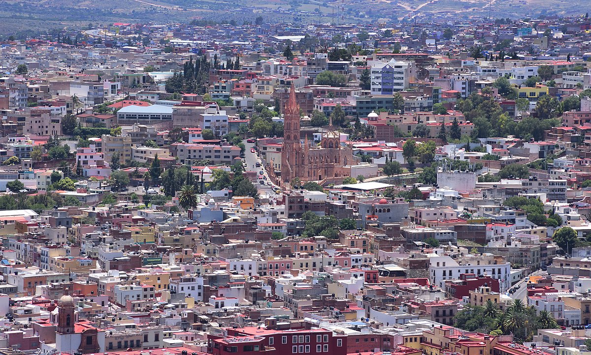
The Cerro de la Bufa is located east of Zacatecas' old town and is 2657 meters high (8,717 ft). Juan de Tolosa, one of the first Spaniards to arrive in the region, gave "Bufa" its Aragonese name, which means "pig's bladder." This city was named by numerous Zacatecas tribes.
King Philip II of Spain granted Zacatecas a coat of arms on June 20, 1588, which features the Cerro de La Bufa, where the city was founded on September 8, 1546. 1914 saw thelast and bloodiest battle of the Mexican Revolution.
Catedral De Zacatecas
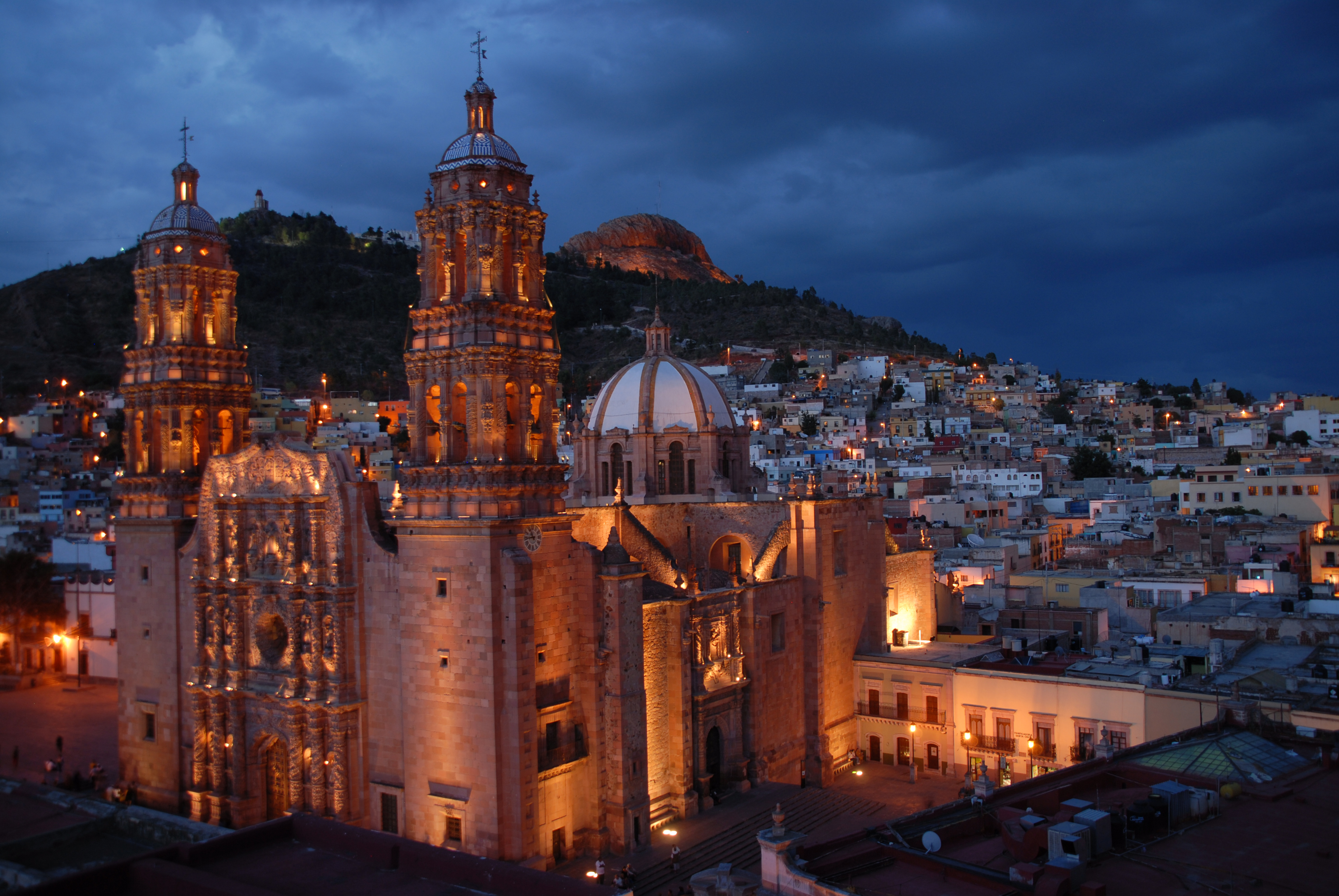
This Churrigueresque church, which dates back to the 18th century and was once known as Nuestra Senora de Asuncion, is a prominent example of the style and very famous among tourists.
People Also Ask
What Is Zacatecas Mexico Known For?
The state is well renowned for its abundant silver and other mineral reserves, colonial architecture, and role in the Mexican Revolution. Mining, agriculture, and tourism are its main economic activities.
Is Zacatecas Mexico Poor?
Zacatecas Has Many Mineral Deposits, but it is a poor area in Mexico. Zacatecas has a very high poverty rate. According to worldatlas.com, around 54.2 percent of the people who live there live in a deplorable environment that is unfit for human habitation.
Is It Safe To Travel To Zacatecas?
Travelshould be reconsidered owing to criminality and kidnapping. In some areas of Zacatecas state, violent crime, extortion, and gang activity are frequent. Kidnappings have occurred involving US citizens and LPRs.
Conclusion
Today, silver, lead, zinc, gold, phosphorite, wollastonite, fluorite, and barium are mined in Zacatecas' more than 15 mining areas. The two largest silver mines, Fresnillo and Zacatecas, have produced nearly 1.5 billion ounces of silver to date. In fact, thanks to Zacatecas, Mexico is now the world's greatest silver producer, accounting for 17 percent of global output.

Michael Rachal
Author
Michael Rachal believes that luxury lies in the details. With over 20 years of experience in the luxury travel industry, he has crafted hundreds of bespoke itineraries for clients seeking personalized, unforgettable experiences.
Whether guiding clients through private cultural tours or curating culinary journeys with world-renowned chefs, Michael ensures that each trip is tailored to perfection.
His ability to anticipate needs and exceed expectations has earned him a reputation as a leading expert in luxury travel.

Finn Wilde
Reviewer
For Finn Wilde, the wilderness is more than just a destination - it’s a way of life. Over the past decade, he has led multiple expeditions in some of the world’s most remote regions, from the icy fjords of Greenland to the rugged trails of Patagonia.
Finn emphasizes sustainability in all of his adventures, helping participants connect with nature while promoting responsible exploration. His expeditions inspire individuals to explore the great outdoors while fostering a deep respect for the environment.
Latest Articles
Popular Articles