Maps Of North Macedonia - Navigating Its Icons And Scenic Wonders
This guide provides comprehensive information for your journey through North Macedonia, a detailed map that unveils hidden gems. Gain essential travel insights, including navigating the country, understanding local customs, and immersing yourself in the vibrant Macedonian culture.
Author:Michael RachalReviewer:Finn WildeApr 05, 202512.6K Shares383.7K Views
North Macedonia is located in Southeast Europe, more specifically on the central Balkan Peninsula. It is a landlocked country bounded by Kosovo to the northwest, Albania to the southwest, Greece to the south, Bulgaria to the east, and Serbia to the north.
The country is known for its varied landscapes, which range from steep mountains to lush plains. North Macedonia has a rich cultural heritage that includes influences from several civilizations, such as the Roman, Ottoman, and Byzantine empires.
Quick Facts About North Macedonia
| Legal Name | North Macedonia |
| Capital City | Skopje |
| Total Land Area | 25,713 km² |
| Population | 1,813,791 |
| Currency | Macedonian Denar. |
| Dialling Code | +389 |
| Largest City | Skopje |
| GDP | $15.28 billion |
| GDP Per Capita | 6572.00 USD |
| Official Language | Macedonian, Albanian |
North Macedonia National Flag
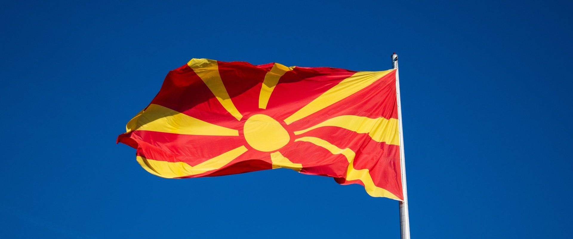
North Macedonia's national flag consists of a red field with a golden sun symbol in the center. The sun features eight rays, which are supposed to radiate from the center of the flag, representing a new dawn and a bright future for the nation.
The flag's red background depicts the people's bravery, strength, and valor, while the golden sun symbolizes the country's hope, freedom, and unification. The flag was adopted on October 5, 1995, after the republic gained independence from Yugoslavia.
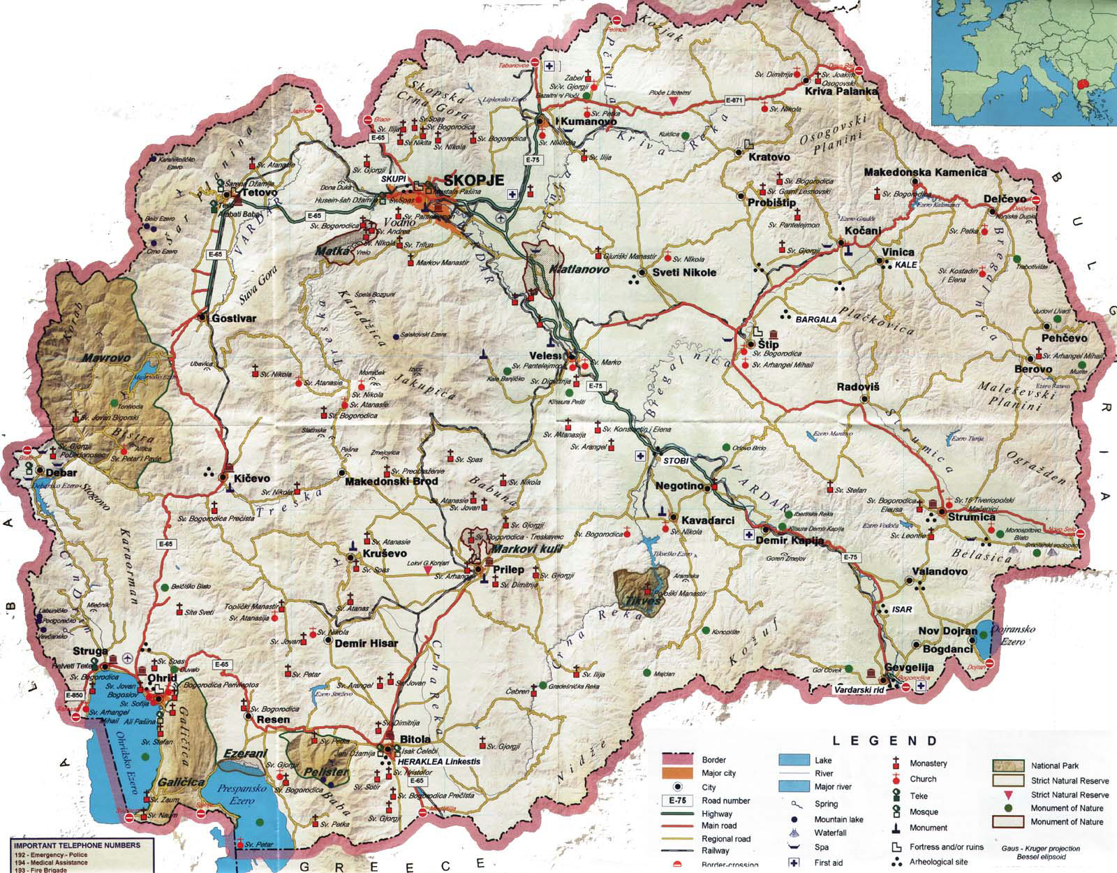
Types Of Maps Of North Macedonia
Maps of North Macedonia are classified into several types, each serving a unique purpose. Administrative maps are one of the most prevalent forms. Physical maps: topographic maps tourist maps
Road Maps Of North Macedonia
Road maps for North Macedonia are crucial for navigating the country's large road networks. They show main highways, smaller roads, and local streets, providing a comprehensive view of the country's transportation system.
These maps are especially handy for vacationers and drivers who wish to see the country by car. North Macedonia is connected to neighboring countries by well-maintained roadways, and road maps assist in route planning and assuring safety.
Tourist Maps Of North Macedonia
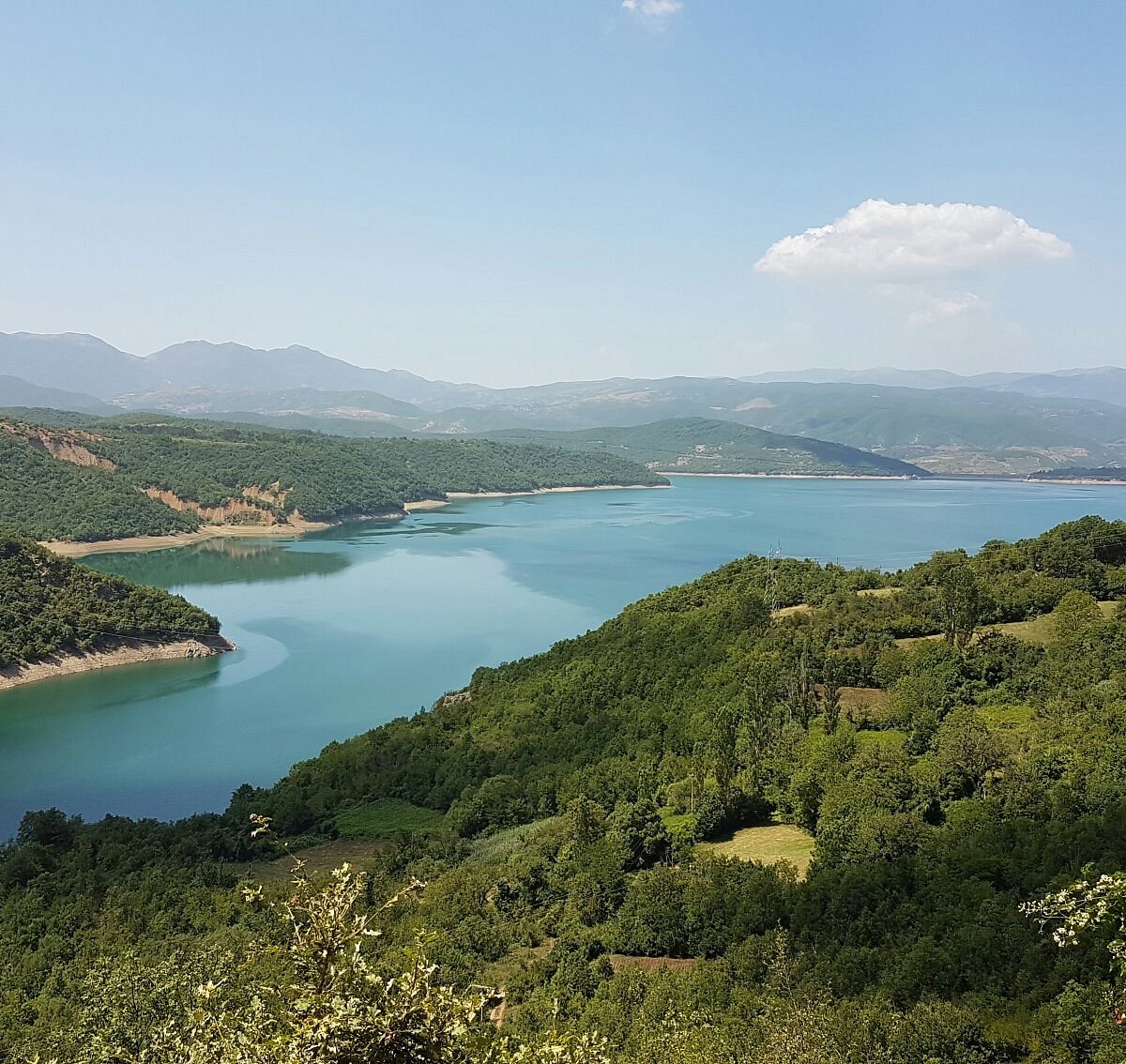
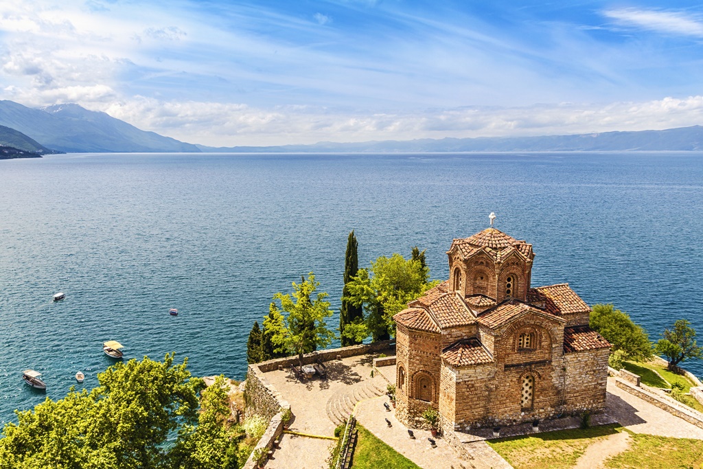
Tourist maps of North Macedonia are intended to help travelers locate important sights and locations. These maps frequently emphasize historical landmarks, national parks, cultural places, and major tourist locations, such as Lake Ohrid, Europe's oldest and deepest lake.
The maps also provide useful information such as lodging possibilities, transportation hubs, and sites of interest. A decent tourist map of North Macedoniawill give you all of the information you need for city exploration and countryside adventures.
Administrative Maps Of North Macedonia
Administrative maps of North Macedonia show the country's political subdivisions, including municipalities, regions, and districts. These maps are useful for government planning, administrative purposes, and policymaking.
They frequently depict boundaries, population distribution, and infrastructure within different regions of the country. Administrative maps can also be valuable to those active in local government or regional development.
Historical Maps Of North Macedonia
North Macedonia Explained in 11 Minutes (History, Geography, & Culture)
Historical maps of North Macedonia are useful for studying the country's history. These maps frequently depict changes in territorial boundaries, the presence of historical civilizations, and changing political environments across time.
Historical maps can show the growth of cities like Skopjee as well as the influence of civilizations like the Roman, Byzantine, and Ottoman empires. These maps are valuable resources for historians, archaeologists, and anybody interested in the region's historical evolution.
Topographic Maps Of North Macedonia
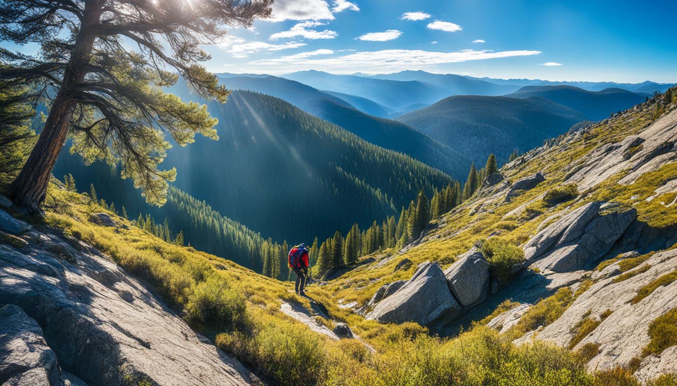
North Macedonia topographic maps provide precise representations of the country's geography, including hill, peak, and valley elevations. These maps are vital for outdoor enthusiasts such as hikers and mountaineers because they contain detailed information on landforms, slopes, and distances. Topographic maps are also useful in scientific research and environmental studies since they may highlight natural features such as rivers, forests, and wetlands.
Using Maps For Navigation In North Macedonia
Maps are essential for navigating in North Macedonia, whether by foot, motor vehicle, or train. Maps assist passengers in identifying the most efficient routes through the country's varied geography and well-established road systems.
Modern digital navigation systems have simplified the use of maps for real-time instructions, resulting in more accurate and safe travel. Physical and digital maps both assist tourists in avoiding getting lost in unfamiliar areas and navigating to their destinationswith ease.
Using Maps For Trip Planning In North Macedonia
Maps are crucial resources for organizing a trip to North Macedonia. They assist travelers in determining the best routes to take, calculating journey times, and identifying nearby attractions and amenities. Either scheduling a road trip through the countryside or a visit to historical places, maps give the required information for good trip organization. Maps are frequently used by trip planners to ensure that they visit as many significant destinations as possible in the time allotted.
Places To Visit In North Macedonia
1. North Macedonia has several locations to explore, with a mix of natural beauty, historical significance, and cultural richness. Some of the more notable locations are
2. Lake Ohrid, a UNESCO World Heritage Site, is one of Europe's oldest and most beautiful lakes. It is surrounded by picturesque mountains and towns, offering opportunities for swimming, boating, and exploring ancient churches and monasteries.
3. Skopje, the capital city, beautifully showcases a blend of Ottoman, Byzantine, and modern influences through landmarks such as the Old Bazaar and the iconic Stone Bridge.
4. Mavrovo National Park, known for its stunning scenery and diverse wildlife, Mavrovo is perfect for hiking, skiing, and nature photography.
5. Bitola, This city is rich in history, offering numerous ancient ruins, including the Roman town of Heraclea Lyncestis.
6. Kokino, a megalithic observatory that dates back to the Bronze Age, offers a glimpse into early astronomical studies.
Personal investmentshave significantly contributed to preserving these historical sites, allowing them to stand as enduring symbols of the city’s rich cultural heritage. These efforts not only protect the past but also enhance the city's appeal, drawing both locals and visitors who value its unique character and history.
National Parks In North Macedonia
North Macedonia's national parks are among the country's most prized natural places, serving as a sanctuary for animals and a shelter for outdoor enthusiasts. Here are some of the major national parks.
Mavrovo National Park
Mavrovo National Park is Mavrovo, located in the country's west, is North Macedonia's largest national park. Its scenery are diverse, including the Zare Laz mountain range and Mavrovo Lake. The park is home to a diverse range of wildlife, including bears, wolves, and lynx. Visitors can participate in activities such as hiking, skiing, and camping. The park also has a number of old churches and villages, which give cultural value to its natural beauty.
Pelister National Park
Pelister National Park Pelister, located in the south of the country, is well-known for its beautiful views of Mount Pelister and the surrounding area. The park has uncommon plant species and is home to the endangered Balkan lynx. Visitors can explore the park on well-marked hiking paths and enjoy the splendor of its pristine lakes, streams, and woodlands.
Galichica National Park
Galichica National Park. This park is located between Lake Ohrid and Lake Prespa and provides stunning views of both bodies of water. Galichica is notable for its diverse wildlife, which includes numerous bird species and rare vegetation. Hiking and birdwatching are popular activities in the park, as is exploring the historical ruins that dot the landscape.
Shar Mountain National Park
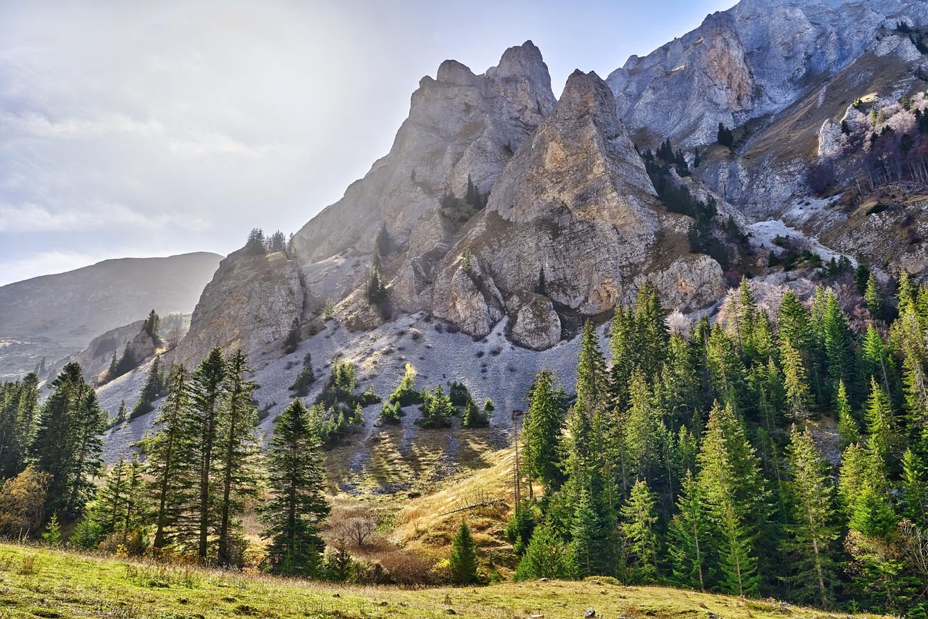
Shar Mountain National Park This park, located on the border between Kosovoand Albania, is well-known for its stunning scenery, which includes steep mountain peaks, deep valleys, and alpine meadows. Shar Mountain is a popular hiking and skiing destination, and it is home to a diverse range of species, including bears, wolves, and eagles.
Fun Facts About North Macedonia
- North Macedonia is one of Europe's oldest human settlements, with evidence of human activity extending back more than a million years.
- The nation was the birthplace of Alexander the Great's father, King Philip II of Macedon.
- North Macedonia has a long history of viticulture and wine production.
- The country features more than 50 lakes, including Lake Ohrid, which is one of Europe's oldest and deepest.
Frequently Asked Questions
What Is The Difference Between Macedonia And North Macedonia?
In June 2018, Macedonia and Greece signed the Prespa Accord, which addressed, among other things, the decades-long dispute over the name of the Republic of Macedonia. In February 2019, Macedonia's name was changed to Republic of North Macedonia.
Do They Speak English In North Macedonia?
A gradually falling proportion of the population, mostly elderly people, speaks Serbo-Croatian, French, or German. Russian is also widely known. Younger generations frequently speak English, as well as Serbo-Croatian and German.
What Is Macedonia Called Today?
The Macedonian parliament voted on January 11, 2019, to modify the constitution in accordance with the Prespa Agreement, which included adopting the Republic of North Macedonia as the country's official name.
Conclusion
A map of North Macedonia is a useful tool for discovering this intriguing country. Maps give critical information to improve the vacation experience. North Macedonia's national parks, bustling cities, and breathtaking natural beauty provide several options for exploration, making maps useful for both inhabitants and visitors.
You Might Also Like: Benefits Of Quality Sleep Mouthpieces For Your Teeth
Jump to
Quick Facts About North Macedonia
North Macedonia National Flag
Types Of Maps Of North Macedonia
Using Maps For Navigation In North Macedonia
Using Maps For Trip Planning In North Macedonia
Places To Visit In North Macedonia
National Parks In North Macedonia
Fun Facts About North Macedonia
Frequently Asked Questions
Conclusion

Michael Rachal
Author
Michael Rachal believes that luxury lies in the details. With over 20 years of experience in the luxury travel industry, he has crafted hundreds of bespoke itineraries for clients seeking personalized, unforgettable experiences.
Whether guiding clients through private cultural tours or curating culinary journeys with world-renowned chefs, Michael ensures that each trip is tailored to perfection.
His ability to anticipate needs and exceed expectations has earned him a reputation as a leading expert in luxury travel.

Finn Wilde
Reviewer
For Finn Wilde, the wilderness is more than just a destination - it’s a way of life. Over the past decade, he has led multiple expeditions in some of the world’s most remote regions, from the icy fjords of Greenland to the rugged trails of Patagonia.
Finn emphasizes sustainability in all of his adventures, helping participants connect with nature while promoting responsible exploration. His expeditions inspire individuals to explore the great outdoors while fostering a deep respect for the environment.
Latest Articles
Popular Articles