Detailed Map Of Denmark: Cities, Regions, And Roads
Find all you need to know about the map of Denmark, from major roads to climate maps. Perfect for travelers and geography enthusiasts.
Author:Finn WildeReviewer:Michael RachalJan 07, 202580K Shares1M Views
Maps are more than just tools for navigation; they’re windows into a country’s identity, showcasing its geography, culture, and history. Denmark, with its captivating mix of cities, islands, and natural wonders, offers an exceptional canvas for cartography.
From its vibrant urban hubs to its serene coastlines and ancient landmarks, every corner of Denmark tells a unique story that a map brings to life.
Understanding the layout of this Scandinavian treasure not only enhances your knowledge but also makes every journey across its landscape more meaningful.
Quick Facts About Denmark
- Official Name: Kingdom of Denmark
- Capital: Copenhagen
- Population: Approximately 5.9 million
- Language: Danish (English is widely spoken)
- Currency: Danish Krone (DKK)
- Dialing Code: +45
- Government: Constitutional monarchy with a parliamentary system
- Total Area: 42,933 km² (16,577 sq mi)
- Flag: Dannebrog (red with a white cross)
- Highest Point: Møllehøj (171 meters / 561 feet)
- Longest River: Gudenå (176 kilometers / 109 miles)
- Coastline Length: Over 7,300 kilometers (4,536 miles)
- Time Zone: Central European Time (CET), UTC+1
- National Dish: Stegt flæsk (crispy pork with parsley sauce)
- Famous Export: LEGO, wind turbines, and Danish design
- National Motto: “Guds hjælp, Folkets kærlighed, Danmarks styrke” (God's help, the people's love, Denmark's strength)
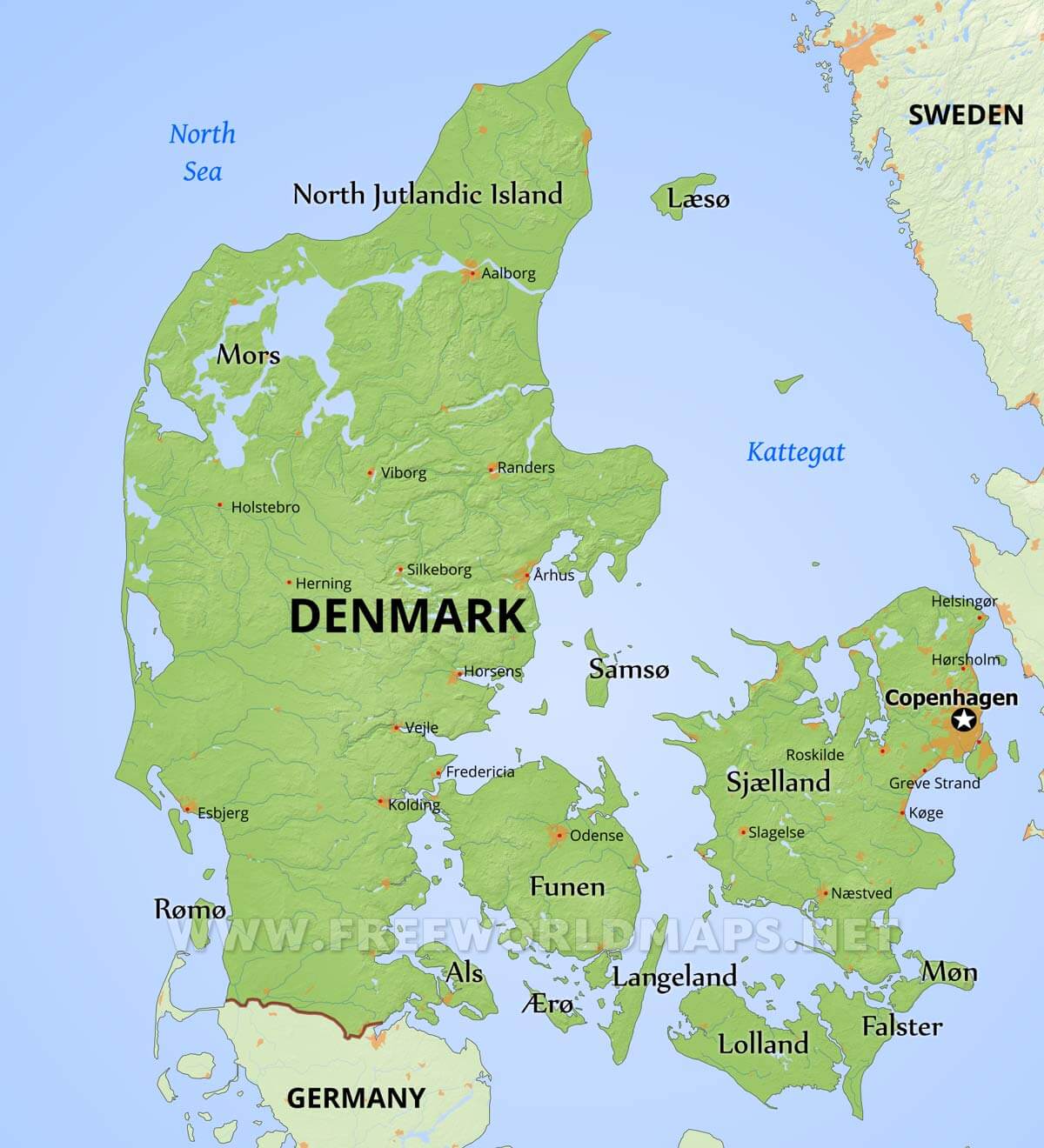
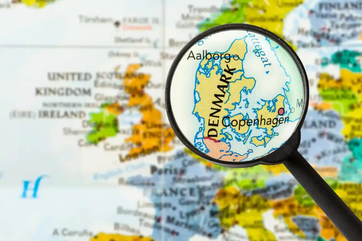
Geographical Overview Of Denmark
Denmark is a Scandinavian country located in Northern Europe, known for its flat terrain, extensive coastline, and temperate climate. The country is composed of the Jutland Peninsula, which connects to mainland Europe, and over 400 islands, of which only a fraction are inhabited.
Some of the largest and most significant islands include Zealand (where the capital, Copenhagen, is situated), Funen, and Bornholm, along with smaller islands like Lolland and Falster.
Capital Of Denmark
Copenhagen, located on the eastern coast of Zealand, is not only the capital of Denmark but also its largest city and the political, economic, and cultural heart of the country. The city is a vibrant metropolis that seamlessly combines modern innovation with historical charm. It is home to iconic landmarks like the Nyhavn waterfront, the Tivoli Gardens, and the Little Mermaid statue, inspired by Hans Christian Andersen’s fairy tale.
Map Of Denmark Cities
1. Copenhagen
The capital and largest city of Denmark, Copenhagen is situated on Zealand and partially on Amager island. It is famous for its mix of historic sites, such as Rosenborg Castle and Amalienborg Palace, and modern attractions like the CopenHill urban ski slope. The city is a hub for culture, nightlife, and gastronomy, boasting numerous Michelin-starred restaurants.
2. Aarhus
Denmark’s second-largest city, Aarhus, is located on the east coast of the Jutland Peninsula. Known as the "City of Smiles", Aarhus is a cultural and educational center with landmarks like the ARoS Aarhus Art Museum and the Old Town open-air museum. The city’s youthful energy stems from its large student population.
3. Odense
Situated on the island of Funen, Odense is renowned as the birthplace of Hans Christian Andersen. It offers attractions like the Hans Christian Andersen Museum, the Egeskov Castle, and vibrant pedestrian streets lined with shops and cafes.
4. Aalborg
In North Jutland, Aalborg is a thriving city with a rich Viking history. Key attractions include the Lindholm Høje Viking burial site, Aalborg Zoo, and the waterfront district, which has undergone significant modern development.
5. Esbjerg
A port city on the North Sea, Esbjerg is a center for offshore energy and maritime industries. Visitors can explore the iconic "Man Meets the Sea" sculpture and nearby natural reserves like the Wadden Sea National Park.
6. Roskilde
Located on Zealand, Roskilde is one of Denmark’s oldest cities and a UNESCO World Heritage Site. The city is famous for its Viking Ship Museum, the Roskilde Cathedral, and the annual Roskilde Music Festival.
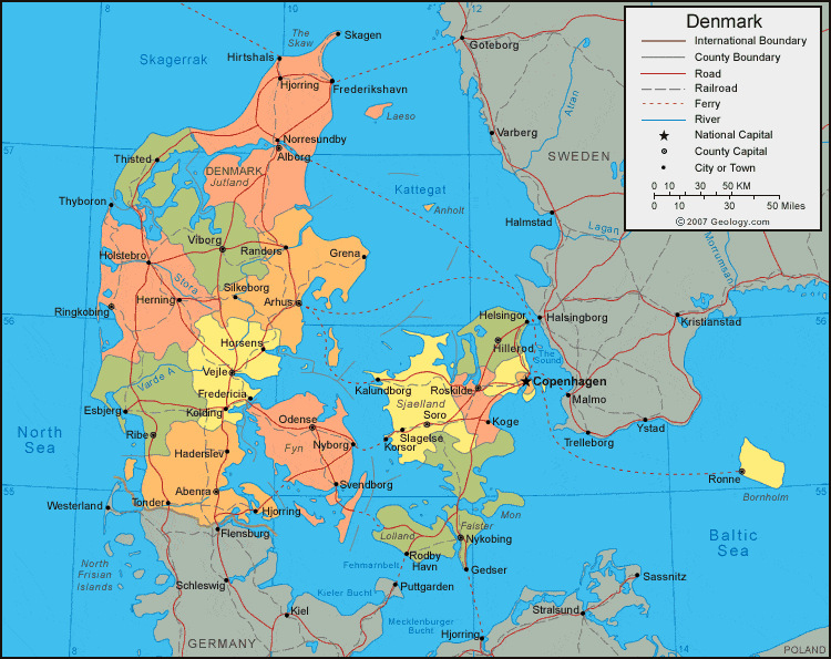
Regions On The Map Of Denmark
1. Hovedstaden (Capital Region)
Centered around Copenhagen, this region encompasses urban areas, rural towns, and coastal retreats. It includes the island of Bornholm in the Baltic Sea. The Capital Region is a hub of innovation, culture, and government.
2. Midtjylland (Central Denmark Region)
This region includes Aarhus and offers a mix of vibrant cities, rolling countryside, and the Central Jutland Heath. It is known for its innovation in renewable energy and technology.
3. Nordjylland (North Jutland Region)
The northernmost region of Denmark, Nordjylland, is famous for its scenic coastline, Skagen, and the confluence of the North and Baltic seas at Grenen.
4. Sjælland (Zealand Region)
Zealand is Denmark’s most populous region and includes historic sites like Kronborg Castle in Helsingør. It also features diverse landscapes, from forests to coastal cliffs.
5. Syddanmark (Southern Denmark Region)
The southern region includes Funen, southern Jutland, and islands in the Wadden Sea. It is known for its charming towns, UNESCO sites, and Odense, the region's cultural heart.
Population Of Denmark
Denmark’s population is approximately 5.9 million, with the majority residing in urban areas. Copenhagen alone houses over 1.3 million people, making it the most populous city. Rural areas, particularly on the smaller islands, are sparsely populated.
Currency Of Denmark
Denmark uses the Danish Krone (DKK), divided into 100 øre. The krone has been in use since 1875 and remains the official currency, despite Denmark being a member of the European Union.
Dialing Code Of Denmark
The international dialing code for Denmark is +45. This is used for making phone calls to Denmark from abroad.
Language Of Denmark
The official language of Denmark is Danish, a North Germanic language closely related to Swedish and Norwegian. Many Danes are fluent in English, making communication easy for international visitors.
Flag Of Denmark
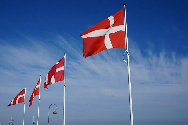
The flag of Denmark, known as the Dannebrog, is a significant symbol of the country's identity and heritage. Featuring a red background with a white Scandinavian cross extending to the edges, it is one of the most recognizable flags in the world.
The Dannebrog holds the distinction of being the oldest continuously used national flag, with origins tracing back to 1219. According to legend, the flag fell from the sky during the Battle of Lyndanisse, inspiring Danish forces to victory. Whether myth or fact, the Dannebrog is deeply rooted in Denmark's history and serves as a unifying emblem of pride and tradition.
Government Of Denmark
Denmark is a constitutional monarchy with a parliamentary system. The monarch, currently Queen Margrethe II, serves as a ceremonial head of state, while legislative power is vested in the Folketing (parliament).
Total Area Of Denmark
Denmark’s total land area is approximately 42,933 square kilometers (16,577 square miles). This includes the Jutland Peninsula and its islands but excludes Greenland and the Faroe Islands, which are autonomous territories. Denmark's temperate climate and vibrant landscapes make it one of the best places to travel in May, as spring brings blooming flora, pleasant temperatures, and numerous cultural events.
Types Of Maps Of Denmark
1. Road And Transport Maps
Road maps outline Denmark’s extensive network of highways, secondary roads, and scenic byways. They’re essential for navigating the country’s iconic cycling routes, such as the North Sea Cycle Route, and ferry connections between islands.
2. Tourist Maps
Tourist maps focus on attractions like:
- Tivoli Gardensin Copenhagen.
- The Little Mermaidstatue.
- Legolandin Billund. They also highlight cultural events and seasonal activities.
3. Historical Maps
Historical maps offer a glimpse into Denmark’s evolution. They depict:
- Viking trade routes.
- Historical borders and territories.
- Key archaeological sites.
4. Topographical Maps
Topographical maps emphasize terrain, showcasing:
- Elevation differences in rolling hills.
- Coastal erosion patterns.
- Rural landscapes ideal for hiking.
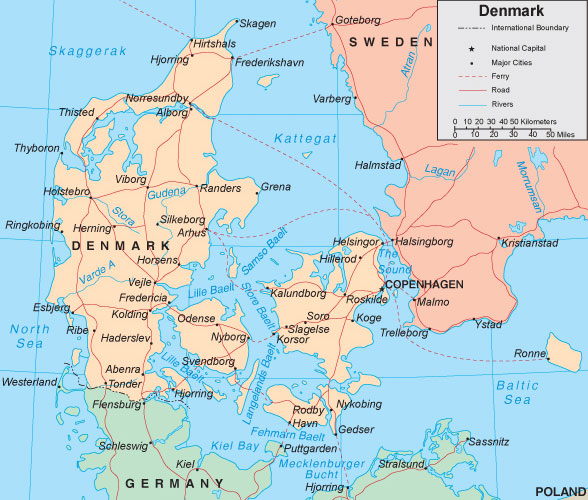
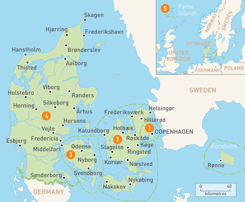
Denmark’s Borders And Neighboring Countries
Denmark is situated in Northern Europe, primarily on the Jutland Peninsula and surrounded by numerous islands in the Baltic and North Seas. It shares a 68-kilometer (42-mile) land border with Germany, a vital route for trade and cultural exchange. Travelers often use the map of Germanyto plan cross-border journeys and explore connections between the two nations.
To the east, Denmark is separated from Sweden by the Øresund Strait, bridged by the iconic Øresund Bridge. To the west lies the North Sea, while the Baltic Sea borders the southeast, shaping Denmark’s maritime traditions and trade economy.
Additionally, Denmark governs two autonomous territories:
- Greenland- The world’s largest island, located in the North Atlantic.
- Faroe Islands- An archipelago of 18 islands in the North Atlantic, known for its stunning landscapes.
National Parks And Landscapes
1. Thy National Park
- Location: Northern Jutland.
- Features: Denmark’s first national park, Thy is known for its expansive coastal dunes, heathlands, and lakes. It offers habitats for diverse bird species and seals, making it a haven for nature enthusiasts.
- Activities: Hiking, birdwatching, and visiting cultural sites like old fishing villages.
2. Mols Bjerge National Park
- Location: Djursland, East Jutland.
- Features: Famous for its rolling hills and diverse flora and fauna. Mols Bjerge is a mix of ancient agricultural landscapes, forests, and beaches.
- Activities: Biking, exploring old villages, and enjoying scenic views.
3. Wadden Sea National Park
- Location: Southwestern Denmark.
- Features: A UNESCO World Heritage Site, this park covers a vast tidal area with unique mudflats, salt marshes, and sandbanks. It is a critical stopover for millions of migratory birds.
- Activities: Birdwatching, seal safaris, and guided tours of tidal flats.
4. Skjoldungernes Land National Park
- Location: Near Roskilde, Zealand.
- Features: This park is rich in cultural history, featuring Viking burial mounds, forests, lakes, and meadows.
- Activities: Historical tours, hiking, and boating on Roskilde Fjord.
5. Kongernes Nordsjælland National Park
- Location: North Zealand.
- Features: Encompasses royal forests, lakes, and castles like Frederiksborg and Fredensborg. It showcases Denmark’s royal heritage alongside natural beauty.
- Activities: Exploring castles, hiking, and cycling.
Denmark’s Natural Wonders On The Map
1. Møns Klint
- Location: Island of Møn.
- Features: Stunning chalk cliffs rising 128 meters above the Baltic Sea. Møns Klint is a geological wonder with rich fossil deposits and rare plant species.
2. Stevns Klint
- Location: Zealand.
- Features: A UNESCO World Heritage Site, Stevns Klint is famous for its fossil-rich chalk cliffs that provide evidence of the asteroid impact that caused the extinction of the dinosaurs.
3. Råbjerg Mile
- Location: Northern Jutland.
- Features: A massive migrating sand dune covering 1 km². It moves approximately 15 meters each year, offering a unique desert-like landscape.
4. The Wadden Sea
- Location: Western Jutland.
- Features: A vast tidal flat ecosystem with exceptional biodiversity and a haven for seals and migratory birds.
5. Lake Arresø
- Location: North Zealand.
- Features: Denmark’s largest lake, surrounded by picturesque landscapes and ideal for fishing and boating.
Major Roads And Transportation
Major Roads
- E45: Runs through Jutland from the German border to Frederikshavn in the north.
- E20: Connects Copenhagen with Odense, Esbjerg, and extends to Sweden via the Øresund Bridge.
- E47/E55: Links Copenhagen to Gedser and includes ferry routes to Germany.
- Marguerite Route: A scenic tourist route covering 4,000 kilometers of Denmark’s countryside.
Modes Of Transportation
- Road Transport: Denmark has a highly developed road network and extensive cycling infrastructure.
- Rail Transport: Operated by DSB, Denmark’s train system connects cities and regions efficiently.
- Ferries: Vital for connecting islands, with major operators like Scandlines and Molslinjen.
- Buses: Local and regional buses provide comprehensive coverage.
- Cycling: With over 12,000 kilometers of designated bike routes, cycling is a popular and eco-friendly mode of transport.
- Air Travel: Major airports include Copenhagen Airport (Kastrup), Billund, and Aalborg.
Climate Map
Denmark has a temperate maritime climateinfluenced by its surrounding seas. Here’s a breakdown of its climatic characteristics:
- Winters: Mild but damp, with average temperatures between 0°C to 5°C (32°F to 41°F). Snowfall is rare and usually light.
- Summers: Cool and pleasant, with average temperatures ranging from 15°C to 25°C (59°F to 77°F).
- Rainfall: Moderate and evenly distributed throughout the year, averaging 750 mm (30 inches)annually.
- Wind: Coastal areas experience frequent winds, especially in winter, due to Denmark's flat terrain.
Denmark Economy
Denmark boasts a highly developed and mixed economy, often ranked among the most competitive and innovative in the world.
Key Economic Sectors
- Renewable Energy: Denmark is a global leader in wind energy, with companies like Vestasspearheading the industry. Over 40% of electricity is generated from wind power.
- Agriculture: Despite its small size, Denmark is a major agricultural exporter, known for dairy products, pork, and high-quality organic produce.
- Maritime Industry: Home to Maersk, the world’s largest shipping company, Denmark plays a crucial role in global trade.
- Pharmaceuticals: Companies like Novo Nordisk lead in diabetes care and biotechnology.
- Design and Innovation: Danish brands like LEGO, Bang & Olufsen, and Royal Copenhagen showcase its strength in creative industries.
Key Economic Facts
- GDP (2023): Approximately $400 billion USD.
- Unemployment Rate: Low, at around 4%.
- Exports: Primarily wind turbines, pharmaceuticals, agricultural goods, and machinery.
- Imports: Includes machinery, vehicles, and electronics.
Using A Map Of Denmark For Travel
Maps play a crucial role in planning an efficient and enjoyable trip. Here are some tips for using maps during your travels:
1. Popular Routes
- Drive the scenic Marguerite Route, which passes through charming villages and historic sites.
- Cycle along the Baltic Sea Cycle Route, offering breathtaking coastal views.
2. Navigating Islands
Denmark’s map is essential for understanding its intricate ferry system and iconic bridges, such as the Øresund and Great Belt Bridges.
3. Sustainable Travel
Maps help travelers explore Denmark’s green initiatives, such as bike-friendly cities and eco-friendly accommodations.
Interactive And Digital Maps Of Denmark
1. Popular Platforms
Digital maps, such as Google Maps and VisitDenmark’s interactive tools, provide real-time updates for navigation and planning.
Advantages Of Interactive Maps
- Real-time traffic updates.
- Points of interest with user reviews.
- Offline mode for remote areas.
2. Offline Map Options
Apps like Maps.me and Pocket Earth offer downloadable maps for regions with limited connectivity.
Interesting Facts About Denmark
- World’s Oldest Flag: Denmark’s flag, the Dannebrog, is the oldest continuously used national flag in the world. It dates back to 1219and symbolizes a rich history and heritage.
- Happiest Country in the World: Denmark consistently ranks among the happiest countries globally, thanks to its strong welfare system, work-life balance, and concept of “hygge”, which emphasizes coziness and contentment.
- Home of the Vikings: Denmark was the heart of the Viking Age, which spanned roughly from 800 to 1050 AD. The Vikings were skilled seafarers and traders, and Denmark still celebrates this history with Viking museums and festivals.
- Copenhagen: Cycling Capital: Copenhagen is one of the most bike-friendly cities in the world. Over 50% of its residentscommute daily by bicycle, with dedicated bike lanes crisscrossing the city.
- Green Energy Leader: Denmark is a global leader in renewable energy. The country generates over 40% of its electricityfrom wind power and aims to be entirely carbon-neutral by 2050.
- Fairy Tale Legacy: Denmark is the birthplace of Hans Christian Andersen, one of the world’s most famous authors, known for timeless fairy tales like "The Little Mermaid", "The Ugly Duckling", and "Thumbelina".
- Hundreds of Islands: Denmark consists of over 400 islands, but only about 70 are inhabited. Major islands include Zealand, Funen, and Bornholm. Each island has its own unique culture and attractions.
- The Øresund Bridge: Connecting Denmark and Sweden, the Øresund Bridgeis a marvel of engineering and a symbol of Scandinavian unity. The bridge spans nearly 8 kilometersand includes a tunnel section.
- World-Class Cuisine: Denmark is renowned for its culinary innovations, with Copenhagen’s Nomarestaurant winning the title of the world’s best restaurantmultiple times. Danish smørrebrød (open-faced sandwiches) is also a beloved dish.
- Birthplace of LEGO: LEGO, the iconic building block toy, was invented in 1932in the town of Billund. Today, Legoland Billundis one of Denmark’s most popular attractions.
- Free Education and Healthcare: Denmark offers free education and healthcare to its citizens, funded through high taxes. This system contributes to the country’s high standard of living and well-being.
- The Wadden Sea (UNESCO Site): The Wadden Sea, shared with Germany and the Netherlands, is a UNESCO World Heritage Site. It is a haven for wildlife and a vital resting area for millions of migratory birds.
- Short Workweeks: Danes enjoy one of the shortest average workweeks globally, with around 37 hoursper week. This contributes to their strong focus on family, leisure, and life satisfaction.
- Oldest Kingdom in Europe: Denmark has one of the oldest continuous monarchies in the world. The Danish monarchy dates back to 10th centuryand is currently headed by Queen Margrethe II.
- No Mountains, Just Hills: Denmark is one of the flattest countries in the world. Its highest natural point, Møllehøj, stands at just 171 meters (561 feet) above sea level, making it ideal for cycling and walking enthusiasts. This accessibility and ease of navigation also make Denmark one of the best backpacking destinations, offering scenic routes and charming towns to explore at a relaxed pace.
FAQs
What Is The Most Accurate Map Of Denmark For Travelers?
For travelers, VisitDenmark's interactive maps and apps like Google Maps are the most accurate and user-friendly. These tools offer real-time navigation, tourist attractions, and public transportation details.
Are There Maps Of Denmark’s Cycling Routes?
Yes, Denmark is a cycling-friendly country, and detailed maps of cycling routes, such as the North Sea Cycle Route and Baltic Sea Cycle Route, are widely available online and at tourist information centers.
Where Can I Find Historical Maps Of Denmark?
Historical maps of Denmark can be found in online archives, libraries, and museums like the National Museum of Denmark. Many digital platforms also provide access to old Viking routes and medieval cartography.
How Many Cities Are Marked On A Typical Map Of Denmark?
A standard map highlights the major cities like Copenhagen, Aarhus, Odense, and Aalborg, as well as smaller cities and towns, totaling around 100 key locations.
Does Denmark’s Map Show Ferry Routes Between Islands?
Yes, most detailed maps include ferry routes that connect Denmark's islands, such as the routes between Zealand, Funen, and Bornholm.
Are There Free Maps Of Denmark Available For Tourists?
Yes, free maps are often available at tourist information centers, airports, and hotels. You can also download maps from websites like VisitDenmark or use offline digital maps.
Conclusion
Denmark’s map is a reflection of its diverse and dynamic essence, combining historical significance with natural beauty and modern development. From the bustling streets of Copenhagen to the tranquil shores of its islands, Denmark invites you to connect with its rich tapestry of experiences.
Jump to
Quick Facts About Denmark
Geographical Overview Of Denmark
Capital Of Denmark
Map Of Denmark Cities
Regions On The Map Of Denmark
Population Of Denmark
Currency Of Denmark
Dialing Code Of Denmark
Language Of Denmark
Flag Of Denmark
Government Of Denmark
Total Area Of Denmark
Types Of Maps Of Denmark
Denmark’s Borders And Neighboring Countries
National Parks And Landscapes
Denmark’s Natural Wonders On The Map
Major Roads And Transportation
Climate Map
Denmark Economy
Using A Map Of Denmark For Travel
Interactive And Digital Maps Of Denmark
Interesting Facts About Denmark
FAQs
Conclusion

Finn Wilde
Author
For Finn Wilde, the wilderness is more than just a destination - it’s a way of life. Over the past decade, he has led multiple expeditions in some of the world’s most remote regions, from the icy fjords of Greenland to the rugged trails of Patagonia.
Finn emphasizes sustainability in all of his adventures, helping participants connect with nature while promoting responsible exploration. His expeditions inspire individuals to explore the great outdoors while fostering a deep respect for the environment.

Michael Rachal
Reviewer
Michael Rachal believes that luxury lies in the details. With over 20 years of experience in the luxury travel industry, he has crafted hundreds of bespoke itineraries for clients seeking personalized, unforgettable experiences.
Whether guiding clients through private cultural tours or curating culinary journeys with world-renowned chefs, Michael ensures that each trip is tailored to perfection.
His ability to anticipate needs and exceed expectations has earned him a reputation as a leading expert in luxury travel.
Latest Articles
Popular Articles